Property Record
Collard Rd, Huntsville, TX 77340

Property Detail
Collard Rd
Huntsville, TX
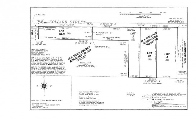
MOCK W M (A-347), TRACT 17, ACRES 3.28
18455
WALKER
Residentialacreage
Texas
B and X Area of moderate flood hazard, usually the area between the limits of the 100-year and 500-year floods.
3.28 AC
2024
Texas East Area
2025
Other Market Areas
790700
NEARBY LISTINGS FOR SALE OR LEASE
DEMOGRAPHICS near Collard Rd
1 mile
3 mile
5 mile
2025 Total Population
4,489
34,484
43,047
2030 Population
4,583
36,439
45,466
Pop Growth 2025-2030
+ 2.09%
+ 5.67%
+ 5.62%
Average Age
32
33
34
2025 Total Households
1,982
12,763
16,012
HH Growth 2025-2030
+ 2.72%
+ 6.84%
+ 6.72%
Median Household Inc
$35,924
$43,345
$46,473
Avg Household Size
2.20
2.20
2.20
2025 Avg HH Vehicles
2.00
2.00
2.00
Median Home Value
$227,103
$240,503
$243,692
Median Year Built
1988
1988
1988
Nearby Places
Map Layers
Map Styles
 Street
 Aerial
Transit
 Traffic
 Biking
Places
Listings with unknown addresses are not visible on the map
- Restaurants
- Banks
- Shops
- Fitness
- Groceries
Nearby Properties
Address
Land Use
TOTAL SIZE
Lot Size
Zoning
Address
Land Use
TOTAL SIZE
Lot Size
Zoning
72,835 SF
9.81 AC
Address
Land Use
TOTAL SIZE
Lot Size
Zoning
220,991 SF
7.11 AC
Address
Land Use
TOTAL SIZE
Lot Size
Zoning
20,996 SF
8.70 AC
Address
Land Use
TOTAL SIZE
Lot Size
Zoning
147,014 SF
775.19 AC
Address
Land Use
TOTAL SIZE
Lot Size
Zoning
471,882 SF
15.44 AC
Address
Land Use
TOTAL SIZE
Lot Size
Zoning
529,686 SF
20.09 AC
Address
Land Use
TOTAL SIZE
Lot Size
Zoning
130,891 SF
23.14 AC
Address
Land Use
TOTAL SIZE
Lot Size
Zoning
739,742 SF
26.49 AC
Address
Land Use
TOTAL SIZE
Lot Size
Zoning
142,792 SF
13.76 AC
Address
Land Use
TOTAL SIZE
Lot Size
Zoning
416,433 SF
12.19 AC
Address
Land Use
TOTAL SIZE
Lot Size
Zoning
290,351 SF
10.32 AC
Address
Land Use
TOTAL SIZE
Lot Size
Zoning
40,221 SF
2.02 AC
Address
Land Use
TOTAL SIZE
Lot Size
Zoning
414,878 SF
9.50 AC
Address
Land Use
TOTAL SIZE
Lot Size
Zoning
720 SF
14.68 AC
Address
Land Use
TOTAL SIZE
Lot Size
Zoning
34,661 SF
3.06 AC
Address
Land Use
TOTAL SIZE
Lot Size
Zoning
81,707 SF
4.59 AC
Address
Land Use
TOTAL SIZE
Lot Size
Zoning
43,752 SF
1.96 AC
Address
Land Use
TOTAL SIZE
Lot Size
Zoning
296,084 SF
7.44 AC
Address
Land Use
TOTAL SIZE
Lot Size
Zoning
134,276 SF
15.74 AC
Address
Land Use
TOTAL SIZE
Lot Size
Zoning
Address
Land Use
TOTAL SIZE
Lot Size
Zoning
74,188 SF
20.71 AC
Address
Land Use
TOTAL SIZE
Lot Size
Zoning
129,902 SF
5.19 AC
Address
Land Use
TOTAL SIZE
Lot Size
Zoning
41,154 SF
2.09 AC
Address
Land Use
TOTAL SIZE
Lot Size
Zoning
28,142 SF
5.39 AC
Address
Land Use
TOTAL SIZE
Lot Size
Zoning
141,611 SF
1.94 AC
Address
Land Use
TOTAL SIZE
Lot Size
Zoning
69,786 SF
12.79 AC
Address
Land Use
TOTAL SIZE
Lot Size
Zoning
72,275 SF
13.10 AC
Address
Land Use
TOTAL SIZE
Lot Size
Zoning
32,446 SF
1.14 AC
Address
Land Use
TOTAL SIZE
Lot Size
Zoning
31,584 SF
2 AC
Address
Land Use
TOTAL SIZE
Lot Size
Zoning
48,000 SF
10.40 AC
The World's #1 Commercial Real Estate Marketplace
Connect with us
© 2026 CoStar Group
The information above has been obtained from sources believed reliable. While we do not doubt its accuracy we have not verified it and make no guarantee, warranty or representation about it. It is your responsibility to independently confirm its accuracy and completeness. Any projections, opinions, assumptions, or estimates used are for example only and do not represent the current or future performance of the property. The value of this transaction to you depends on tax and other factors which should be evaluated by your tax, financial, and legal advisors. You and your advisors should conduct a careful, independent investigation of the property to determine to your satisfaction the suitability of the property for your needs.