Property Record
Cologne Ave, Hamilton, NJ 08330

Save to a Folder
{{folder.Name}}
{{folder.ListingIds.length}} Properties
{{folder.ListingIds.length}} Property
Create a New Folder
Property Detail
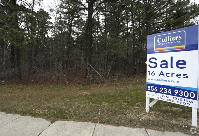
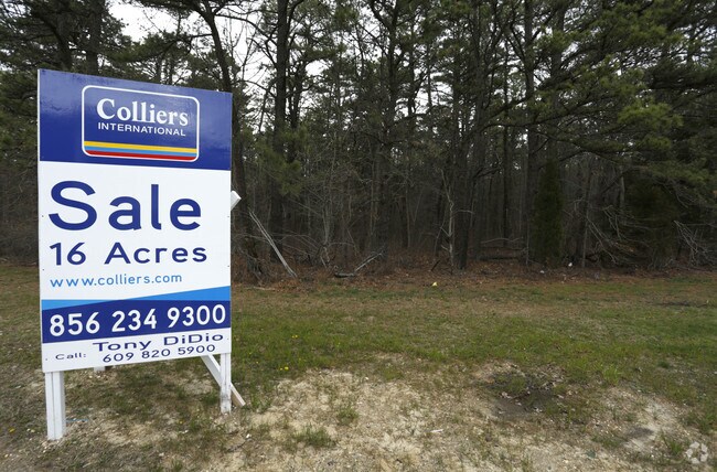
Cologne Ave
Atlantic City-Hammonton, NJ
ADDITIONAL LOTS: OPEN SPACE HOA
12-00854-0000-00043
ATLANTIC
Taxexempt
New Jersey
GA-M
43
A Areas with a 1% annual chance of flooding and a 26% chance of flooding over the life of a 30-year mortgage.
9.97 AC
0
Atlantic City/Hammonton
2026
Philadelphia
011401
NEARBY LISTINGS FOR SALE OR LEASE
DEMOGRAPHICS near Cologne Ave
1 mile
3 mile
5 mile
2025 Total Population
5,031
17,043
40,522
2030 Population
5,001
16,952
40,382
Pop Growth 2025-2030
(0.60%)
(0.53%)
(0.35%)
Average Age
36
40
41
2025 Total Households
1,948
6,390
14,636
HH Growth 2025-2030
(0.92%)
(1.10%)
(0.97%)
Median Household Inc
$81,492
$88,854
$89,988
Avg Household Size
2.50
2.50
2.60
2025 Avg HH Vehicles
2.00
2.00
2.00
Median Home Value
$267,038
$269,909
$273,416
Median Year Built
1986
1992
1987
Nearby Places
Map Layers
Map Styles
 Street
 Aerial
Layers
 Traffic
 Biking
Places
Listings with unknown addresses are not visible on the map
- Restaurants
- Banks
- Shops
- Fitness
- Groceries
PUBLIC TRANSPORTATION
COMMUTER RAIL
Egg Harbor City (Atlantic City Line - NJ Transit Commuter Rail (NJ Transit))
Drive
Walk
Distance
Egg Harbor City (Atlantic City Line - NJ Transit Commuter Rail (NJ Transit))
12 min
7.9 mi
AIRPORT
Atlantic City International
Drive
Walk
Distance
Atlantic City International
31 min
8.7 mi
Freight Ports
Broadway Terminal - Pier 5
Drive
Walk
Distance
Broadway Terminal - Pier 5
57 min
44.3 mi
Nearby Properties
Address
Land Use
TOTAL SIZE
Lot Size
Zoning
Address
Land Use
TOTAL SIZE
Lot Size
Zoning
75.97 AC
DC
Address
Land Use
TOTAL SIZE
Lot Size
Zoning
52.37 AC
GA-I
Address
Land Use
TOTAL SIZE
Lot Size
Zoning
48.59 AC
IBP
Address
Land Use
TOTAL SIZE
Lot Size
Zoning
78.84 AC
GA-M
Address
Land Use
TOTAL SIZE
Lot Size
Zoning
31.46 AC
DC
Address
Land Use
TOTAL SIZE
Lot Size
Zoning
19.70 AC
IBP
Address
Land Use
TOTAL SIZE
Lot Size
Zoning
360 SF
23.28 AC
GA-I
Address
Land Use
TOTAL SIZE
Lot Size
Zoning
53.17 AC
IBP
Address
Land Use
TOTAL SIZE
Lot Size
Zoning
312.70 AC
GA-M
Address
Land Use
TOTAL SIZE
Lot Size
Zoning
28,284 SF
27.87 AC
RG5
Address
Land Use
TOTAL SIZE
Lot Size
Zoning
31.17 AC
GA-M
Address
Land Use
TOTAL SIZE
Lot Size
Zoning
28.50 AC
IBP
Address
Land Use
TOTAL SIZE
Lot Size
Zoning
175,248 SF
20.85 AC
IBP
Address
Land Use
TOTAL SIZE
Lot Size
Zoning
190,410 SF
36.97 AC
DC
Address
Land Use
TOTAL SIZE
Lot Size
Zoning
11,572 SF
19.68 AC
DC
Address
Land Use
TOTAL SIZE
Lot Size
Zoning
45.45 AC
IBP
Address
Land Use
TOTAL SIZE
Lot Size
Zoning
10.83 AC
DC
Address
Land Use
TOTAL SIZE
Lot Size
Zoning
13.50 AC
GA-I
Address
Land Use
TOTAL SIZE
Lot Size
Zoning
9.25 AC
DC
Address
Land Use
TOTAL SIZE
Lot Size
Zoning
16.24 AC
HB
Address
Land Use
TOTAL SIZE
Lot Size
Zoning
10.30 AC
GA-I
Address
Land Use
TOTAL SIZE
Lot Size
Zoning
11.60 AC
GA-I
Address
Land Use
TOTAL SIZE
Lot Size
Zoning
33,811 SF
18.28 AC
PVD
Address
Land Use
TOTAL SIZE
Lot Size
Zoning
70,742 SF
16.53 AC
IBP
Address
Land Use
TOTAL SIZE
Lot Size
Zoning
25.80 AC
DC
Address
Land Use
TOTAL SIZE
Lot Size
Zoning
59,354 SF
5.29 AC
IBP
Address
Land Use
TOTAL SIZE
Lot Size
Zoning
70.67 AC
RD-5
Address
Land Use
TOTAL SIZE
Lot Size
Zoning
5.95 AC
DC
Address
Land Use
TOTAL SIZE
Lot Size
Zoning
90.90 AC
RD-5
Address
Land Use
TOTAL SIZE
Lot Size
Zoning
10.42 AC
HB
The World's #1 Commercial Real Estate Marketplace
Connect with us
© 2026 CoStar Group
The information above has been obtained from sources believed reliable. While we do not doubt its accuracy we have not verified it and make no guarantee, warranty or representation about it. It is your responsibility to independently confirm its accuracy and completeness. Any projections, opinions, assumptions, or estimates used are for example only and do not represent the current or future performance of the property. The value of this transaction to you depends on tax and other factors which should be evaluated by your tax, financial, and legal advisors. You and your advisors should conduct a careful, independent investigation of the property to determine to your satisfaction the suitability of the property for your needs.