Property Record
Firetower Rd, Colora, MD 21917
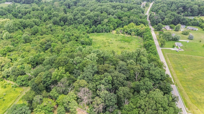
This Property Is For Sale
Property Detail
Firetower Rd
06-030785
5 ACRES W/S FIRETOWER ROAD N/W OF WOODLAWN
Residentialacreage
CECIL
NAR
Maryland
B and X Area of moderate flood hazard, usually the area between the limits of the 100-year and 500-year floods.
5 AC
2025
Cecil County
2025
Baltimore
031301
Philadelphia-Camden-Wilmington, PA-NJ-DE-MD
NEARBY LISTINGS FOR SALE OR LEASE
-
-
View all Colora listings for sale on LoopNet.com
DEMOGRAPHICS near Firetower Rd
1 mile
3 mile
5 mile
2025 Total Population
998
9,516
20,733
2030 Population
1,023
9,703
21,020
Pop Growth 2025-2030
+ 2.51%
+ 1.97%
+ 1.38%
Average Age
43
42
42
2025 Total Households
367
3,543
7,723
HH Growth 2025-2030
+ 2.45%
+ 2.15%
+ 1.49%
Median Household Inc
$104,286
$92,688
$92,605
Avg Household Size
2.70
2.60
2.60
2025 Avg HH Vehicles
2.00
2.00
2.00
Median Home Value
$325,555
$329,050
$324,623
Median Year Built
1987
1985
1984
Nearby Places
Map Layers
Map Styles
 Street
 Aerial
Transit
 Traffic
 Biking
Places
Listings with unknown addresses are not visible on the map
- Restaurants
- Banks
- Shops
- Fitness
- Groceries
PUBLIC TRANSPORTATION
COMMUTER RAIL
Perryville Marc (PENN - WASHINGTON - Maryland Transit Administration)
Drive
Walk
Distance
Perryville Marc (PENN - WASHINGTON - Maryland Transit Administration)
12 min
6.9 mi
Freight Ports
Port of Wilmington, RI
Drive
Walk
Distance
Port of Wilmington, RI
48 min
36.8 mi
Nearby Properties
Address
Land Use
TOTAL SIZE
Lot Size
Zoning
Address
Land Use
TOTAL SIZE
Lot Size
Zoning
1,026,000 SF
114.22 AC
Address
Land Use
TOTAL SIZE
Lot Size
Zoning
601,549 SF
95.21 AC
Address
Land Use
TOTAL SIZE
Lot Size
Zoning
12,128 SF
56.42 AC
NAR
Address
Land Use
TOTAL SIZE
Lot Size
Zoning
66,647 SF
12.05 AC
RR
Address
Land Use
TOTAL SIZE
Lot Size
Zoning
13,660 SF
11 AC
DR
Address
Land Use
TOTAL SIZE
Lot Size
Zoning
55,386 SF
14.99 AC
ST
Address
Land Use
TOTAL SIZE
Lot Size
Zoning
44.75 AC
MH
Address
Land Use
TOTAL SIZE
Lot Size
Zoning
40.69 AC
MH
Address
Land Use
TOTAL SIZE
Lot Size
Zoning
19,965 SF
12.71 AC
RR
Address
Land Use
TOTAL SIZE
Lot Size
Zoning
21.16 AC
MH
Address
Land Use
TOTAL SIZE
Lot Size
Zoning
27.14 AC
MH
Address
Land Use
TOTAL SIZE
Lot Size
Zoning
3,706 SF
10 AC
RR
Address
Land Use
TOTAL SIZE
Lot Size
Zoning
29,112 SF
2.70 AC
RC
Address
Land Use
TOTAL SIZE
Lot Size
Zoning
9.83 AC
MH
Address
Land Use
TOTAL SIZE
Lot Size
Zoning
6,080 SF
3.56 AC
NAR
Address
Land Use
TOTAL SIZE
Lot Size
Zoning
19.76 AC
MH
Address
Land Use
TOTAL SIZE
Lot Size
Zoning
17,500 SF
12.32 AC
BG
Address
Land Use
TOTAL SIZE
Lot Size
Zoning
2,532 SF
1.73 AC
RR
Address
Land Use
TOTAL SIZE
Lot Size
Zoning
9,440 SF
10.12 AC
RR
Address
Land Use
TOTAL SIZE
Lot Size
Zoning
155.10 AC
LDR
Address
Land Use
TOTAL SIZE
Lot Size
Zoning
23,400 SF
7.65 AC
SPLIT
Address
Land Use
TOTAL SIZE
Lot Size
Zoning
2,180 SF
8.03 AC
SPLIT
Address
Land Use
TOTAL SIZE
Lot Size
Zoning
640 SF
6.07 AC
MH
Address
Land Use
TOTAL SIZE
Lot Size
Zoning
45.47 AC
NAR
Address
Land Use
TOTAL SIZE
Lot Size
Zoning
640 SF
86.68 AC
M2
Address
Land Use
TOTAL SIZE
Lot Size
Zoning
1,425 SF
30.50 AC
BG
Address
Land Use
TOTAL SIZE
Lot Size
Zoning
5,004 SF
2.37 AC
BG
Address
Land Use
TOTAL SIZE
Lot Size
Zoning
4.19 AC
MH
Address
Land Use
TOTAL SIZE
Lot Size
Zoning
8,468 SF
1.63 AC
LDR
Address
Land Use
TOTAL SIZE
Lot Size
Zoning
6,292 SF
9.11 AC
RR
The World's #1 Commercial Real Estate Marketplace
Connect with us
© 2026 CoStar Group
The information above has been obtained from sources believed reliable. While we do not doubt its accuracy we have not verified it and make no guarantee, warranty or representation about it. It is your responsibility to independently confirm its accuracy and completeness. Any projections, opinions, assumptions, or estimates used are for example only and do not represent the current or future performance of the property. The value of this transaction to you depends on tax and other factors which should be evaluated by your tax, financial, and legal advisors. You and your advisors should conduct a careful, independent investigation of the property to determine to your satisfaction the suitability of the property for your needs.