Property Record
Colts Neck Rd, Freehold, NJ 07728


NEARBY LISTINGS FOR SALE OR LEASE
-
-
View all Freehold listings for sale on LoopNet.com
Property Detail
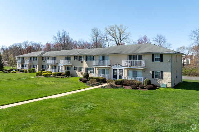
Colts Neck Rd
Lakewood-New Brunswick, NJ
Briar Hill Estates
17-00041-01-00005-03
ADDITIONAL LOTS: B41 L5.04,5.05,5.06
Apartment
Monmouth
X
New Jersey
34025C0144F
5.3
2024
19.02 AC
2025
West Monmouth County
810501
Northern New Jersey
DEMOGRAPHICS near Colts Neck Rd
1 Mile
3 Mile
5 Mile
2024 Total Population
9,440
40,909
93,357
2029 Population
9,306
40,347
92,059
Pop Growth 2024-2029
(1.42%)
(1.37%)
(1.39%)
Average Age
40
40
42
2024 Total Households
3,204
13,365
32,351
HH Growth 2024-2029
(1.72%)
(1.62%)
(1.59%)
Median Household Inc
$107,751
$128,979
$133,077
Avg Household Size
2.80
2.90
2.80
2024 Avg HH Vehicles
2.00
2.00
2.00
Median Home Value
$497,174
$560,989
$551,520
Median Year Built
1978
1979
1982
Nearby Places
Map Layers
Map Styles
 Street
 Aerial
- Restaurants
- Banks
- Shops
- Fitness
- Groceries
PUBLIC TRANSPORTATION
AIRPORT
Trenton Mercer
DRIVE
WALK
Distance
Trenton Mercer
55 min
36.4 mi
Newark Liberty International
DRIVE
WALK
Distance
Newark Liberty International
52 min
41.5 mi
Freight Ports
New York Container Terminal
DRIVE
WALK
Distance
New York Container Terminal
45 min
33.7 mi
Nearby Properties
Address
Land Use
TOTAL SIZE
Lot Size
Zoning
Address
Land Use
TOTAL SIZE
Lot Size
Zoning
825,686 SF
151.47 AC
575
Address
Land Use
TOTAL SIZE
Lot Size
Zoning
4,649 SF
40.27 AC
ML-7
Address
Land Use
TOTAL SIZE
Lot Size
Zoning
904,310 SF
85.13 AC
M2M1
Address
Land Use
TOTAL SIZE
Lot Size
Zoning
267,666 SF
29.06 AC
M-1
Address
Land Use
TOTAL SIZE
Lot Size
Zoning
69.99 AC
AG
Address
Land Use
TOTAL SIZE
Lot Size
Zoning
73,884 SF
37.60 AC
R-40
Address
Land Use
TOTAL SIZE
Lot Size
Zoning
25.27 AC
C1
Address
Land Use
TOTAL SIZE
Lot Size
Zoning
114,738 SF
19.02 AC
M-1
Address
Land Use
TOTAL SIZE
Lot Size
Zoning
42,982 SF
118.30 AC
R-40
Address
Land Use
TOTAL SIZE
Lot Size
Zoning
2.91 AC
RCR
Address
Land Use
TOTAL SIZE
Lot Size
Zoning
278,199 SF
6.92 AC
R-10
Address
Land Use
TOTAL SIZE
Lot Size
Zoning
81,690 SF
42.46 AC
RMZ-
Address
Land Use
TOTAL SIZE
Lot Size
Zoning
138.38 AC
R-E
Address
Land Use
TOTAL SIZE
Lot Size
Zoning
82,872 SF
25.58 AC
B-10
Address
Land Use
TOTAL SIZE
Lot Size
Zoning
21 AC
R-40
Address
Land Use
TOTAL SIZE
Lot Size
Zoning
48,451 SF
12.17 AC
B-10
Address
Land Use
TOTAL SIZE
Lot Size
Zoning
200,294 SF
12 AC
R10
Address
Land Use
TOTAL SIZE
Lot Size
Zoning
93.79 AC
R-60
Address
Land Use
TOTAL SIZE
Lot Size
Zoning
7,112 SF
10.01 AC
CM3A
Address
Land Use
TOTAL SIZE
Lot Size
Zoning
13.21 AC
OB01
Address
Land Use
TOTAL SIZE
Lot Size
Zoning
185,237 SF
20.18 AC
VC
Address
Land Use
TOTAL SIZE
Lot Size
Zoning
54,065 SF
19.07 AC
CM3A
Address
Land Use
TOTAL SIZE
Lot Size
Zoning
1,800 SF
83.93 AC
R120
Address
Land Use
TOTAL SIZE
Lot Size
Zoning
134,977 SF
2.30 AC
A
Address
Land Use
TOTAL SIZE
Lot Size
Zoning
92,832 SF
29.69 AC
M-1
Address
Land Use
TOTAL SIZE
Lot Size
Zoning
88,303 SF
39.55 AC
R-40
Address
Land Use
TOTAL SIZE
Lot Size
Zoning
126,388 SF
11.56 AC
CM10
Address
Land Use
TOTAL SIZE
Lot Size
Zoning
189,210 SF
8.07 AC
0
Address
Land Use
TOTAL SIZE
Lot Size
Zoning
126,300 SF
10.12 AC
M-1
The World's #1 Commercial Real Estate Marketplace
Connect with us
© 2026 CoStar Group
The information above has been obtained from sources believed reliable. While we do not doubt its accuracy we have not verified it and make no guarantee, warranty or representation about it. It is your responsibility to independently confirm its accuracy and completeness. Any projections, opinions, assumptions, or estimates used are for example only and do not represent the current or future performance of the property. The value of this transaction to you depends on tax and other factors which should be evaluated by your tax, financial, and legal advisors. You and your advisors should conduct a careful, independent investigation of the property to determine to your satisfaction the suitability of the property for your needs.