Property Record
Comer Ave, Pell City, AL 35125


Property Detail
Comer Ave
Birmingham, AL
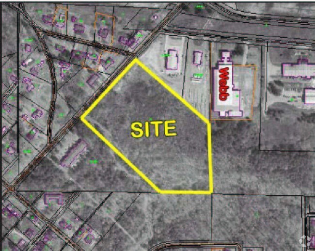
BEG SE COR SW NW N 495.19' NW 682.58' SW ALG R/W 592.4' SE 764.17' E 342.13' TO POB 31-16-4
22-09-31-2-000-034.000
ST CLAIR
Vacantlandnec
Alabama
B and X Area of moderate flood hazard, usually the area between the limits of the 100-year and 500-year floods.
11 AC
2025
St Clair County
2025
Birmingham
040207
NEARBY LISTINGS FOR SALE OR LEASE
DEMOGRAPHICS near Comer Ave
1 mile
3 mile
5 mile
2025 Total Population
2,311
10,979
19,534
2030 Population
2,398
11,456
20,452
Pop Growth 2025-2030
+ 3.76%
+ 4.34%
+ 4.70%
Average Age
38
40
41
2025 Total Households
933
4,303
7,621
HH Growth 2025-2030
+ 3.75%
+ 4.37%
+ 4.71%
Median Household Inc
$41,521
$70,175
$72,651
Avg Household Size
2.50
2.50
2.50
2025 Avg HH Vehicles
2.00
2.00
2.00
Median Home Value
$181,481
$196,289
$212,306
Median Year Built
1990
1991
1991
Nearby Places
Map Layers
Map Styles
 Street
 Aerial
Layers
 Traffic
 Biking
Places
Listings with unknown addresses are not visible on the map
- Restaurants
- Banks
- Shops
- Fitness
- Groceries
PUBLIC TRANSPORTATION
AIRPORT
Birmingham-Shuttlesworth International
Drive
Walk
Distance
Birmingham-Shuttlesworth International
39 min
31.5 mi
Freight Ports
Port of Mobile
Drive
Walk
Distance
Port of Mobile
308 min
273.3 mi
SALE & LEASE HISTORY
LISTING DATE
SALE/LEASE

Sep 24, 2016
For Sale
Apr 03, 2020
For Lease
Nearby Properties
Address
Land Use
TOTAL SIZE
Lot Size
Zoning
Address
Land Use
TOTAL SIZE
Lot Size
Zoning
Address
Land Use
TOTAL SIZE
Lot Size
Zoning
5,752 SF
12 AC
Address
Land Use
TOTAL SIZE
Lot Size
Zoning
Address
Land Use
TOTAL SIZE
Lot Size
Zoning
22.24 AC
Address
Land Use
TOTAL SIZE
Lot Size
Zoning
Address
Land Use
TOTAL SIZE
Lot Size
Zoning
Address
Land Use
TOTAL SIZE
Lot Size
Zoning
53,538 SF
3.92 AC
Address
Land Use
TOTAL SIZE
Lot Size
Zoning
96,029 SF
20 AC
Address
Land Use
TOTAL SIZE
Lot Size
Zoning
10,000 SF
7.50 AC
Address
Land Use
TOTAL SIZE
Lot Size
Zoning
7,287 SF
15 AC
Address
Land Use
TOTAL SIZE
Lot Size
Zoning
2.85 AC
Address
Land Use
TOTAL SIZE
Lot Size
Zoning
45,690 SF
15 AC
Address
Land Use
TOTAL SIZE
Lot Size
Zoning
112,991 SF
11.80 AC
Address
Land Use
TOTAL SIZE
Lot Size
Zoning
5,650 SF
15 AC
Address
Land Use
TOTAL SIZE
Lot Size
Zoning
27,216 SF
3.90 AC
Address
Land Use
TOTAL SIZE
Lot Size
Zoning
5,832 SF
10.11 AC
Address
Land Use
TOTAL SIZE
Lot Size
Zoning
48,000 SF
20 AC
Address
Land Use
TOTAL SIZE
Lot Size
Zoning
6,080 SF
2.90 AC
Address
Land Use
TOTAL SIZE
Lot Size
Zoning
9,504 SF
11 AC
Address
Land Use
TOTAL SIZE
Lot Size
Zoning
19,584 SF
Address
Land Use
TOTAL SIZE
Lot Size
Zoning
6,400 SF
6.42 AC
Address
Land Use
TOTAL SIZE
Lot Size
Zoning
11,702 SF
4.35 AC
Address
Land Use
TOTAL SIZE
Lot Size
Zoning
8,600 SF
17.70 AC
Address
Land Use
TOTAL SIZE
Lot Size
Zoning
22,130 SF
10.35 AC
Address
Land Use
TOTAL SIZE
Lot Size
Zoning
11,029 SF
1.77 AC
Address
Land Use
TOTAL SIZE
Lot Size
Zoning
Address
Land Use
TOTAL SIZE
Lot Size
Zoning
4,360 SF
152 AC
Address
Land Use
TOTAL SIZE
Lot Size
Zoning
13,364 SF
2.62 AC
The World's #1 Commercial Real Estate Marketplace
Connect with us
© 2026 CoStar Group
The information above has been obtained from sources believed reliable. While we do not doubt its accuracy we have not verified it and make no guarantee, warranty or representation about it. It is your responsibility to independently confirm its accuracy and completeness. Any projections, opinions, assumptions, or estimates used are for example only and do not represent the current or future performance of the property. The value of this transaction to you depends on tax and other factors which should be evaluated by your tax, financial, and legal advisors. You and your advisors should conduct a careful, independent investigation of the property to determine to your satisfaction the suitability of the property for your needs.