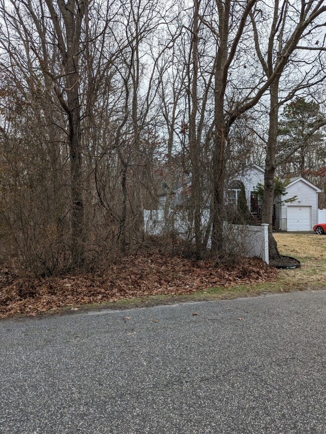
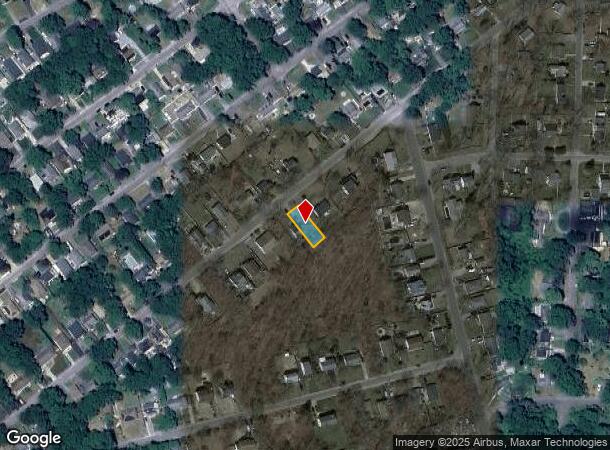
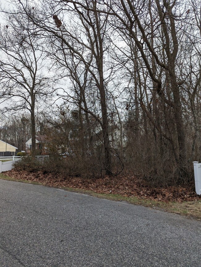
Property Record
Commack Rd, Shirley, NY 11967
NEARBY LISTINGS FOR SALE OR LEASE
Property Detail
Commack Rd
Nassau County-Suffolk County, NY
Mastic Acres
0200-981-90-02-00-021-000
MASTIC ACRES 1643 UNIT 22 126 & 127
Residentialacreage
Suffolk
X
New York
36103C0738H
21
2024
0.12 AC
2024
Eastern Suffolk
159513
Long Island (New York)
DEMOGRAPHICS near Commack Rd
1 Mile
3 Mile
5 Mile
2024 Total Population
11,307
37,144
74,251
2029 Population
11,348
36,947
73,849
Pop Growth 2024-2029
+ 0.36%
(0.53%)
(0.54%)
Average Age
38
39
39
2024 Total Households
3,705
11,857
23,932
HH Growth 2024-2029
+ 0.19%
(0.67%)
(0.69%)
Median Household Inc
$83,173
$88,513
$95,999
Avg Household Size
3.00
3.00
3.00
2024 Avg HH Vehicles
2.00
2.00
2.00
Median Home Value
$302,338
$301,986
$353,978
Median Year Built
1974
1974
1974
Nearby Places
Map Layers
Map Styles
 Street
 Aerial
- Restaurants
- Banks
- Shops
- Fitness
- Groceries
PUBLIC TRANSPORTATION
COMMUTER RAIL
Mastic-Shirley Station (Montauk Branch - Long Island Rail Road)
DRIVE
WALK
Distance
Mastic-Shirley Station (Montauk Branch - Long Island Rail Road)
7 min
3.5 mi
Bellport Station (Montauk Branch - Long Island Rail Road)
DRIVE
WALK
Distance
Bellport Station (Montauk Branch - Long Island Rail Road)
15 min
8.4 mi
AIRPORT
Long Island MacArthur
DRIVE
WALK
Distance
Long Island MacArthur
30 min
17.3 mi
SALE & LEASE HISTORY
LISTING DATE
SALE/LEASE

Dec 30, 2022
For Sale
Nearby Properties
Address
Land Use
TOTAL SIZE
Lot Size
Zoning
Address
Land Use
TOTAL SIZE
Lot Size
Zoning
8,802 SF
2.74 AC
R80
Address
Land Use
TOTAL SIZE
Lot Size
Zoning
4,016 SF
0.50 AC
R4
Address
Land Use
TOTAL SIZE
Lot Size
Zoning
2,040 SF
0.59 AC
R20
Address
Land Use
TOTAL SIZE
Lot Size
Zoning
0.48 AC
R40
Address
Land Use
TOTAL SIZE
Lot Size
Zoning
Address
Land Use
TOTAL SIZE
Lot Size
Zoning
Address
Land Use
TOTAL SIZE
Lot Size
Zoning
19.69 AC
Address
Land Use
TOTAL SIZE
Lot Size
Zoning
0.46 AC
R20
Address
Land Use
TOTAL SIZE
Lot Size
Zoning
Address
Land Use
TOTAL SIZE
Lot Size
Zoning
Address
Land Use
TOTAL SIZE
Lot Size
Zoning
12.31 AC
Address
Land Use
TOTAL SIZE
Lot Size
Zoning
92.78 AC
Address
Land Use
TOTAL SIZE
Lot Size
Zoning
Address
Land Use
TOTAL SIZE
Lot Size
Zoning
14.83 AC
Address
Land Use
TOTAL SIZE
Lot Size
Zoning
Address
Land Use
TOTAL SIZE
Lot Size
Zoning
Address
Land Use
TOTAL SIZE
Lot Size
Zoning
Address
Land Use
TOTAL SIZE
Lot Size
Zoning
0.79 AC
Address
Land Use
TOTAL SIZE
Lot Size
Zoning
Address
Land Use
TOTAL SIZE
Lot Size
Zoning
Address
Land Use
TOTAL SIZE
Lot Size
Zoning
611.50 AC
Address
Land Use
TOTAL SIZE
Lot Size
Zoning
Address
Land Use
TOTAL SIZE
Lot Size
Zoning
Address
Land Use
TOTAL SIZE
Lot Size
Zoning
127.50 AC
Address
Land Use
TOTAL SIZE
Lot Size
Zoning
103.66 AC
Address
Land Use
TOTAL SIZE
Lot Size
Zoning
Address
Land Use
TOTAL SIZE
Lot Size
Zoning
249.95 AC
Address
Land Use
TOTAL SIZE
Lot Size
Zoning
Address
Land Use
TOTAL SIZE
Lot Size
Zoning
Address
Land Use
TOTAL SIZE
Lot Size
Zoning
The World's #1 Commercial Real Estate Marketplace
Connect with us
© 2026 CoStar Group
The information above has been obtained from sources believed reliable. While we do not doubt its accuracy we have not verified it and make no guarantee, warranty or representation about it. It is your responsibility to independently confirm its accuracy and completeness. Any projections, opinions, assumptions, or estimates used are for example only and do not represent the current or future performance of the property. The value of this transaction to you depends on tax and other factors which should be evaluated by your tax, financial, and legal advisors. You and your advisors should conduct a careful, independent investigation of the property to determine to your satisfaction the suitability of the property for your needs.