Property Record
Community Rd, Great Neck, NY 11021


Property Detail
Community Rd
Nassau County-Suffolk County, NY
TOWN #2 SCH DIST 007
2219-02-358-00-0037-0
NASSAU
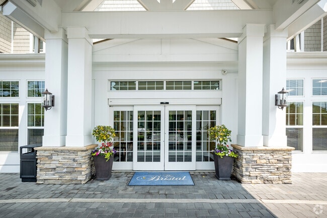
Religious
New York
B and X Area of moderate flood hazard, usually the area between the limits of the 100-year and 500-year floods.
37
0
11.07 AC
2025
Western Nassau
300700
Long Island (New York)
23,871 SF
NEARBY LISTINGS FOR SALE OR LEASE
-
-
View all Great Neck listings for sale on LoopNet.com
DEMOGRAPHICS near Community Rd
1 mile
3 mile
5 mile
2025 Total Population
7,939
186,962
548,475
2030 Population
8,108
187,068
544,181
Pop Growth 2025-2030
+ 2.13%
+ 0.06%
(0.78%)
Average Age
52
45
44
2025 Total Households
3,356
64,444
188,389
HH Growth 2025-2030
+ 2.98%
(0.19%)
(1.02%)
Median Household Inc
$145,815
$133,569
$121,921
Avg Household Size
2.30
2.80
2.80
2025 Avg HH Vehicles
2.00
2.00
2.00
Median Home Value
$919,171
$843,562
$805,541
Median Year Built
1971
1954
1953
Nearby Places
Map Layers
Map Styles
 Street
 Aerial
Layers
 Traffic
 Biking
Places
Listings with unknown addresses are not visible on the map
- Restaurants
- Banks
- Shops
- Fitness
- Groceries
PUBLIC TRANSPORTATION
COMMUTER RAIL
Great Neck Station (Port Washington Branch - Long Island Rail Road)
Drive
Walk
Distance
Great Neck Station (Port Washington Branch - Long Island Rail Road)
4 min
1.9 mi
Manhasset Station (Port Washington Branch - Long Island Rail Road)
Drive
Walk
Distance
Manhasset Station (Port Washington Branch - Long Island Rail Road)
6 min
3.0 mi
AIRPORT
LaGuardia
Drive
Walk
Distance
LaGuardia
19 min
11.3 mi
John F Kennedy International
Drive
Walk
Distance
John F Kennedy International
23 min
14.5 mi
Westchester County
Drive
Walk
Distance
Westchester County
49 min
31.7 mi
Freight Ports
NY - Red Hook Container Terminal
Drive
Walk
Distance
NY - Red Hook Container Terminal
30 min
19.4 mi
Nearby Properties
Address
Land Use
TOTAL SIZE
Lot Size
Zoning
Address
Land Use
TOTAL SIZE
Lot Size
Zoning
2,697,663 SF
3.46 AC
C5-3
Address
Land Use
TOTAL SIZE
Lot Size
Zoning
1,666,696 SF
1.87 AC
C52.5
Address
Land Use
TOTAL SIZE
Lot Size
Zoning
7,975 SF
133 AC
PARK
Address
Land Use
TOTAL SIZE
Lot Size
Zoning
1,667,567 SF
30 AC
R3-2
Address
Land Use
TOTAL SIZE
Lot Size
Zoning
986,724 SF
89.79 AC
R3-2
Address
Land Use
TOTAL SIZE
Lot Size
Zoning
878,386 SF
20.55 AC
R4
Address
Land Use
TOTAL SIZE
Lot Size
Zoning
202,459 SF
82.16 AC
R3-2
Address
Land Use
TOTAL SIZE
Lot Size
Zoning
448,500 SF
22.59 AC
R3-2
Address
Land Use
TOTAL SIZE
Lot Size
Zoning
900 SF
86.35 AC
PARK
Address
Land Use
TOTAL SIZE
Lot Size
Zoning
1,800 SF
54.60 AC
PARK
Address
Land Use
TOTAL SIZE
Lot Size
Zoning
201,770 SF
7.09 AC
R3-2
Address
Land Use
TOTAL SIZE
Lot Size
Zoning
268,500 SF
27.50 AC
R4
Address
Land Use
TOTAL SIZE
Lot Size
Zoning
32,000 SF
50 AC
PARK
Address
Land Use
TOTAL SIZE
Lot Size
Zoning
344,292 SF
12.56 AC
R4
Address
Land Use
TOTAL SIZE
Lot Size
Zoning
7,030 SF
12.43 AC
R3-2
Address
Land Use
TOTAL SIZE
Lot Size
Zoning
95.36 AC
PARK
Address
Land Use
TOTAL SIZE
Lot Size
Zoning
111,122 SF
8.94 AC
R3-2
Address
Land Use
TOTAL SIZE
Lot Size
Zoning
231,865 SF
9.99 AC
C4-1
Address
Land Use
TOTAL SIZE
Lot Size
Zoning
123,832 SF
5.29 AC
R3-2
Address
Land Use
TOTAL SIZE
Lot Size
Zoning
356,093 SF
3 AC
R3-2
Address
Land Use
TOTAL SIZE
Lot Size
Zoning
171,000 SF
2.76 AC
R2A
Address
Land Use
TOTAL SIZE
Lot Size
Zoning
142,000 SF
2.38 AC
R3-2
Address
Land Use
TOTAL SIZE
Lot Size
Zoning
161,500 SF
3.44 AC
R3-2
Address
Land Use
TOTAL SIZE
Lot Size
Zoning
11.30 AC
PARK
Address
Land Use
TOTAL SIZE
Lot Size
Zoning
400 SF
25.80 AC
PARK
Address
Land Use
TOTAL SIZE
Lot Size
Zoning
224,106 SF
6.72 AC
M1-1
Address
Land Use
TOTAL SIZE
Lot Size
Zoning
43,190 SF
6.64 AC
R3-2
Address
Land Use
TOTAL SIZE
Lot Size
Zoning
114,000 SF
4.36 AC
R3-2
Address
Land Use
TOTAL SIZE
Lot Size
Zoning
243,883 SF
3.51 AC
R6A
Address
Land Use
TOTAL SIZE
Lot Size
Zoning
38,014 SF
1.29 AC
M1-1
The World's #1 Commercial Real Estate Marketplace
Connect with us
© 2026 CoStar Group
The information above has been obtained from sources believed reliable. While we do not doubt its accuracy we have not verified it and make no guarantee, warranty or representation about it. It is your responsibility to independently confirm its accuracy and completeness. Any projections, opinions, assumptions, or estimates used are for example only and do not represent the current or future performance of the property. The value of this transaction to you depends on tax and other factors which should be evaluated by your tax, financial, and legal advisors. You and your advisors should conduct a careful, independent investigation of the property to determine to your satisfaction the suitability of the property for your needs.