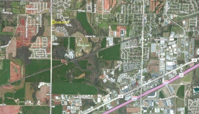
Property Record
County Line Rd, Madison, AL 35758


Property Detail
County Line Rd
Huntsville, AL
LOT 18A CEDAR SPRINGS STATION PHASE IX PB #2019-26261
16-04-18-0-000-007.009
MADISON
Commercialacreage
Alabama
B and X Area of moderate flood hazard, usually the area between the limits of the 100-year and 500-year floods.
18a
2025
1.99 AC
2025
Jetplex/Madison
011013
Huntsville
NEARBY LISTINGS FOR SALE OR LEASE
DEMOGRAPHICS near County Line Rd
1 mile
3 mile
5 mile
2025 Total Population
5,905
37,513
80,050
2030 Population
6,503
40,750
86,860
Pop Growth 2025-2030
+ 10.13%
+ 8.63%
+ 8.51%
Average Age
37
37
39
2025 Total Households
1,982
13,674
31,119
HH Growth 2025-2030
+ 10.29%
+ 8.69%
+ 8.68%
Median Household Inc
$161,418
$127,887
$114,028
Avg Household Size
2.90
2.70
2.50
2025 Avg HH Vehicles
2.00
2.00
2.00
Median Home Value
$469,239
$427,393
$403,058
Median Year Built
2010
2002
2001
Nearby Places
Map Layers
Map Styles
 Street
 Aerial
Layers
 Traffic
 Biking
Places
Listings with unknown addresses are not visible on the map
- Restaurants
- Banks
- Shops
- Fitness
- Groceries
PUBLIC TRANSPORTATION
AIRPORT
Huntsville International-Carl T Jones Field
Drive
Walk
Distance
Huntsville International-Carl T Jones Field
12 min
6.2 mi
Freight Ports
Port of Mobile
Drive
Walk
Distance
Port of Mobile
379 min
345.2 mi
SALE & LEASE HISTORY
LISTING DATE
SALE/LEASE

Sep 24, 2016
For Sale
Jul 06, 2017
For Sale
Apr 13, 2017
For Sale
Nearby Properties
Address
Land Use
TOTAL SIZE
Lot Size
Zoning
Address
Land Use
TOTAL SIZE
Lot Size
Zoning
91,200 SF
Address
Land Use
TOTAL SIZE
Lot Size
Zoning
584,820 SF
3 AC
Address
Land Use
TOTAL SIZE
Lot Size
Zoning
46,245 SF
21.49 AC
Address
Land Use
TOTAL SIZE
Lot Size
Zoning
83,201 SF
Address
Land Use
TOTAL SIZE
Lot Size
Zoning
27,558 SF
12.41 AC
Address
Land Use
TOTAL SIZE
Lot Size
Zoning
337,050 SF
66 AC
Address
Land Use
TOTAL SIZE
Lot Size
Zoning
5,487 SF
30 AC
Address
Land Use
TOTAL SIZE
Lot Size
Zoning
30,552 SF
22.24 AC
Address
Land Use
TOTAL SIZE
Lot Size
Zoning
547,730 SF
26 AC
Address
Land Use
TOTAL SIZE
Lot Size
Zoning
3,772 SF
31 AC
Address
Land Use
TOTAL SIZE
Lot Size
Zoning
108,800 SF
Address
Land Use
TOTAL SIZE
Lot Size
Zoning
87.59 AC
Address
Land Use
TOTAL SIZE
Lot Size
Zoning
4,644 SF
20.70 AC
Address
Land Use
TOTAL SIZE
Lot Size
Zoning
8,096 SF
7.15 AC
Address
Land Use
TOTAL SIZE
Lot Size
Zoning
159,547 SF
14.66 AC
Address
Land Use
TOTAL SIZE
Lot Size
Zoning
9,808 SF
10.62 AC
Address
Land Use
TOTAL SIZE
Lot Size
Zoning
7,920 SF
49 AC
Address
Land Use
TOTAL SIZE
Lot Size
Zoning
2,009 SF
20.06 AC
Address
Land Use
TOTAL SIZE
Lot Size
Zoning
11,255 SF
37 AC
Address
Land Use
TOTAL SIZE
Lot Size
Zoning
5,600 SF
17.16 AC
Address
Land Use
TOTAL SIZE
Lot Size
Zoning
299,200 SF
33 AC
Address
Land Use
TOTAL SIZE
Lot Size
Zoning
2,687 SF
14 AC
Address
Land Use
TOTAL SIZE
Lot Size
Zoning
38,047 SF
7 AC
Address
Land Use
TOTAL SIZE
Lot Size
Zoning
2,471 SF
14.08 AC
Address
Land Use
TOTAL SIZE
Lot Size
Zoning
207,500 SF
19 AC
Address
Land Use
TOTAL SIZE
Lot Size
Zoning
3,055 SF
14.14 AC
Address
Land Use
TOTAL SIZE
Lot Size
Zoning
7,160 SF
10.13 AC
Address
Land Use
TOTAL SIZE
Lot Size
Zoning
11,590 SF
23.09 AC
Address
Land Use
TOTAL SIZE
Lot Size
Zoning
39,385 SF
4.52 AC
Address
Land Use
TOTAL SIZE
Lot Size
Zoning
203,449 SF
22.14 AC
The World's #1 Commercial Real Estate Marketplace
Connect with us
© 2026 CoStar Group
The information above has been obtained from sources believed reliable. While we do not doubt its accuracy we have not verified it and make no guarantee, warranty or representation about it. It is your responsibility to independently confirm its accuracy and completeness. Any projections, opinions, assumptions, or estimates used are for example only and do not represent the current or future performance of the property. The value of this transaction to you depends on tax and other factors which should be evaluated by your tax, financial, and legal advisors. You and your advisors should conduct a careful, independent investigation of the property to determine to your satisfaction the suitability of the property for your needs.