Property Record
County Line Rd, Monument, CO 80132


Save to a Folder
{{folder.Name}}
{{folder.ListingIds.length}} Properties
{{folder.ListingIds.length}} Property
Create a New Folder
Property Detail
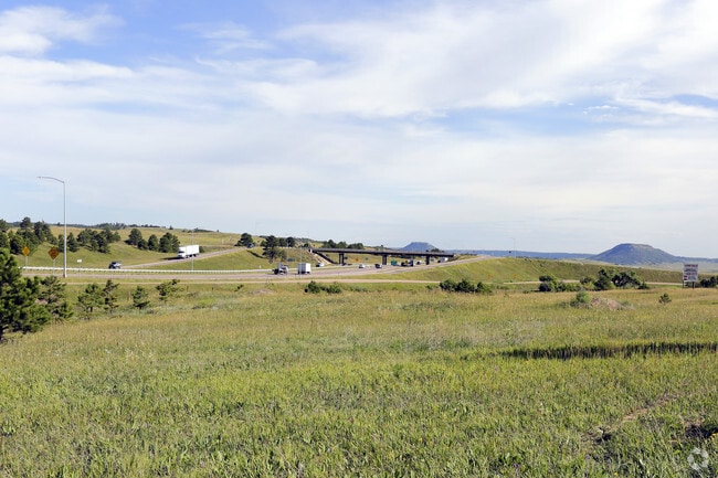
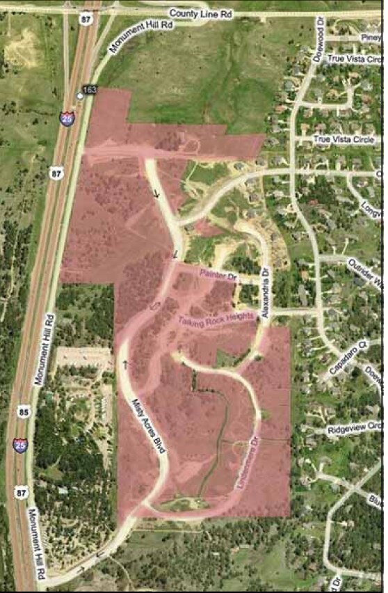
County Line Rd
71022-00-013
TRACT OF LAND IN N2 SEC 02-11-67 DESC AS FOLS, COM AT NE COR OF SD SEC, TH S 89<0654 W 1320.00 FT, S 00<5312 W 30.00 FT FOR POB, TH S 89<0654 W 1834.51 FT TO PT ON ELY R/W LN OF I25, TH ALG SD R/W S 29<3300 W 180.19 FT, S 89<0500 W 500.00 FT, S 29<16
Vacantlandnec
EL PASO
CC, RM-12,
Colorado
B and X Area of moderate flood hazard, usually the area between the limits of the 100-year and 500-year floods.
21.88 AC
2025
Northeast
2026
Colorado Springs
007401
Colorado Springs, CO
NEARBY LISTINGS FOR SALE OR LEASE
DEMOGRAPHICS near County Line Rd
1 mile
3 mile
5 mile
2025 Total Population
2,029
14,223
30,306
2030 Population
2,022
14,413
31,010
Pop Growth 2025-2030
(0.34%)
+ 1.34%
+ 2.32%
Average Age
43
43
42
2025 Total Households
677
5,104
10,761
HH Growth 2025-2030
0.00%
+ 1.53%
+ 2.51%
Median Household Inc
$172,637
$158,239
$155,108
Avg Household Size
3.00
2.80
2.80
2025 Avg HH Vehicles
3.00
3.00
3.00
Median Home Value
$786,734
$767,235
$762,981
Median Year Built
1995
1993
1997
Nearby Places
Map Layers
Map Styles
 Street
 Aerial
Layers
 Traffic
 Biking
Places
Listings with unknown addresses are not visible on the map
- Restaurants
- Banks
- Shops
- Fitness
- Groceries
PUBLIC TRANSPORTATION
AIRPORT
City of Colorado Springs Municipal
Drive
Walk
Distance
City of Colorado Springs Municipal
40 min
28.8 mi
Freight Ports
Tulsa Port Of Catoosa
Drive
Walk
Distance
Tulsa Port Of Catoosa
749 min
703.8 mi
SALE & LEASE HISTORY
LISTING DATE
SALE/LEASE

Sep 24, 2016
For Sale
Nearby Properties
Address
Land Use
TOTAL SIZE
Lot Size
Zoning
Address
Land Use
TOTAL SIZE
Lot Size
Zoning
57,619 SF
3.26 AC
SFD-2
Address
Land Use
TOTAL SIZE
Lot Size
Zoning
49,258 SF
3.68 AC
PUD
Address
Land Use
TOTAL SIZE
Lot Size
Zoning
53,026 SF
17.20 AC
RR-5
Address
Land Use
TOTAL SIZE
Lot Size
Zoning
21,695 SF
1.17 AC
BP
Address
Land Use
TOTAL SIZE
Lot Size
Zoning
38,142 SF
7.28 AC
A-5
Address
Land Use
TOTAL SIZE
Lot Size
Zoning
25,600 SF
10.11 AC
CC
Address
Land Use
TOTAL SIZE
Lot Size
Zoning
16,608 SF
1.14 AC
P
Address
Land Use
TOTAL SIZE
Lot Size
Zoning
12,167 SF
1.40 AC
DB
Address
Land Use
TOTAL SIZE
Lot Size
Zoning
31,037 SF
9.80 AC
PUD
Address
Land Use
TOTAL SIZE
Lot Size
Zoning
14,684 SF
5 AC
RS-20000
Address
Land Use
TOTAL SIZE
Lot Size
Zoning
16,230 SF
2.81 AC
Address
Land Use
TOTAL SIZE
Lot Size
Zoning
1,047.40 AC
OS
Address
Land Use
TOTAL SIZE
Lot Size
Zoning
11,794 SF
17.98 AC
RR-5
Address
Land Use
TOTAL SIZE
Lot Size
Zoning
9,631 SF
15.85 AC
PUD
Address
Land Use
TOTAL SIZE
Lot Size
Zoning
12.30 AC
CC
Address
Land Use
TOTAL SIZE
Lot Size
Zoning
625 SF
23.13 AC
SFD
Address
Land Use
TOTAL SIZE
Lot Size
Zoning
87,656 SF
4.30 AC
I-2
Address
Land Use
TOTAL SIZE
Lot Size
Zoning
21.63 AC
RR-5
Address
Land Use
TOTAL SIZE
Lot Size
Zoning
7,924 SF
0.59 AC
CC
Address
Land Use
TOTAL SIZE
Lot Size
Zoning
7,040 SF
0.22 AC
Address
Land Use
TOTAL SIZE
Lot Size
Zoning
12,000 SF
1.72 AC
DB
Address
Land Use
TOTAL SIZE
Lot Size
Zoning
16,230 SF
2.82 AC
R
Address
Land Use
TOTAL SIZE
Lot Size
Zoning
29,253 SF
21.12 AC
Address
Land Use
TOTAL SIZE
Lot Size
Zoning
11,616 SF
4.81 AC
RR-5
Address
Land Use
TOTAL SIZE
Lot Size
Zoning
53,688 SF
14.12 AC
PUD
Address
Land Use
TOTAL SIZE
Lot Size
Zoning
10 AC
CC
Address
Land Use
TOTAL SIZE
Lot Size
Zoning
16,230 SF
2.94 AC
RS-20000
Address
Land Use
TOTAL SIZE
Lot Size
Zoning
43,428 SF
385.83 AC
Address
Land Use
TOTAL SIZE
Lot Size
Zoning
7,797 SF
1.28 AC
RA
Address
Land Use
TOTAL SIZE
Lot Size
Zoning
15.37 AC
RR-5
The World's #1 Commercial Real Estate Marketplace
Connect with us
© 2026 CoStar Group
The information above has been obtained from sources believed reliable. While we do not doubt its accuracy we have not verified it and make no guarantee, warranty or representation about it. It is your responsibility to independently confirm its accuracy and completeness. Any projections, opinions, assumptions, or estimates used are for example only and do not represent the current or future performance of the property. The value of this transaction to you depends on tax and other factors which should be evaluated by your tax, financial, and legal advisors. You and your advisors should conduct a careful, independent investigation of the property to determine to your satisfaction the suitability of the property for your needs.