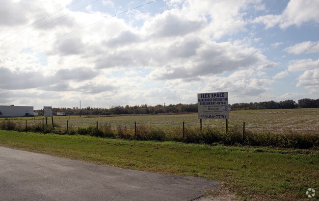
Property Record
County Line Rd, Ruskin, FL 33570

Property Detail
County Line Rd
Tampa-St. Petersburg-Clearwater, FL
PLANT CITY COMMERCE CENTER PHASE 1 COMM AT NE COR 25-28-22 THN N 89 DEG 45 MIN 16 SEC W 26.01 FT TO POB S 01 DEG 29 MIN 50 SEC E 658.95 FT S 89 DEG 08 MIN 35 SEC W 580.20 FT S 01 CDEG 29 MIN 14 SEC E 85 FT S 83 DEG 06 MIN 24 SEC E 220.81 FT TO CURVE
U-32-32-18-ZZZ-000001-11670.0
HILLSBOROUGH
Stateproperty
Florida
AR
1
AE The base floodplain where base flood elevations are provided. AE Zones are now used on new format FIRMs instead of A1-A30 Zones.
181.15 AC
0
Eastern Outlying
2025
Tampa/St Petersburg
012600
NEARBY LISTINGS FOR SALE OR LEASE
DEMOGRAPHICS near County Line Rd
1 mile
3 mile
5 mile
2025 Total Population
1,328
14,778
74,253
2030 Population
1,446
16,604
83,549
Pop Growth 2025-2030
+ 8.89%
+ 12.36%
+ 12.52%
Average Age
39
42
41
2025 Total Households
453
5,572
28,112
HH Growth 2025-2030
+ 9.05%
+ 12.87%
+ 13.01%
Median Household Inc
$76,017
$75,856
$62,717
Avg Household Size
2.80
2.60
2.60
2025 Avg HH Vehicles
2.00
2.00
2.00
Median Home Value
$267,741
$326,328
$269,015
Median Year Built
1997
1994
1988
Nearby Places
Map Layers
Map Styles
 Street
 Aerial
Transit
 Traffic
 Biking
Places
Listings with unknown addresses are not visible on the map
- Restaurants
- Banks
- Shops
- Fitness
- Groceries
PUBLIC TRANSPORTATION
AIRPORT
Sarasota/Bradenton International
Drive
Walk
Distance
Sarasota/Bradenton International
33 min
20.0 mi
St Pete-Clearwater International
Drive
Walk
Distance
St Pete-Clearwater International
51 min
36.5 mi
Tampa International
Drive
Walk
Distance
Tampa International
58 min
38.1 mi
Freight Ports
Port Manatee
Drive
Walk
Distance
Port Manatee
8 min
3.1 mi
SALE & LEASE HISTORY
LISTING DATE
SALE/LEASE

Sep 24, 2016
For Sale
Nearby Properties
Address
Land Use
TOTAL SIZE
Lot Size
Zoning
Address
Land Use
TOTAL SIZE
Lot Size
Zoning
594,436 SF
68.40 AC
PD-PM
Address
Land Use
TOTAL SIZE
Lot Size
Zoning
350,076 SF
349 AC
PD-PM
Address
Land Use
TOTAL SIZE
Lot Size
Zoning
322,319 SF
17.98 AC
PD-EZ
Address
Land Use
TOTAL SIZE
Lot Size
Zoning
177,572 SF
16.48 AC
PD-EZ
Address
Land Use
TOTAL SIZE
Lot Size
Zoning
122,346 SF
12.43 AC
PD-EZ
Address
Land Use
TOTAL SIZE
Lot Size
Zoning
628.36 AC
AR
Address
Land Use
TOTAL SIZE
Lot Size
Zoning
178,041 SF
414.24 AC
PD-PM
Address
Land Use
TOTAL SIZE
Lot Size
Zoning
127,606 SF
18.02 AC
LM LIGHT M
Address
Land Use
TOTAL SIZE
Lot Size
Zoning
236.45 AC
AR
Address
Land Use
TOTAL SIZE
Lot Size
Zoning
459 SF
149.45 AC
AR
Address
Land Use
TOTAL SIZE
Lot Size
Zoning
139,909 SF
3.25 AC
PD-M
Address
Land Use
TOTAL SIZE
Lot Size
Zoning
154,940 SF
3.94 AC
PD-M
Address
Land Use
TOTAL SIZE
Lot Size
Zoning
14,756 SF
82.96 AC
PD
Address
Land Use
TOTAL SIZE
Lot Size
Zoning
7.24 AC
Address
Land Use
TOTAL SIZE
Lot Size
Zoning
61.03 AC
Address
Land Use
TOTAL SIZE
Lot Size
Zoning
126,912 SF
8.40 AC
PD-EZ
Address
Land Use
TOTAL SIZE
Lot Size
Zoning
93,104 SF
2.57 AC
PD-EZ
Address
Land Use
TOTAL SIZE
Lot Size
Zoning
177,498 SF
25.46 AC
PD-EZ
Address
Land Use
TOTAL SIZE
Lot Size
Zoning
117.12 AC
Address
Land Use
TOTAL SIZE
Lot Size
Zoning
43,852 SF
11.85 AC
PD
Address
Land Use
TOTAL SIZE
Lot Size
Zoning
103.09 AC
Address
Land Use
TOTAL SIZE
Lot Size
Zoning
59,541 SF
0.50 AC
PD-M
Address
Land Use
TOTAL SIZE
Lot Size
Zoning
18,265 SF
161.22 AC
PD-PM
Address
Land Use
TOTAL SIZE
Lot Size
Zoning
195.16 AC
AR
Address
Land Use
TOTAL SIZE
Lot Size
Zoning
51,758 SF
84.10 AC
A,PD-PI
Address
Land Use
TOTAL SIZE
Lot Size
Zoning
13,484 SF
2.74 AC
PD-EZ
Address
Land Use
TOTAL SIZE
Lot Size
Zoning
47,234 SF
4.48 AC
PD-EZ
Address
Land Use
TOTAL SIZE
Lot Size
Zoning
77,000 SF
0.72 AC
PD-M
Address
Land Use
TOTAL SIZE
Lot Size
Zoning
54,275 SF
1.28 AC
PD-PM
The World's #1 Commercial Real Estate Marketplace
Connect with us
© 2026 CoStar Group
The information above has been obtained from sources believed reliable. While we do not doubt its accuracy we have not verified it and make no guarantee, warranty or representation about it. It is your responsibility to independently confirm its accuracy and completeness. Any projections, opinions, assumptions, or estimates used are for example only and do not represent the current or future performance of the property. The value of this transaction to you depends on tax and other factors which should be evaluated by your tax, financial, and legal advisors. You and your advisors should conduct a careful, independent investigation of the property to determine to your satisfaction the suitability of the property for your needs.