Property Record
State Road 26, Oshkosh, WI 54904


Property Detail
State Road 26
Oshkosh-Neenah, WI
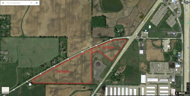
PT NW SE DESC AS LOT 1 OF CSM-6712 6.54 A.
012-027704
WINNEBAGO
Agriculturalland
Wisconsin
B and X Area of moderate flood hazard, usually the area between the limits of the 100-year and 500-year floods.
1
2024
6.54 AC
2025
Appleton/Oshkosh
001803
Other Market Areas
NEARBY LISTINGS FOR SALE OR LEASE
DEMOGRAPHICS near State Road 26
1 mile
3 mile
5 mile
2025 Total Population
65
2,697
23,945
2030 Population
67
2,779
24,314
Pop Growth 2025-2030
+ 3.08%
+ 3.04%
+ 1.54%
Average Age
47
46
42
2025 Total Households
31
1,257
10,540
HH Growth 2025-2030
+ 3.23%
+ 2.94%
+ 1.50%
Median Household Inc
$89,583
$88,706
$75,337
Avg Household Size
2.10
2.10
2.20
2025 Avg HH Vehicles
2.00
2.00
2.00
Median Home Value
$255,555
$264,411
$208,243
Median Year Built
1996
1995
1976
Nearby Places
Map Layers
Map Styles
 Street
 Aerial
Layers
 Traffic
 Biking
Places
Listings with unknown addresses are not visible on the map
- Restaurants
- Banks
- Shops
- Fitness
- Groceries
PUBLIC TRANSPORTATION
AIRPORT
Appleton International
Drive
Walk
Distance
Appleton International
33 min
26.4 mi
Freight Ports
Port Milwaukee
Drive
Walk
Distance
Port Milwaukee
98 min
83.3 mi
SALE & LEASE HISTORY
LISTING DATE
SALE/LEASE

Apr 22, 2020
For Sale
Nearby Properties
Address
Land Use
TOTAL SIZE
Lot Size
Zoning
Address
Land Use
TOTAL SIZE
Lot Size
Zoning
15.37 AC
SMU-PD
Address
Land Use
TOTAL SIZE
Lot Size
Zoning
58,465 SF
43.67 AC
M3
Address
Land Use
TOTAL SIZE
Lot Size
Zoning
18.38 AC
UIPD
Address
Land Use
TOTAL SIZE
Lot Size
Zoning
41.70 AC
HI
Address
Land Use
TOTAL SIZE
Lot Size
Zoning
110,200 SF
14.77 AC
MR-12-PD
Address
Land Use
TOTAL SIZE
Lot Size
Zoning
238,238 SF
22.60 AC
M3
Address
Land Use
TOTAL SIZE
Lot Size
Zoning
271,088 SF
36.80 AC
M3
Address
Land Use
TOTAL SIZE
Lot Size
Zoning
32,430 SF
7.44 AC
M1
Address
Land Use
TOTAL SIZE
Lot Size
Zoning
28,512 SF
6.20 AC
M1
Address
Land Use
TOTAL SIZE
Lot Size
Zoning
42,092 SF
3.21 AC
C2
Address
Land Use
TOTAL SIZE
Lot Size
Zoning
126,814 SF
22.60 AC
HI
Address
Land Use
TOTAL SIZE
Lot Size
Zoning
62,880 SF
5.78 AC
M3
Address
Land Use
TOTAL SIZE
Lot Size
Zoning
66,456 SF
5.91 AC
MR-12-PD
Address
Land Use
TOTAL SIZE
Lot Size
Zoning
38,858 SF
8.15 AC
M1
Address
Land Use
TOTAL SIZE
Lot Size
Zoning
13.67 AC
Address
Land Use
TOTAL SIZE
Lot Size
Zoning
13.75 AC
Address
Land Use
TOTAL SIZE
Lot Size
Zoning
20,544 SF
4.16 AC
M-1PD
Address
Land Use
TOTAL SIZE
Lot Size
Zoning
67,734 SF
5.62 AC
MR-12-PD
Address
Land Use
TOTAL SIZE
Lot Size
Zoning
150,000 SF
17.87 AC
M3
Address
Land Use
TOTAL SIZE
Lot Size
Zoning
596 SF
4.94 AC
R3
Address
Land Use
TOTAL SIZE
Lot Size
Zoning
89,520 SF
7 AC
M3
Address
Land Use
TOTAL SIZE
Lot Size
Zoning
561 SF
8.24 AC
R3
Address
Land Use
TOTAL SIZE
Lot Size
Zoning
57,297 SF
3.23 AC
M1
Address
Land Use
TOTAL SIZE
Lot Size
Zoning
117,249 SF
22.05 AC
M3
Address
Land Use
TOTAL SIZE
Lot Size
Zoning
101,265 SF
9.76 AC
M3
Address
Land Use
TOTAL SIZE
Lot Size
Zoning
25,000 SF
6.94 AC
HI
Address
Land Use
TOTAL SIZE
Lot Size
Zoning
18,150 SF
4.30 AC
M1
Address
Land Use
TOTAL SIZE
Lot Size
Zoning
42,000 SF
5 AC
M3
Address
Land Use
TOTAL SIZE
Lot Size
Zoning
78,000 SF
19.02 AC
M3
Address
Land Use
TOTAL SIZE
Lot Size
Zoning
26,852 SF
7.28 AC
IPD
The World's #1 Commercial Real Estate Marketplace
Connect with us
© 2026 CoStar Group
The information above has been obtained from sources believed reliable. While we do not doubt its accuracy we have not verified it and make no guarantee, warranty or representation about it. It is your responsibility to independently confirm its accuracy and completeness. Any projections, opinions, assumptions, or estimates used are for example only and do not represent the current or future performance of the property. The value of this transaction to you depends on tax and other factors which should be evaluated by your tax, financial, and legal advisors. You and your advisors should conduct a careful, independent investigation of the property to determine to your satisfaction the suitability of the property for your needs.