Property Record
County Road 100, Pearland, TX 77584


NEARBY LISTINGS FOR SALE OR LEASE
Property Detail
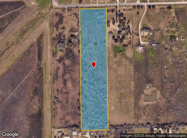
County Road 100
Houston-The Woodlands-Sugar Land, TX
H T & B R R
0552-0003-414
A0552 H T & B R R TRACT 1A4 ACRES 9.155
Agriculturalland
Brazoria
X
Texas
48039C0044K
9.16 AC
2024
South
2025
Houston
660701
DEMOGRAPHICS near County Road 100
1 Mile
3 Mile
5 Mile
2024 Total Population
2,978
29,340
109,281
2029 Population
3,359
32,474
118,914
Pop Growth 2024-2029
+ 12.79%
+ 10.68%
+ 8.81%
Average Age
34
36
38
2024 Total Households
868
9,510
36,867
HH Growth 2024-2029
+ 12.79%
+ 10.83%
+ 8.90%
Median Household Inc
$66,435
$98,831
$103,788
Avg Household Size
3.10
3.00
2.90
2024 Avg HH Vehicles
3.00
2.00
2.00
Median Home Value
$274,218
$289,147
$286,952
Median Year Built
1995
1998
1996
Nearby Places
Map Layers
Map Styles
 Street
 Aerial
- Restaurants
- Banks
- Shops
- Fitness
- Groceries
PUBLIC TRANSPORTATION
AIRPORT
William P Hobby
DRIVE
WALK
Distance
William P Hobby
22 min
10.0 mi
Freight Ports
Port of Houston
DRIVE
WALK
Distance
Port of Houston
33 min
18.2 mi
SALE & LEASE HISTORY
LISTING DATE
SALE/LEASE

Aug 10, 2021
For Sale
Nearby Properties
Address
Land Use
TOTAL SIZE
Lot Size
Zoning
Address
Land Use
TOTAL SIZE
Lot Size
Zoning
40.52 AC
0017
Address
Land Use
TOTAL SIZE
Lot Size
Zoning
83.37 AC
0004
Address
Land Use
TOTAL SIZE
Lot Size
Zoning
64.56 AC
0016
Address
Land Use
TOTAL SIZE
Lot Size
Zoning
236,642 SF
11.48 AC
Address
Land Use
TOTAL SIZE
Lot Size
Zoning
7.42 AC
Address
Land Use
TOTAL SIZE
Lot Size
Zoning
97,736 SF
16.49 AC
Address
Land Use
TOTAL SIZE
Lot Size
Zoning
113,376 SF
9.80 AC
Address
Land Use
TOTAL SIZE
Lot Size
Zoning
67,595 SF
4.97 AC
Address
Land Use
TOTAL SIZE
Lot Size
Zoning
49.29 AC
0007
Address
Land Use
TOTAL SIZE
Lot Size
Zoning
6,948 SF
54.94 AC
2080
Address
Land Use
TOTAL SIZE
Lot Size
Zoning
63,615 SF
6.42 AC
0010
Address
Land Use
TOTAL SIZE
Lot Size
Zoning
19.61 AC
Address
Land Use
TOTAL SIZE
Lot Size
Zoning
45,108 SF
3.74 AC
Address
Land Use
TOTAL SIZE
Lot Size
Zoning
77,997 SF
19 AC
0065
Address
Land Use
TOTAL SIZE
Lot Size
Zoning
67,000 SF
28.97 AC
Address
Land Use
TOTAL SIZE
Lot Size
Zoning
Address
Land Use
TOTAL SIZE
Lot Size
Zoning
67,130 SF
17.70 AC
0151
Address
Land Use
TOTAL SIZE
Lot Size
Zoning
9.72 AC
Address
Land Use
TOTAL SIZE
Lot Size
Zoning
15.30 AC
Address
Land Use
TOTAL SIZE
Lot Size
Zoning
27,648 SF
3.23 AC
0009
Address
Land Use
TOTAL SIZE
Lot Size
Zoning
32,130 SF
17.88 AC
0027
Address
Land Use
TOTAL SIZE
Lot Size
Zoning
1,920 SF
14.94 AC
Address
Land Use
TOTAL SIZE
Lot Size
Zoning
153,736 SF
9.25 AC
Address
Land Use
TOTAL SIZE
Lot Size
Zoning
24,000 SF
3.53 AC
0001
Address
Land Use
TOTAL SIZE
Lot Size
Zoning
39,208 SF
8.03 AC
0060
Address
Land Use
TOTAL SIZE
Lot Size
Zoning
55,152 SF
7.29 AC
0070
Address
Land Use
TOTAL SIZE
Lot Size
Zoning
32.73 AC
0019
Address
Land Use
TOTAL SIZE
Lot Size
Zoning
60,440 SF
5 AC
7010
Address
Land Use
TOTAL SIZE
Lot Size
Zoning
41.07 AC
Address
Land Use
TOTAL SIZE
Lot Size
Zoning
47,260 SF
9.80 AC
0146
The World's #1 Commercial Real Estate Marketplace
Connect with us
© 2025 CoStar Group
The information above has been obtained from sources believed reliable. While we do not doubt its accuracy we have not verified it and make no guarantee, warranty or representation about it. It is your responsibility to independently confirm its accuracy and completeness. Any projections, opinions, assumptions, or estimates used are for example only and do not represent the current or future performance of the property. The value of this transaction to you depends on tax and other factors which should be evaluated by your tax, financial, and legal advisors. You and your advisors should conduct a careful, independent investigation of the property to determine to your satisfaction the suitability of the property for your needs.