Property Record
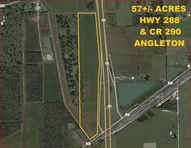
County Road 290, Angleton, TX 77515
Property Detail
County Road 290
0699-0014-110
A0699 M C TOBIN TRACT 9-11-12-13 ACRES 22.94
Agriculturalland
BRAZORIA
0031
Texas
B and X Area of moderate flood hazard, usually the area between the limits of the 100-year and 500-year floods.
22.94 AC
0
Southwest Far
2025
Houston
662100
Houston-Pasadena-The Woodlands, TX
NEARBY LISTINGS FOR SALE OR LEASE
DEMOGRAPHICS near County Road 290
1 mile
3 mile
5 mile
2025 Total Population
562
17,198
29,782
2030 Population
625
19,088
32,985
Pop Growth 2025-2030
+ 11.21%
+ 10.99%
+ 10.75%
Average Age
40
38
39
2025 Total Households
196
6,249
10,578
HH Growth 2025-2030
+ 11.22%
+ 11.27%
+ 11.23%
Median Household Inc
$87,500
$91,852
$86,491
Avg Household Size
2.80
2.70
2.70
2025 Avg HH Vehicles
2.00
2.00
2.00
Median Home Value
$313,043
$217,634
$220,560
Median Year Built
1990
1979
1983
Nearby Places
Map Layers
Map Styles
 Street
 Aerial
Layers
 Traffic
 Biking
Places
Listings with unknown addresses are not visible on the map
- Restaurants
- Banks
- Shops
- Fitness
- Groceries
SALE & LEASE HISTORY
LISTING DATE
SALE/LEASE

Sep 24, 2016
For Sale
Nearby Properties
Address
Land Use
TOTAL SIZE
Lot Size
Zoning
Address
Land Use
TOTAL SIZE
Lot Size
Zoning
305,581 SF
8.28 AC
Address
Land Use
TOTAL SIZE
Lot Size
Zoning
318,545 SF
50.52 AC
Address
Land Use
TOTAL SIZE
Lot Size
Zoning
128,857 SF
10.65 AC
0140
Address
Land Use
TOTAL SIZE
Lot Size
Zoning
92,290 SF
6.17 AC
0361
Address
Land Use
TOTAL SIZE
Lot Size
Zoning
145,006 SF
6.97 AC
Address
Land Use
TOTAL SIZE
Lot Size
Zoning
45,000 SF
13.30 AC
0062
Address
Land Use
TOTAL SIZE
Lot Size
Zoning
14.46 AC
0138
Address
Land Use
TOTAL SIZE
Lot Size
Zoning
128,247 SF
17.49 AC
0114
Address
Land Use
TOTAL SIZE
Lot Size
Zoning
266,816 SF
20.34 AC
Address
Land Use
TOTAL SIZE
Lot Size
Zoning
116,629 SF
44.43 AC
Address
Land Use
TOTAL SIZE
Lot Size
Zoning
96,487 SF
1 AC
0011
Address
Land Use
TOTAL SIZE
Lot Size
Zoning
36,320 SF
10 AC
098A
Address
Land Use
TOTAL SIZE
Lot Size
Zoning
6.52 AC
Address
Land Use
TOTAL SIZE
Lot Size
Zoning
4.60 AC
Address
Land Use
TOTAL SIZE
Lot Size
Zoning
95,358 SF
4.78 AC
0140
Address
Land Use
TOTAL SIZE
Lot Size
Zoning
10,683 SF
21.02 AC
Address
Land Use
TOTAL SIZE
Lot Size
Zoning
60.29 AC
0068
Address
Land Use
TOTAL SIZE
Lot Size
Zoning
18,091 SF
29.61 AC
Address
Land Use
TOTAL SIZE
Lot Size
Zoning
77,295 SF
6.63 AC
0056
Address
Land Use
TOTAL SIZE
Lot Size
Zoning
1,930 SF
30 AC
0436
Address
Land Use
TOTAL SIZE
Lot Size
Zoning
33,546 SF
13.28 AC
Address
Land Use
TOTAL SIZE
Lot Size
Zoning
112,149 SF
35.71 AC
Address
Land Use
TOTAL SIZE
Lot Size
Zoning
14.90 AC
Address
Land Use
TOTAL SIZE
Lot Size
Zoning
14.52 AC
Address
Land Use
TOTAL SIZE
Lot Size
Zoning
11,888 SF
6.07 AC
Address
Land Use
TOTAL SIZE
Lot Size
Zoning
66.66 AC
0260
Address
Land Use
TOTAL SIZE
Lot Size
Zoning
34,125 SF
1.67 AC
Address
Land Use
TOTAL SIZE
Lot Size
Zoning
125,915 SF
6.02 AC
Address
Land Use
TOTAL SIZE
Lot Size
Zoning
57,828 SF
4.36 AC
Address
Land Use
TOTAL SIZE
Lot Size
Zoning
20,171 SF
35 AC
The World's #1 Commercial Real Estate Marketplace
Connect with us
© 2026 CoStar Group
The information above has been obtained from sources believed reliable. While we do not doubt its accuracy we have not verified it and make no guarantee, warranty or representation about it. It is your responsibility to independently confirm its accuracy and completeness. Any projections, opinions, assumptions, or estimates used are for example only and do not represent the current or future performance of the property. The value of this transaction to you depends on tax and other factors which should be evaluated by your tax, financial, and legal advisors. You and your advisors should conduct a careful, independent investigation of the property to determine to your satisfaction the suitability of the property for your needs.