Property Record
Covered Bridge Rd, Clayton, NC 27527
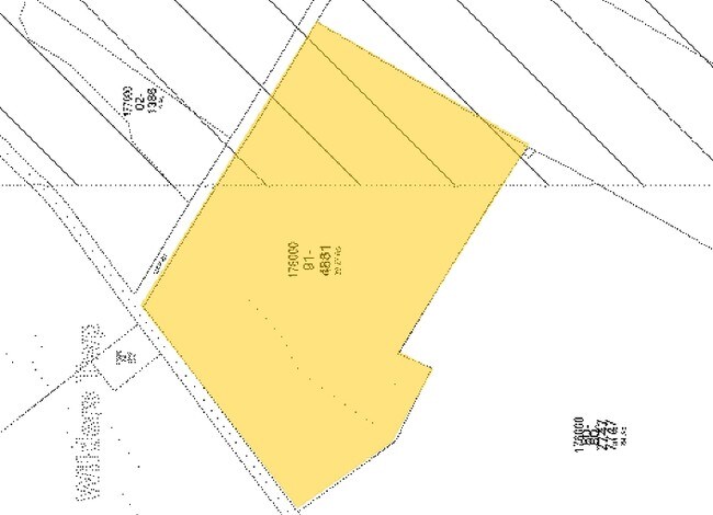

Property Detail
Covered Bridge Rd
16I03029A
TOWN OF CLAYTON 80/270 97/79
Vacantlandnec
JOHNSTON
COM
North Carolina
B and X Area of moderate flood hazard, usually the area between the limits of the 100-year and 500-year floods.
39.55 AC
0
Johnston County
2025
Raleigh/Durham
040207
Raleigh-Cary, NC
NEARBY LISTINGS FOR SALE OR LEASE
DEMOGRAPHICS near Covered Bridge Rd
1 mile
3 mile
5 mile
2025 Total Population
4,022
24,902
69,023
2030 Population
4,479
27,977
77,412
Pop Growth 2025-2030
+ 11.36%
+ 12.35%
+ 12.15%
Average Age
34
38
38
2025 Total Households
1,316
9,238
25,031
HH Growth 2025-2030
+ 11.40%
+ 12.46%
+ 12.24%
Median Household Inc
$101,081
$94,855
$95,367
Avg Household Size
3.00
2.70
2.70
2025 Avg HH Vehicles
2.00
2.00
2.00
Median Home Value
$358,539
$372,349
$368,466
Median Year Built
2010
2007
2006
Nearby Places
Map Layers
Map Styles
 Street
 Aerial
Transit
 Traffic
 Biking
Places
Listings with unknown addresses are not visible on the map
- Restaurants
- Banks
- Shops
- Fitness
- Groceries
PUBLIC TRANSPORTATION
AIRPORT
Raleigh-Durham International
Drive
Walk
Distance
Raleigh-Durham International
45 min
34.7 mi
Freight Ports
Port of Wilmington
Drive
Walk
Distance
Port of Wilmington
152 min
128.8 mi
Nearby Properties
Address
Land Use
TOTAL SIZE
Lot Size
Zoning
Address
Land Use
TOTAL SIZE
Lot Size
Zoning
22,428 SF
19.98 AC
COM
Address
Land Use
TOTAL SIZE
Lot Size
Zoning
46,266 SF
19.36 AC
COM
Address
Land Use
TOTAL SIZE
Lot Size
Zoning
27,636 SF
17.81 AC
PUD
Address
Land Use
TOTAL SIZE
Lot Size
Zoning
65,586 SF
15.48 AC
OFF
Address
Land Use
TOTAL SIZE
Lot Size
Zoning
16,236 SF
45.70 AC
RES
Address
Land Use
TOTAL SIZE
Lot Size
Zoning
72,416 SF
6.61 AC
COM
Address
Land Use
TOTAL SIZE
Lot Size
Zoning
84,379 SF
6.87 AC
PUD
Address
Land Use
TOTAL SIZE
Lot Size
Zoning
97,500 SF
3.96 AC
COM
Address
Land Use
TOTAL SIZE
Lot Size
Zoning
282,196 SF
139.44 AC
IND
Address
Land Use
TOTAL SIZE
Lot Size
Zoning
59,600 SF
29 AC
PUD
Address
Land Use
TOTAL SIZE
Lot Size
Zoning
18,000 SF
249.20 AC
IND
Address
Land Use
TOTAL SIZE
Lot Size
Zoning
57,701 SF
4.93 AC
COM
Address
Land Use
TOTAL SIZE
Lot Size
Zoning
20,991 SF
16.69 AC
RES
Address
Land Use
TOTAL SIZE
Lot Size
Zoning
51,494 SF
6.52 AC
PUD
Address
Land Use
TOTAL SIZE
Lot Size
Zoning
54,968 SF
11.14 AC
PUD
Address
Land Use
TOTAL SIZE
Lot Size
Zoning
68,984 SF
6.66 AC
SUP
Address
Land Use
TOTAL SIZE
Lot Size
Zoning
27,048 SF
2.41 AC
COM
Address
Land Use
TOTAL SIZE
Lot Size
Zoning
19,944 SF
1.08 AC
RES
Address
Land Use
TOTAL SIZE
Lot Size
Zoning
5,381 SF
1.18 AC
COM
Address
Land Use
TOTAL SIZE
Lot Size
Zoning
14,300 SF
5.01 AC
PUD
Address
Land Use
TOTAL SIZE
Lot Size
Zoning
6,960 SF
1.37 AC
PUD
Address
Land Use
TOTAL SIZE
Lot Size
Zoning
7,568 SF
1.48 AC
COM
Address
Land Use
TOTAL SIZE
Lot Size
Zoning
5,550 SF
2.29 AC
COM
Address
Land Use
TOTAL SIZE
Lot Size
Zoning
7,488 SF
1.35 AC
COM
Address
Land Use
TOTAL SIZE
Lot Size
Zoning
7,568 SF
1.64 AC
COM
Address
Land Use
TOTAL SIZE
Lot Size
Zoning
31,536 SF
4.03 AC
SUP
Address
Land Use
TOTAL SIZE
Lot Size
Zoning
56,904 SF
8.62 AC
IND
Address
Land Use
TOTAL SIZE
Lot Size
Zoning
15,360 SF
1.17 AC
COM
Address
Land Use
TOTAL SIZE
Lot Size
Zoning
3,956 SF
6.80 AC
RES
Address
Land Use
TOTAL SIZE
Lot Size
Zoning
6,960 SF
2 AC
PUD
The World's #1 Commercial Real Estate Marketplace
Connect with us
© 2026 CoStar Group
The information above has been obtained from sources believed reliable. While we do not doubt its accuracy we have not verified it and make no guarantee, warranty or representation about it. It is your responsibility to independently confirm its accuracy and completeness. Any projections, opinions, assumptions, or estimates used are for example only and do not represent the current or future performance of the property. The value of this transaction to you depends on tax and other factors which should be evaluated by your tax, financial, and legal advisors. You and your advisors should conduct a careful, independent investigation of the property to determine to your satisfaction the suitability of the property for your needs.