Property Record
Crabb River Rd, Sugar Land, TX 77479


Property Detail
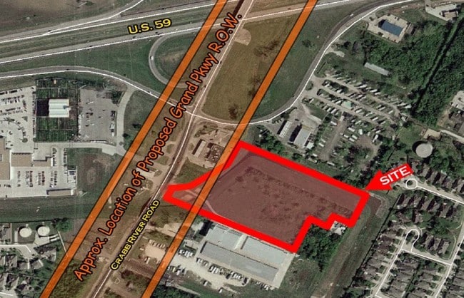
Crabb River Rd
0049-00-000-0128-901
0049 J KUYKENDALL, TRACT 12(PT), ACRES 7.6953
Residentialacreage
FORT BEND
ZQOS
Texas
AE The base floodplain where base flood elevations are provided. AE Zones are now used on new format FIRMs instead of A1-A30 Zones.
7.70 AC
2024
Southwest Outlier
2025
Houston
674200
Houston-Pasadena-The Woodlands, TX
NEARBY LISTINGS FOR SALE OR LEASE
DEMOGRAPHICS near Crabb River Rd
1 mile
3 mile
5 mile
2025 Total Population
10,902
63,894
155,449
2030 Population
12,258
72,099
176,243
Pop Growth 2025-2030
+ 12.44%
+ 12.84%
+ 13.38%
Average Age
40
40
40
2025 Total Households
3,610
21,108
51,406
HH Growth 2025-2030
+ 12.85%
+ 13.35%
+ 13.87%
Median Household Inc
$141,410
$130,258
$122,963
Avg Household Size
3.00
3.00
3.00
2025 Avg HH Vehicles
2.00
2.00
2.00
Median Home Value
$378,806
$402,287
$417,735
Median Year Built
1999
2003
2005
Nearby Places
Map Layers
Map Styles
 Street
 Aerial
Layers
 Traffic
 Biking
Places
Listings with unknown addresses are not visible on the map
- Restaurants
- Banks
- Shops
- Fitness
- Groceries
PUBLIC TRANSPORTATION
AIRPORT
William P Hobby
Drive
Walk
Distance
William P Hobby
46 min
32.3 mi
George Bush Intcntl/Houston
Drive
Walk
Distance
George Bush Intcntl/Houston
57 min
46.5 mi
Freight Ports
Port of Houston
Drive
Walk
Distance
Port of Houston
48 min
32.9 mi
Nearby Properties
Address
Land Use
TOTAL SIZE
Lot Size
Zoning
Address
Land Use
TOTAL SIZE
Lot Size
Zoning
401,314 SF
16.61 AC
Address
Land Use
TOTAL SIZE
Lot Size
Zoning
189,381 SF
167.45 AC
Address
Land Use
TOTAL SIZE
Lot Size
Zoning
133,259 SF
9.99 AC
Address
Land Use
TOTAL SIZE
Lot Size
Zoning
11.65 AC
Address
Land Use
TOTAL SIZE
Lot Size
Zoning
573,314 SF
115.57 AC
Address
Land Use
TOTAL SIZE
Lot Size
Zoning
203,739 SF
13.28 AC
Address
Land Use
TOTAL SIZE
Lot Size
Zoning
85,021 SF
12 AC
Address
Land Use
TOTAL SIZE
Lot Size
Zoning
102,715 SF
14.99 AC
Address
Land Use
TOTAL SIZE
Lot Size
Zoning
310,144 SF
7.19 AC
Address
Land Use
TOTAL SIZE
Lot Size
Zoning
10,000,000 SF
54.91 AC
YQS
Address
Land Use
TOTAL SIZE
Lot Size
Zoning
89,753 SF
10.61 AC
Address
Land Use
TOTAL SIZE
Lot Size
Zoning
Address
Land Use
TOTAL SIZE
Lot Size
Zoning
4,084 SF
680.16 AC
QSOT
Address
Land Use
TOTAL SIZE
Lot Size
Zoning
312,108 SF
24.39 AC
Address
Land Use
TOTAL SIZE
Lot Size
Zoning
Address
Land Use
TOTAL SIZE
Lot Size
Zoning
126,080 SF
0.76 AC
Address
Land Use
TOTAL SIZE
Lot Size
Zoning
50.31 AC
Address
Land Use
TOTAL SIZE
Lot Size
Zoning
Address
Land Use
TOTAL SIZE
Lot Size
Zoning
Address
Land Use
TOTAL SIZE
Lot Size
Zoning
16.48 AC
Address
Land Use
TOTAL SIZE
Lot Size
Zoning
Address
Land Use
TOTAL SIZE
Lot Size
Zoning
100,000 SF
12.01 AC
Address
Land Use
TOTAL SIZE
Lot Size
Zoning
86,856 SF
10 AC
X
Address
Land Use
TOTAL SIZE
Lot Size
Zoning
Address
Land Use
TOTAL SIZE
Lot Size
Zoning
88,728 SF
5.04 AC
Address
Land Use
TOTAL SIZE
Lot Size
Zoning
87,094 SF
12.50 AC
QYS
Address
Land Use
TOTAL SIZE
Lot Size
Zoning
107,849 SF
6.75 AC
SQ
Address
Land Use
TOTAL SIZE
Lot Size
Zoning
9.99 AC
Address
Land Use
TOTAL SIZE
Lot Size
Zoning
60,728 SF
5.59 AC
Address
Land Use
TOTAL SIZE
Lot Size
Zoning
60,391 SF
5.50 AC
The World's #1 Commercial Real Estate Marketplace
Connect with us
© 2026 CoStar Group
The information above has been obtained from sources believed reliable. While we do not doubt its accuracy we have not verified it and make no guarantee, warranty or representation about it. It is your responsibility to independently confirm its accuracy and completeness. Any projections, opinions, assumptions, or estimates used are for example only and do not represent the current or future performance of the property. The value of this transaction to you depends on tax and other factors which should be evaluated by your tax, financial, and legal advisors. You and your advisors should conduct a careful, independent investigation of the property to determine to your satisfaction the suitability of the property for your needs.