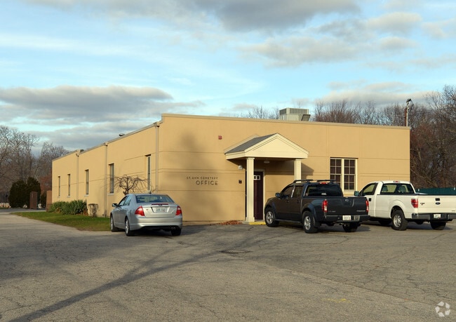
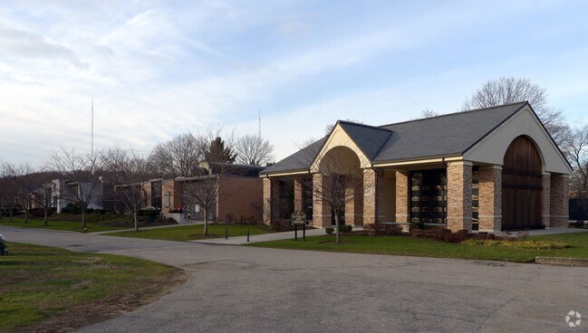
Property Record
Cranston St, Cranston, RI 02910
Property Detail
Cranston St
CRAN-000008-000001-000220
PROVIDENCE
Cemetery
Rhode Island
S1
220
AE The base floodplain where base flood elevations are provided. AE Zones are now used on new format FIRMs instead of A1-A30 Zones.
22.89 AC
0
Cranston
2025
Providence
013702
Providence-Warwick, RI-MA
NEARBY LISTINGS FOR SALE OR LEASE
DEMOGRAPHICS near Cranston St
1 mile
3 mile
5 mile
2025 Total Population
18,318
175,591
346,939
2030 Population
18,813
179,841
356,643
Pop Growth 2025-2030
+ 2.70%
+ 2.42%
+ 2.80%
Average Age
40
38
39
2025 Total Households
7,365
67,087
136,153
HH Growth 2025-2030
+ 2.80%
+ 2.58%
+ 3.00%
Median Household Inc
$63,694
$69,402
$74,036
Avg Household Size
2.40
2.50
2.40
2025 Avg HH Vehicles
1.00
2.00
2.00
Median Home Value
$337,842
$349,614
$366,510
Median Year Built
1956
1951
1952
Nearby Places
Map Layers
Map Styles
 Street
 Aerial
Layers
 Traffic
 Biking
Places
Listings with unknown addresses are not visible on the map
- Restaurants
- Banks
- Shops
- Fitness
- Groceries
PUBLIC TRANSPORTATION
COMMUTER RAIL
Providence (Providence/Stoughton Line - Massachusetts Bay Transportation Authority Commuter Rail (Purple Line))
Drive
Walk
Distance
Providence (Providence/Stoughton Line - Massachusetts Bay Transportation Authority Commuter Rail (Purple Line))
9 min
4.8 mi
Tf Green Airport (Providence/Stoughton Line - MBTA)
Drive
Walk
Distance
Tf Green Airport (Providence/Stoughton Line - MBTA)
15 min
7.1 mi
AIRPORT
Rhode Island Tf Green International
Drive
Walk
Distance
Rhode Island Tf Green International
17 min
8.0 mi
Freight Ports
Port of Davisville, RI
Drive
Walk
Distance
Port of Davisville, RI
31 min
18.3 mi
Nearby Properties
Address
Land Use
TOTAL SIZE
Lot Size
Zoning
Address
Land Use
TOTAL SIZE
Lot Size
Zoning
8.93 AC
OS
Address
Land Use
TOTAL SIZE
Lot Size
Zoning
45,000 SF
22.22 AC
M2
Address
Land Use
TOTAL SIZE
Lot Size
Zoning
9.06 AC
PS
Address
Land Use
TOTAL SIZE
Lot Size
Zoning
13.40 AC
C3
Address
Land Use
TOTAL SIZE
Lot Size
Zoning
91.15 AC
PUD
Address
Land Use
TOTAL SIZE
Lot Size
Zoning
33.13 AC
S1
Address
Land Use
TOTAL SIZE
Lot Size
Zoning
129,144 SF
3.60 AC
PS
Address
Land Use
TOTAL SIZE
Lot Size
Zoning
6.80 AC
R-3
Address
Land Use
TOTAL SIZE
Lot Size
Zoning
4,954 SF
11.22 AC
C5
Address
Land Use
TOTAL SIZE
Lot Size
Zoning
126,703 SF
6.53 AC
I-2
Address
Land Use
TOTAL SIZE
Lot Size
Zoning
136,906 SF
4.96 AC
PS
Address
Land Use
TOTAL SIZE
Lot Size
Zoning
118,237 SF
2.90 AC
PS
Address
Land Use
TOTAL SIZE
Lot Size
Zoning
333,161 SF
25.85 AC
B1
Address
Land Use
TOTAL SIZE
Lot Size
Zoning
32.30 AC
I
Address
Land Use
TOTAL SIZE
Lot Size
Zoning
27.47 AC
S1
Address
Land Use
TOTAL SIZE
Lot Size
Zoning
99,500 SF
4.94 AC
PS
Address
Land Use
TOTAL SIZE
Lot Size
Zoning
27.46 AC
C4
Address
Land Use
TOTAL SIZE
Lot Size
Zoning
13,542 SF
95.26 AC
R10
Address
Land Use
TOTAL SIZE
Lot Size
Zoning
15.57 AC
M-MU-7
Address
Land Use
TOTAL SIZE
Lot Size
Zoning
15.35 AC
MPD
Address
Land Use
TOTAL SIZE
Lot Size
Zoning
10.78 AC
MPD
Address
Land Use
TOTAL SIZE
Lot Size
Zoning
57,068 SF
3.73 AC
Address
Land Use
TOTAL SIZE
Lot Size
Zoning
5.54 AC
R-4
Address
Land Use
TOTAL SIZE
Lot Size
Zoning
3.07 AC
M-MU-7
Address
Land Use
TOTAL SIZE
Lot Size
Zoning
Address
Land Use
TOTAL SIZE
Lot Size
Zoning
2,308 SF
12.82 AC
B2
Address
Land Use
TOTAL SIZE
Lot Size
Zoning
12.81 AC
A8
Address
Land Use
TOTAL SIZE
Lot Size
Zoning
138,056 SF
3.22 AC
PS
Address
Land Use
TOTAL SIZE
Lot Size
Zoning
81,129 SF
5.75 AC
A8
Address
Land Use
TOTAL SIZE
Lot Size
Zoning
6.30 AC
PS
The World's #1 Commercial Real Estate Marketplace
Connect with us
© 2026 CoStar Group
The information above has been obtained from sources believed reliable. While we do not doubt its accuracy we have not verified it and make no guarantee, warranty or representation about it. It is your responsibility to independently confirm its accuracy and completeness. Any projections, opinions, assumptions, or estimates used are for example only and do not represent the current or future performance of the property. The value of this transaction to you depends on tax and other factors which should be evaluated by your tax, financial, and legal advisors. You and your advisors should conduct a careful, independent investigation of the property to determine to your satisfaction the suitability of the property for your needs.