No Photo
Property Record
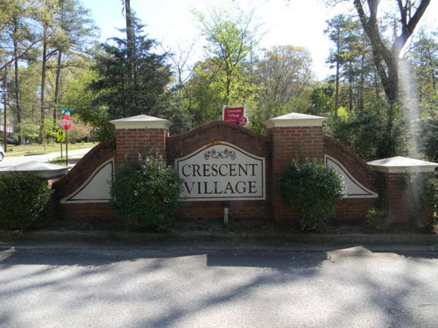
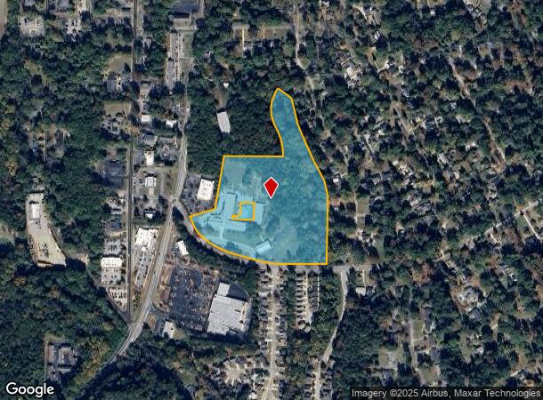
201 Crescent Rd, Griffin, GA 30224
NEARBY LISTINGS FOR SALE OR LEASE
-
-
-
-
-
-
No Photo
-
-
View all Griffin listings for sale on LoopNet.com
Property Detail
201 Crescent Rd
Atlanta-Sandy Springs-Roswell, GA
Walker Estate
031-04-001
CRESCENT SCHOOL ELEM PB 5/20
Publicschool
Spalding
A
Georgia
13255C0185D
16 AC
0
Spalding County
2024
Atlanta
161202
DEMOGRAPHICS near 201 Crescent Rd
1 Mile
3 Mile
5 Mile
2024 Total Population
5,100
31,244
48,034
2029 Population
5,398
33,157
51,086
Pop Growth 2024-2029
+ 5.84%
+ 6.12%
+ 6.35%
Average Age
39
38
38
2024 Total Households
2,101
11,894
18,081
HH Growth 2024-2029
+ 5.76%
+ 6.03%
+ 6.27%
Median Household Inc
$61,868
$45,558
$48,725
Avg Household Size
2.40
2.50
2.60
2024 Avg HH Vehicles
2.00
2.00
2.00
Median Home Value
$217,708
$172,557
$172,682
Median Year Built
1967
1973
1978
Nearby Places
Map Layers
Map Styles
 Street
 Aerial
- Restaurants
- Banks
- Shops
- Fitness
- Groceries
PUBLIC TRANSPORTATION
AIRPORT
Hartsfield - Jackson Atlanta International
DRIVE
WALK
Distance
Hartsfield - Jackson Atlanta International
52 min
32.8 mi
Freight Ports
Georgia Ports - Savannah
DRIVE
WALK
Distance
Georgia Ports - Savannah
245 min
217.5 mi
SALE & LEASE HISTORY
LISTING DATE
SALE/LEASE

May 03, 2017
For Sale
Nearby Properties
Address
Land Use
TOTAL SIZE
Lot Size
Zoning
Address
Land Use
TOTAL SIZE
Lot Size
Zoning
210,196 SF
14.92 AC
PCD
Address
Land Use
TOTAL SIZE
Lot Size
Zoning
112,554 SF
40.27 AC
C2
Address
Land Use
TOTAL SIZE
Lot Size
Zoning
56,415 SF
0.56 AC
PCD
Address
Land Use
TOTAL SIZE
Lot Size
Zoning
367,793 SF
223.84 AC
C2
Address
Land Use
TOTAL SIZE
Lot Size
Zoning
70,817 SF
0.79 AC
CBD
Address
Land Use
TOTAL SIZE
Lot Size
Zoning
13,392 SF
31.70 AC
Address
Land Use
TOTAL SIZE
Lot Size
Zoning
133.41 AC
INST
Address
Land Use
TOTAL SIZE
Lot Size
Zoning
305,123 SF
37 AC
C2
Address
Land Use
TOTAL SIZE
Lot Size
Zoning
125,587 SF
11.87 AC
HDRA
Address
Land Use
TOTAL SIZE
Lot Size
Zoning
16,394 SF
24.32 AC
LDRB
Address
Land Use
TOTAL SIZE
Lot Size
Zoning
89.45 AC
INST
Address
Land Use
TOTAL SIZE
Lot Size
Zoning
73.71 AC
AR1
Address
Land Use
TOTAL SIZE
Lot Size
Zoning
2,374 SF
38.28 AC
HDRB
Address
Land Use
TOTAL SIZE
Lot Size
Zoning
216,242 SF
15.21 AC
C2
Address
Land Use
TOTAL SIZE
Lot Size
Zoning
96,787 SF
14.07 AC
LDRB
Address
Land Use
TOTAL SIZE
Lot Size
Zoning
92,331 SF
29.84 AC
C2
Address
Land Use
TOTAL SIZE
Lot Size
Zoning
39,105 SF
33.98 AC
PDD
Address
Land Use
TOTAL SIZE
Lot Size
Zoning
84,105 SF
17 AC
AR1
Address
Land Use
TOTAL SIZE
Lot Size
Zoning
293,260 SF
23.27 AC
C-2
Address
Land Use
TOTAL SIZE
Lot Size
Zoning
31,328 SF
58.43 AC
PID
Address
Land Use
TOTAL SIZE
Lot Size
Zoning
31,328 SF
58.43 AC
PID
Address
Land Use
TOTAL SIZE
Lot Size
Zoning
54,980 SF
1.09 AC
CBD
Address
Land Use
TOTAL SIZE
Lot Size
Zoning
118,410 SF
15.42 AC
LDRB
Address
Land Use
TOTAL SIZE
Lot Size
Zoning
99,469 SF
28.98 AC
R-2
Address
Land Use
TOTAL SIZE
Lot Size
Zoning
39,105 SF
33.98 AC
PDD
Address
Land Use
TOTAL SIZE
Lot Size
Zoning
4,118 SF
14.40 AC
PID
Address
Land Use
TOTAL SIZE
Lot Size
Zoning
74,412 SF
11.87 AC
HDRA
Address
Land Use
TOTAL SIZE
Lot Size
Zoning
65,058 SF
3.74 AC
Address
Land Use
TOTAL SIZE
Lot Size
Zoning
39,130 SF
4.01 AC
CBD
The World's #1 Commercial Real Estate Marketplace
Connect with us
© 2025 CoStar Group
The information above has been obtained from sources believed reliable. While we do not doubt its accuracy we have not verified it and make no guarantee, warranty or representation about it. It is your responsibility to independently confirm its accuracy and completeness. Any projections, opinions, assumptions, or estimates used are for example only and do not represent the current or future performance of the property. The value of this transaction to you depends on tax and other factors which should be evaluated by your tax, financial, and legal advisors. You and your advisors should conduct a careful, independent investigation of the property to determine to your satisfaction the suitability of the property for your needs.