Property Record
Crestline Ave, Cleveland, OH 44109


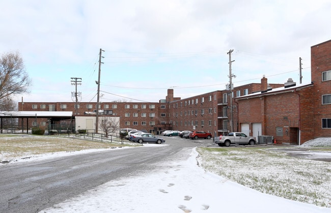
Property Detail
Crestline Ave
009-08-019
PCL A VOL 347 PG 62 FF 944.54 9.10 AC OL 75 2007S/R
Storebuilding
CUYAHOGA
MF-1
Ohio
B and X Area of moderate flood hazard, usually the area between the limits of the 100-year and 500-year floods.
a
0
9.10 AC
2025
Old Brooklyn
105700
Cleveland
197,916 SF
Cleveland-Elyria, OH
NEARBY LISTINGS FOR SALE OR LEASE
DEMOGRAPHICS near Crestline Ave
1 mile
3 mile
5 mile
2025 Total Population
11,471
103,762
300,143
2030 Population
11,275
101,711
295,967
Pop Growth 2025-2030
(1.71%)
(1.98%)
(1.39%)
Average Age
39
39
39
2025 Total Households
5,155
45,424
132,312
HH Growth 2025-2030
(1.92%)
(2.02%)
(1.32%)
Median Household Inc
$41,160
$49,542
$50,505
Avg Household Size
2.10
2.20
2.10
2025 Avg HH Vehicles
1.00
1.00
1.00
Median Home Value
$134,239
$137,479
$142,018
Median Year Built
1948
1947
1949
Nearby Places
Map Layers
Map Styles
 Street
 Aerial
Layers
 Traffic
 Biking
Places
Listings with unknown addresses are not visible on the map
- Restaurants
- Banks
- Shops
- Fitness
- Groceries
PUBLIC TRANSPORTATION
COMMUTER RAIL
Cleveland Lakefront Station (Blue Line - Greater Cleveland Regional Transit Authority Rapid Transit (The Rapid), Green Line - Greater Cleveland Regional Transit Authority Rapid Transit (The Rapid))
Drive
Walk
Distance
Cleveland Lakefront Station (Blue Line - Greater Cleveland Regional Transit Authority Rapid Transit (The Rapid), Green Line - Greater Cleveland Regional Transit Authority Rapid Transit (The Rapid))
16 min
6.6 mi
Rockside (National Park Scenic Railway - Cuyahoga Valley Scenic Railroad)
Drive
Walk
Distance
Rockside (National Park Scenic Railway - Cuyahoga Valley Scenic Railroad)
16 min
7.3 mi
AIRPORT
Cleveland-Hopkins International
Drive
Walk
Distance
Cleveland-Hopkins International
22 min
10.5 mi
Freight Ports
Port of Toledo
Drive
Walk
Distance
Port of Toledo
136 min
111.4 mi
Nearby Properties
Address
Land Use
TOTAL SIZE
Lot Size
Zoning
Address
Land Use
TOTAL SIZE
Lot Size
Zoning
3,491,901 SF
34.32 AC
Address
Land Use
TOTAL SIZE
Lot Size
Zoning
162,711 SF
192.04 AC
IG
Address
Land Use
TOTAL SIZE
Lot Size
Zoning
3.23 AC
LLR
Address
Land Use
TOTAL SIZE
Lot Size
Zoning
257,857 SF
8.03 AC
GR
Address
Land Use
TOTAL SIZE
Lot Size
Zoning
2.83 AC
LLR
Address
Land Use
TOTAL SIZE
Lot Size
Zoning
299,507 SF
2.14 AC
LR
Address
Land Use
TOTAL SIZE
Lot Size
Zoning
164,294 SF
13.81 AC
GI
Address
Land Use
TOTAL SIZE
Lot Size
Zoning
194,257 SF
94.46 AC
IG
Address
Land Use
TOTAL SIZE
Lot Size
Zoning
595.30 AC
UI
Address
Land Use
TOTAL SIZE
Lot Size
Zoning
227,787 SF
3.40 AC
LR
Address
Land Use
TOTAL SIZE
Lot Size
Zoning
308,339 SF
9.78 AC
2F
Address
Land Use
TOTAL SIZE
Lot Size
Zoning
102,219 SF
14.01 AC
RB
Address
Land Use
TOTAL SIZE
Lot Size
Zoning
28,852 SF
8.17 AC
Address
Land Use
TOTAL SIZE
Lot Size
Zoning
372,486 SF
3.98 AC
GR
Address
Land Use
TOTAL SIZE
Lot Size
Zoning
361,287 SF
86.50 AC
2F
Address
Land Use
TOTAL SIZE
Lot Size
Zoning
167,376 SF
0.70 AC
LR
Address
Land Use
TOTAL SIZE
Lot Size
Zoning
22,928 SF
2.17 AC
LR
Address
Land Use
TOTAL SIZE
Lot Size
Zoning
142,935 SF
1.02 AC
LR
Address
Land Use
TOTAL SIZE
Lot Size
Zoning
104,170 SF
2.70 AC
2F
Address
Land Use
TOTAL SIZE
Lot Size
Zoning
389,067 SF
12.05 AC
A-H
Address
Land Use
TOTAL SIZE
Lot Size
Zoning
148,877 SF
1.53 AC
MF-1
Address
Land Use
TOTAL SIZE
Lot Size
Zoning
500,398 SF
24.49 AC
IG
Address
Land Use
TOTAL SIZE
Lot Size
Zoning
180,175 SF
111.96 AC
IG
Address
Land Use
TOTAL SIZE
Lot Size
Zoning
120,061 SF
1.91 AC
GI
Address
Land Use
TOTAL SIZE
Lot Size
Zoning
209,068 SF
23.10 AC
IG
Address
Land Use
TOTAL SIZE
Lot Size
Zoning
277,049 SF
24.15 AC
2F
Address
Land Use
TOTAL SIZE
Lot Size
Zoning
19.48 AC
U5-A
Address
Land Use
TOTAL SIZE
Lot Size
Zoning
87,489 SF
8.01 AC
Address
Land Use
TOTAL SIZE
Lot Size
Zoning
16,023 SF
18.41 AC
SF-DH
Address
Land Use
TOTAL SIZE
Lot Size
Zoning
208,675 SF
17.33 AC
G-B
The World's #1 Commercial Real Estate Marketplace
Connect with us
© 2026 CoStar Group
The information above has been obtained from sources believed reliable. While we do not doubt its accuracy we have not verified it and make no guarantee, warranty or representation about it. It is your responsibility to independently confirm its accuracy and completeness. Any projections, opinions, assumptions, or estimates used are for example only and do not represent the current or future performance of the property. The value of this transaction to you depends on tax and other factors which should be evaluated by your tax, financial, and legal advisors. You and your advisors should conduct a careful, independent investigation of the property to determine to your satisfaction the suitability of the property for your needs.