Property Record
5599 Ralph Harper Ln, Clover, SC 29710


NEARBY LISTINGS FOR SALE OR LEASE
Property Detail
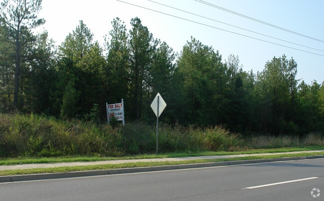
5599 Ralph Harper Ln
Charlotte-Concord-Gastonia, NC-SC
Crowders Cove
5620000079
SC HWY 49 CROWDERS COVE RD
Residentialacreage
York
AE
South Carolina
45091C0177E
6.13 AC
2025
York County
2025
Charlotte
061710
DEMOGRAPHICS near 5599 Ralph Harper Ln
1 Mile
3 Mile
5 Mile
2024 Total Population
5,511
24,856
52,419
2029 Population
6,247
28,247
58,543
Pop Growth 2024-2029
+ 13.36%
+ 13.64%
+ 11.68%
Average Age
39
41
41
2024 Total Households
2,178
9,731
19,971
HH Growth 2024-2029
+ 13.82%
+ 14.03%
+ 12.01%
Median Household Inc
$90,763
$100,627
$110,720
Avg Household Size
2.50
2.50
2.60
2024 Avg HH Vehicles
2.00
2.00
2.00
Median Home Value
$385,950
$410,015
$407,163
Median Year Built
2007
2006
2006
Nearby Places
Map Layers
Map Styles
 Street
 Aerial
- Restaurants
- Banks
- Shops
- Fitness
- Groceries
PUBLIC TRANSPORTATION
AIRPORT
Charlotte/Douglas International
DRIVE
WALK
Distance
Charlotte/Douglas International
31 min
16.4 mi
Concord-Padgett Regional
DRIVE
WALK
Distance
Concord-Padgett Regional
52 min
38.0 mi
Freight Ports
North Charleston Terminal
DRIVE
WALK
Distance
North Charleston Terminal
226 min
192.2 mi
Nearby Properties
Address
Land Use
TOTAL SIZE
Lot Size
Zoning
Address
Land Use
TOTAL SIZE
Lot Size
Zoning
415,150 SF
18.68 AC
MX-3
Address
Land Use
TOTAL SIZE
Lot Size
Zoning
298,790 SF
18.23 AC
MX3
Address
Land Use
TOTAL SIZE
Lot Size
Zoning
972 SF
6.91 AC
B-2
Address
Land Use
TOTAL SIZE
Lot Size
Zoning
95 AC
RUD
Address
Land Use
TOTAL SIZE
Lot Size
Zoning
21,537 SF
3.32 AC
BDIII
Address
Land Use
TOTAL SIZE
Lot Size
Zoning
5,000 SF
14.33 AC
R-5
Address
Land Use
TOTAL SIZE
Lot Size
Zoning
35,174 SF
6.74 AC
B2CD
Address
Land Use
TOTAL SIZE
Lot Size
Zoning
11.62 AC
R-5
Address
Land Use
TOTAL SIZE
Lot Size
Zoning
5.45 AC
UD
Address
Land Use
TOTAL SIZE
Lot Size
Zoning
7,028 SF
11.62 AC
MX3
Address
Land Use
TOTAL SIZE
Lot Size
Zoning
38,142 SF
30.01 AC
PD
Address
Land Use
TOTAL SIZE
Lot Size
Zoning
27,372 SF
14.37 AC
RDII
Address
Land Use
TOTAL SIZE
Lot Size
Zoning
13.46 AC
MX-3
Address
Land Use
TOTAL SIZE
Lot Size
Zoning
4,976 SF
3.81 AC
B2
Address
Land Use
TOTAL SIZE
Lot Size
Zoning
14.43 AC
RDI
Address
Land Use
TOTAL SIZE
Lot Size
Zoning
27,600 SF
35.50 AC
RDI
Address
Land Use
TOTAL SIZE
Lot Size
Zoning
7,840 SF
10.44 AC
RDI
Address
Land Use
TOTAL SIZE
Lot Size
Zoning
4.97 AC
BDI
Address
Land Use
TOTAL SIZE
Lot Size
Zoning
44,977 SF
24.59 AC
BDIII
Address
Land Use
TOTAL SIZE
Lot Size
Zoning
8.89 AC
BDIII
Address
Land Use
TOTAL SIZE
Lot Size
Zoning
10.56 AC
Address
Land Use
TOTAL SIZE
Lot Size
Zoning
10.18 AC
Address
Land Use
TOTAL SIZE
Lot Size
Zoning
3.89 AC
BDIII
Address
Land Use
TOTAL SIZE
Lot Size
Zoning
6,103 SF
65.50 AC
RUD
Address
Land Use
TOTAL SIZE
Lot Size
Zoning
7,878 SF
47.68 AC
UD
Address
Land Use
TOTAL SIZE
Lot Size
Zoning
8,876 SF
1 AC
RDII
Address
Land Use
TOTAL SIZE
Lot Size
Zoning
3,438 SF
46.81 AC
RCI
Address
Land Use
TOTAL SIZE
Lot Size
Zoning
4,910 SF
0.69 AC
RDI
Address
Land Use
TOTAL SIZE
Lot Size
Zoning
2.92 AC
BDIII
Address
Land Use
TOTAL SIZE
Lot Size
Zoning
1,730 SF
6.88 AC
RCI
The World's #1 Commercial Real Estate Marketplace
Connect with us
© 2026 CoStar Group
The information above has been obtained from sources believed reliable. While we do not doubt its accuracy we have not verified it and make no guarantee, warranty or representation about it. It is your responsibility to independently confirm its accuracy and completeness. Any projections, opinions, assumptions, or estimates used are for example only and do not represent the current or future performance of the property. The value of this transaction to you depends on tax and other factors which should be evaluated by your tax, financial, and legal advisors. You and your advisors should conduct a careful, independent investigation of the property to determine to your satisfaction the suitability of the property for your needs.