Property Record
S Crowell Rd, Covington, GA 30014

NEARBY LISTINGS FOR SALE OR LEASE
Property Detail
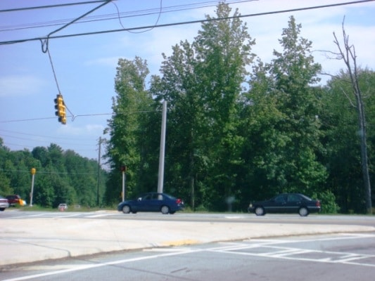
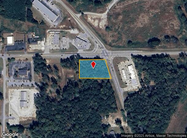
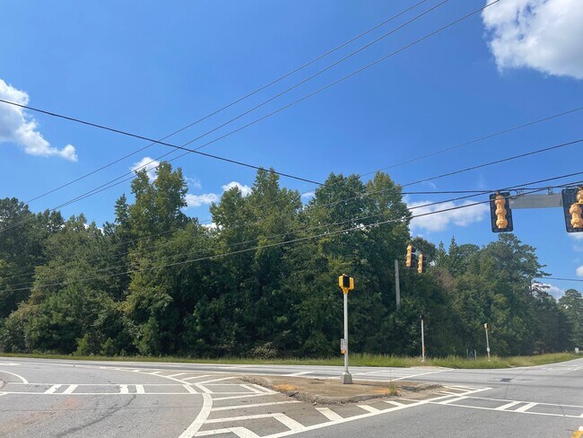
S Crowell Rd
Atlanta-Sandy Springs-Roswell, GA
Crowell Road/Newton Woods
0044000000094000
1.21AC LT 18 NEWTON WOOD
Residentialacreage
Newton
X
Georgia
13217C0108D
18
2025
1.21 AC
2025
Newton County
100302
Atlanta
DEMOGRAPHICS near S Crowell Rd
1 Mile
3 Mile
5 Mile
2024 Total Population
3,596
36,963
85,277
2029 Population
3,990
41,053
94,002
Pop Growth 2024-2029
+ 10.96%
+ 11.07%
+ 10.23%
Average Age
37
37
37
2024 Total Households
1,222
12,994
30,148
HH Growth 2024-2029
+ 11.21%
+ 11.36%
+ 10.54%
Median Household Inc
$69,112
$69,949
$72,239
Avg Household Size
2.90
2.70
2.80
2024 Avg HH Vehicles
2.00
2.00
2.00
Median Home Value
$173,764
$164,530
$180,815
Median Year Built
2000
1998
1997
Nearby Places
Map Layers
Map Styles
 Street
 Aerial
- Restaurants
- Banks
- Shops
- Fitness
- Groceries
PUBLIC TRANSPORTATION
AIRPORT
Hartsfield - Jackson Atlanta International
DRIVE
WALK
Distance
Hartsfield - Jackson Atlanta International
49 min
36.8 mi
SALE & LEASE HISTORY
LISTING DATE
SALE/LEASE

Sep 24, 2016
For Sale
Sep 22, 2022
For Sale
Dec 17, 2019
For Sale
Nearby Properties
Address
Land Use
TOTAL SIZE
Lot Size
Zoning
Address
Land Use
TOTAL SIZE
Lot Size
Zoning
4,734 SF
35.19 AC
RMF
Address
Land Use
TOTAL SIZE
Lot Size
Zoning
306,886 SF
118.50 AC
R2
Address
Land Use
TOTAL SIZE
Lot Size
Zoning
14,624 SF
26.09 AC
C1
Address
Land Use
TOTAL SIZE
Lot Size
Zoning
19,292 SF
8.20 AC
H1
Address
Land Use
TOTAL SIZE
Lot Size
Zoning
88,944 SF
0.98 AC
E1
Address
Land Use
TOTAL SIZE
Lot Size
Zoning
92,162 SF
11.21 AC
R2
Address
Land Use
TOTAL SIZE
Lot Size
Zoning
5,160 SF
45.17 AC
C1
Address
Land Use
TOTAL SIZE
Lot Size
Zoning
82,716 SF
21.04 AC
R2
Address
Land Use
TOTAL SIZE
Lot Size
Zoning
222,056 SF
13.35 AC
Address
Land Use
TOTAL SIZE
Lot Size
Zoning
3,888 SF
7.17 AC
C1
Address
Land Use
TOTAL SIZE
Lot Size
Zoning
28,790 SF
3.70 AC
E1
Address
Land Use
TOTAL SIZE
Lot Size
Zoning
65,520 SF
35 AC
E6
Address
Land Use
TOTAL SIZE
Lot Size
Zoning
65,008 SF
23.81 AC
R2
Address
Land Use
TOTAL SIZE
Lot Size
Zoning
151,955 SF
26.17 AC
R1
Address
Land Use
TOTAL SIZE
Lot Size
Zoning
64,799 SF
19.10 AC
E6
Address
Land Use
TOTAL SIZE
Lot Size
Zoning
4,768 SF
263.26 AC
C1
Address
Land Use
TOTAL SIZE
Lot Size
Zoning
6,936 SF
8.88 AC
C1
Address
Land Use
TOTAL SIZE
Lot Size
Zoning
28,512 SF
0.52 AC
Address
Land Use
TOTAL SIZE
Lot Size
Zoning
99,686 SF
11.50 AC
C1
Address
Land Use
TOTAL SIZE
Lot Size
Zoning
38,120 SF
155.15 AC
E1
Address
Land Use
TOTAL SIZE
Lot Size
Zoning
54,712 SF
54.54 AC
E6
Address
Land Use
TOTAL SIZE
Lot Size
Zoning
27,492 SF
0.47 AC
Address
Land Use
TOTAL SIZE
Lot Size
Zoning
101,010 SF
59.60 AC
E6
Address
Land Use
TOTAL SIZE
Lot Size
Zoning
5,226 SF
8.13 AC
C1
Address
Land Use
TOTAL SIZE
Lot Size
Zoning
40,138 SF
13.59 AC
R1
Address
Land Use
TOTAL SIZE
Lot Size
Zoning
85,560 SF
10.26 AC
C1
Address
Land Use
TOTAL SIZE
Lot Size
Zoning
73,624 SF
15.25 AC
C1
Address
Land Use
TOTAL SIZE
Lot Size
Zoning
12,812 SF
0.17 AC
E1
Address
Land Use
TOTAL SIZE
Lot Size
Zoning
24,788 SF
2 AC
C1
Address
Land Use
TOTAL SIZE
Lot Size
Zoning
65,360 SF
20 AC
E6
The World's #1 Commercial Real Estate Marketplace
Connect with us
© 2026 CoStar Group
The information above has been obtained from sources believed reliable. While we do not doubt its accuracy we have not verified it and make no guarantee, warranty or representation about it. It is your responsibility to independently confirm its accuracy and completeness. Any projections, opinions, assumptions, or estimates used are for example only and do not represent the current or future performance of the property. The value of this transaction to you depends on tax and other factors which should be evaluated by your tax, financial, and legal advisors. You and your advisors should conduct a careful, independent investigation of the property to determine to your satisfaction the suitability of the property for your needs.