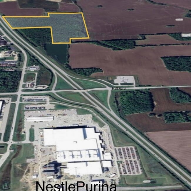
Property Record
Curliss Ln, Batavia, OH 45103

Property Detail
Curliss Ln
Cincinnati, OH-KY-IN
DEF NORTH AFTON SEWER PH 2 (CALL OMB); CREATE T WHEN TIF BEGINS-NEW BUILDING
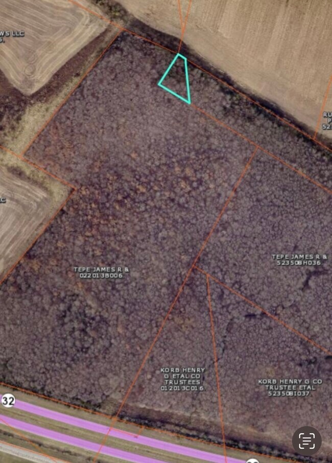
02-20-13B-006
CLERMONT
Agriculturalland
Ohio
B and X Area of moderate flood hazard, usually the area between the limits of the 100-year and 500-year floods.
26.70 AC
2025
Outlying Cincinnati East
2025
Cincinnati/Dayton
041002
NEARBY LISTINGS FOR SALE OR LEASE
DEMOGRAPHICS near Curliss Ln
1 mile
3 mile
5 mile
2025 Total Population
792
8,724
18,955
2030 Population
815
8,957
19,408
Pop Growth 2025-2030
+ 2.90%
+ 2.67%
+ 2.39%
Average Age
37
40
41
2025 Total Households
267
3,112
7,051
HH Growth 2025-2030
+ 3.00%
+ 2.76%
+ 2.40%
Median Household Inc
$60,937
$78,342
$74,231
Avg Household Size
2.90
2.70
2.60
2025 Avg HH Vehicles
2.00
2.00
2.00
Median Home Value
$131,481
$237,404
$250,126
Median Year Built
1990
1987
1981
Nearby Places
Map Layers
Map Styles
 Street
 Aerial
Layers
 Traffic
 Biking
Places
Listings with unknown addresses are not visible on the map
- Restaurants
- Banks
- Shops
- Fitness
- Groceries
PUBLIC TRANSPORTATION
AIRPORT
Cincinnati/Northern Kentucky International
Drive
Walk
Distance
Cincinnati/Northern Kentucky International
52 min
36.0 mi
Freight Ports
Port of Toledo
Drive
Walk
Distance
Port of Toledo
256 min
219.2 mi
SALE & LEASE HISTORY
LISTING DATE
SALE/LEASE

Jul 01, 2025
For Sale
Nearby Properties
Address
Land Use
TOTAL SIZE
Lot Size
Zoning
Address
Land Use
TOTAL SIZE
Lot Size
Zoning
540,906 SF
192.49 AC
Address
Land Use
TOTAL SIZE
Lot Size
Zoning
540,906 SF
192.49 AC
Address
Land Use
TOTAL SIZE
Lot Size
Zoning
Address
Land Use
TOTAL SIZE
Lot Size
Zoning
58.36 AC
Address
Land Use
TOTAL SIZE
Lot Size
Zoning
23,380 SF
91.85 AC
Address
Land Use
TOTAL SIZE
Lot Size
Zoning
973,058 SF
61.50 AC
Address
Land Use
TOTAL SIZE
Lot Size
Zoning
11,215 SF
20.57 AC
Address
Land Use
TOTAL SIZE
Lot Size
Zoning
Address
Land Use
TOTAL SIZE
Lot Size
Zoning
617,760 SF
46.80 AC
Address
Land Use
TOTAL SIZE
Lot Size
Zoning
11,566 SF
28.70 AC
Address
Land Use
TOTAL SIZE
Lot Size
Zoning
26,263 SF
49.43 AC
Address
Land Use
TOTAL SIZE
Lot Size
Zoning
494,336 SF
65.71 AC
Address
Land Use
TOTAL SIZE
Lot Size
Zoning
6,987 SF
80.44 AC
Address
Land Use
TOTAL SIZE
Lot Size
Zoning
39.27 AC
Address
Land Use
TOTAL SIZE
Lot Size
Zoning
Address
Land Use
TOTAL SIZE
Lot Size
Zoning
30,540 SF
20.57 AC
Address
Land Use
TOTAL SIZE
Lot Size
Zoning
481,944 SF
23.27 AC
Address
Land Use
TOTAL SIZE
Lot Size
Zoning
617,760 SF
46.80 AC
Address
Land Use
TOTAL SIZE
Lot Size
Zoning
158,700 SF
31.20 AC
Address
Land Use
TOTAL SIZE
Lot Size
Zoning
2,856 SF
36.20 AC
Address
Land Use
TOTAL SIZE
Lot Size
Zoning
228,888 SF
20.10 AC
Address
Land Use
TOTAL SIZE
Lot Size
Zoning
225,000 SF
9.48 AC
Address
Land Use
TOTAL SIZE
Lot Size
Zoning
81,672 SF
10.57 AC
Address
Land Use
TOTAL SIZE
Lot Size
Zoning
4,272 SF
9.32 AC
Address
Land Use
TOTAL SIZE
Lot Size
Zoning
35,646 SF
12.52 AC
Address
Land Use
TOTAL SIZE
Lot Size
Zoning
147,180 SF
9.94 AC
Address
Land Use
TOTAL SIZE
Lot Size
Zoning
33.81 AC
Address
Land Use
TOTAL SIZE
Lot Size
Zoning
5.42 AC
Address
Land Use
TOTAL SIZE
Lot Size
Zoning
486,913 SF
88.21 AC
Address
Land Use
TOTAL SIZE
Lot Size
Zoning
33,696 SF
12.20 AC
The World's #1 Commercial Real Estate Marketplace
Connect with us
© 2026 CoStar Group
The information above has been obtained from sources believed reliable. While we do not doubt its accuracy we have not verified it and make no guarantee, warranty or representation about it. It is your responsibility to independently confirm its accuracy and completeness. Any projections, opinions, assumptions, or estimates used are for example only and do not represent the current or future performance of the property. The value of this transaction to you depends on tax and other factors which should be evaluated by your tax, financial, and legal advisors. You and your advisors should conduct a careful, independent investigation of the property to determine to your satisfaction the suitability of the property for your needs.