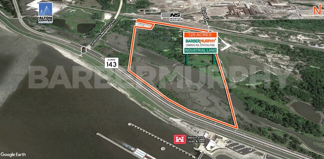
Property Record
Cut St, Alton, IL 62002
NEARBY LISTINGS FOR SALE OR LEASE
Property Detail
Cut St
St. Louis, MO-IL
W PT NW EXC
19-1-08-19-00-000-001
Madison
Industrialgeneral
Illinois
2024
72.30 AC
2024
Illinois
402000
St. Louis
DEMOGRAPHICS near Cut St
1 mile
3 mile
5 mile
2024 Total Population
486
25,920
57,314
2029 Population
490
25,951
57,120
Pop Growth 2024-2029
+ 0.82%
+ 0.12%
(0.34%)
Average Age
40
41
42
2024 Total Households
219
11,550
25,015
HH Growth 2024-2029
+ 0.46%
+ 0.08%
(0.39%)
Median Household Inc
$47,500
$49,786
$58,053
Avg Household Size
2.20
2.20
2.20
2024 Avg HH Vehicles
1.00
2.00
2.00
Median Home Value
$57,471
$87,069
$116,643
Median Year Built
1949
1951
1955
Nearby Places
Map Layers
Map Styles
 Street
 Aerial
Transit
 Traffic
 Biking
Places
Listings with unknown addresses are not visible on the map
- Restaurants
- Banks
- Shops
- Fitness
- Groceries
PUBLIC TRANSPORTATION
COMMUTER RAIL
Alton Amtrak Station (Lincoln Service - Amtrak, Lincoln Service Missouri River Runner - Amtrak, Texas Eagle - Amtrak)
Drive
Walk
Distance
Alton Amtrak Station (Lincoln Service - Amtrak, Lincoln Service Missouri River Runner - Amtrak, Texas Eagle - Amtrak)
8 min
4.5 mi
AIRPORT
St Louis Lambert International
Drive
Walk
Distance
St Louis Lambert International
28 min
19.6 mi
Scott AFB/Midamerica St Louis
Drive
Walk
Distance
Scott AFB/Midamerica St Louis
60 min
42.3 mi
Freight Ports
Port Milwaukee
Drive
Walk
Distance
Port Milwaukee
413 min
359.2 mi
SALE & LEASE HISTORY
LISTING DATE
SALE/LEASE

Sep 29, 2025
For Sale
Sep 25, 2016
For Lease
Aug 14, 2018
For Sale
Nearby Properties
Address
Land Use
TOTAL SIZE
Lot Size
Zoning
Address
Land Use
TOTAL SIZE
Lot Size
Zoning
16.61 AC
Address
Land Use
TOTAL SIZE
Lot Size
Zoning
117,520 SF
2.29 AC
Address
Land Use
TOTAL SIZE
Lot Size
Zoning
625.98 AC
AA9
Address
Land Use
TOTAL SIZE
Lot Size
Zoning
26.24 AC
Address
Land Use
TOTAL SIZE
Lot Size
Zoning
37,533 SF
7.80 AC
Address
Land Use
TOTAL SIZE
Lot Size
Zoning
45,834 SF
7.10 AC
Address
Land Use
TOTAL SIZE
Lot Size
Zoning
87,624 SF
4.28 AC
Address
Land Use
TOTAL SIZE
Lot Size
Zoning
75,312 SF
4.35 AC
Address
Land Use
TOTAL SIZE
Lot Size
Zoning
6,146 SF
9 AC
Address
Land Use
TOTAL SIZE
Lot Size
Zoning
1.90 AC
Address
Land Use
TOTAL SIZE
Lot Size
Zoning
576 SF
16.80 AC
Address
Land Use
TOTAL SIZE
Lot Size
Zoning
64,260 SF
3.90 AC
Address
Land Use
TOTAL SIZE
Lot Size
Zoning
56,684 SF
2.19 AC
Address
Land Use
TOTAL SIZE
Lot Size
Zoning
1.90 AC
Address
Land Use
TOTAL SIZE
Lot Size
Zoning
334.25 AC
AA9
Address
Land Use
TOTAL SIZE
Lot Size
Zoning
320.80 AC
AA1
Address
Land Use
TOTAL SIZE
Lot Size
Zoning
Address
Land Use
TOTAL SIZE
Lot Size
Zoning
155,147 SF
14.37 AC
Address
Land Use
TOTAL SIZE
Lot Size
Zoning
235.26 AC
AA9
Address
Land Use
TOTAL SIZE
Lot Size
Zoning
39.31 AC
Address
Land Use
TOTAL SIZE
Lot Size
Zoning
Address
Land Use
TOTAL SIZE
Lot Size
Zoning
23,918 SF
1.26 AC
Address
Land Use
TOTAL SIZE
Lot Size
Zoning
6,510 SF
2.57 AC
Address
Land Use
TOTAL SIZE
Lot Size
Zoning
10,440 SF
1.91 AC
Address
Land Use
TOTAL SIZE
Lot Size
Zoning
89,691 SF
7.78 AC
Address
Land Use
TOTAL SIZE
Lot Size
Zoning
0.39 AC
Address
Land Use
TOTAL SIZE
Lot Size
Zoning
23.20 AC
Address
Land Use
TOTAL SIZE
Lot Size
Zoning
14,583 SF
2.37 AC
Address
Land Use
TOTAL SIZE
Lot Size
Zoning
35,604 SF
0.68 AC
Address
Land Use
TOTAL SIZE
Lot Size
Zoning
0.13 AC
The World's #1 Commercial Real Estate Marketplace
Connect with us
© 2026 CoStar Group
The information above has been obtained from sources believed reliable. While we do not doubt its accuracy we have not verified it and make no guarantee, warranty or representation about it. It is your responsibility to independently confirm its accuracy and completeness. Any projections, opinions, assumptions, or estimates used are for example only and do not represent the current or future performance of the property. The value of this transaction to you depends on tax and other factors which should be evaluated by your tax, financial, and legal advisors. You and your advisors should conduct a careful, independent investigation of the property to determine to your satisfaction the suitability of the property for your needs.