Property Record
Cypress Rd, Pocomoke, MD 21851


This Property Is For Sale
Property Detail
Cypress Rd
01-001841
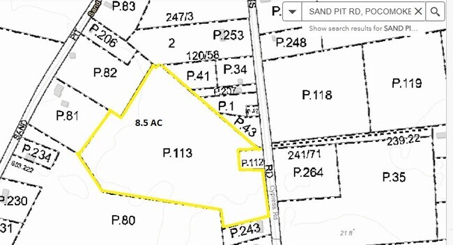
9.45 ACS W SIDE CYPRESS RD DEED SRB 8914/10 BNDY SU
Residentialacreage
WORCESTER
R-5
Maryland
B and X Area of moderate flood hazard, usually the area between the limits of the 100-year and 500-year floods.
9.45 AC
2025
Chesapeake Bay/Salisbury
2025
Other Market Areas
951500
Ocean Pines, MD
NEARBY LISTINGS FOR SALE OR LEASE
-
-
View all Pocomoke listings for sale on LoopNet.com
DEMOGRAPHICS near Cypress Rd
1 mile
3 mile
5 mile
2025 Total Population
80
3,092
4,414
2030 Population
69
2,720
3,984
Pop Growth 2025-2030
(13.75%)
(12.03%)
(9.74%)
Average Age
42
38
40
2025 Total Households
30
1,099
1,629
HH Growth 2025-2030
(20.00%)
(16.01%)
(12.52%)
Median Household Inc
$47,500
$50,469
$53,979
Avg Household Size
2.40
2.50
2.50
2025 Avg HH Vehicles
3.00
2.00
2.00
Median Home Value
$99,999
$160,350
$185,941
Median Year Built
1977
1958
1965
Nearby Places
Map Layers
Map Styles
 Street
 Aerial
Transit
 Traffic
 Biking
Places
Listings with unknown addresses are not visible on the map
- Restaurants
- Banks
- Shops
- Fitness
- Groceries
PUBLIC TRANSPORTATION
AIRPORT
Salisbury-Ocean City Wicomico Regional
Drive
Walk
Distance
Salisbury-Ocean City Wicomico Regional
51 min
31.2 mi
Freight Ports
Virginia Port Authority - Newport News
Drive
Walk
Distance
Virginia Port Authority - Newport News
174 min
120.3 mi
Nearby Properties
Address
Land Use
TOTAL SIZE
Lot Size
Zoning
Address
Land Use
TOTAL SIZE
Lot Size
Zoning
124,620 SF
22.02 AC
R-2
Address
Land Use
TOTAL SIZE
Lot Size
Zoning
10,535 SF
17.46 AC
C-3
Address
Land Use
TOTAL SIZE
Lot Size
Zoning
151,642 SF
17.81 AC
B-2
Address
Land Use
TOTAL SIZE
Lot Size
Zoning
111,039 SF
14.56 AC
B-2
Address
Land Use
TOTAL SIZE
Lot Size
Zoning
88,152 SF
21.28 AC
R-3
Address
Land Use
TOTAL SIZE
Lot Size
Zoning
43,649 SF
1.99 AC
B-2
Address
Land Use
TOTAL SIZE
Lot Size
Zoning
21,224 SF
3.37 AC
B-2
Address
Land Use
TOTAL SIZE
Lot Size
Zoning
27,000 SF
4.28 AC
B-2
Address
Land Use
TOTAL SIZE
Lot Size
Zoning
47,120 SF
7.24 AC
B-2
Address
Land Use
TOTAL SIZE
Lot Size
Zoning
48,750 SF
4.62 AC
M-1
Address
Land Use
TOTAL SIZE
Lot Size
Zoning
51,614 SF
2.06 AC
R-2
Address
Land Use
TOTAL SIZE
Lot Size
Zoning
558 SF
195 AC
M-1
Address
Land Use
TOTAL SIZE
Lot Size
Zoning
40,216 SF
3.97 AC
R-3
Address
Land Use
TOTAL SIZE
Lot Size
Zoning
2,310 SF
9.46 AC
M-1
Address
Land Use
TOTAL SIZE
Lot Size
Zoning
20,000 SF
7.94 AC
M-1
Address
Land Use
TOTAL SIZE
Lot Size
Zoning
2,560 SF
149.33 AC
A
Address
Land Use
TOTAL SIZE
Lot Size
Zoning
4,326 SF
3.26 AC
R-3
Address
Land Use
TOTAL SIZE
Lot Size
Zoning
1,140 SF
45 AC
R-1
Address
Land Use
TOTAL SIZE
Lot Size
Zoning
49,693 SF
10.24 AC
B-2
Address
Land Use
TOTAL SIZE
Lot Size
Zoning
150,720 SF
128.26 AC
I-2
Address
Land Use
TOTAL SIZE
Lot Size
Zoning
3,600 SF
2 AC
C2
Address
Land Use
TOTAL SIZE
Lot Size
Zoning
11,078 SF
0.40 AC
B-2
Address
Land Use
TOTAL SIZE
Lot Size
Zoning
12,352 SF
2.04 AC
R-2
Address
Land Use
TOTAL SIZE
Lot Size
Zoning
36,288 SF
2.88 AC
R-3
Address
Land Use
TOTAL SIZE
Lot Size
Zoning
4,922 SF
1.56 AC
B-2
Address
Land Use
TOTAL SIZE
Lot Size
Zoning
4,663 SF
2.02 AC
B-2
Address
Land Use
TOTAL SIZE
Lot Size
Zoning
14,186 SF
0.56 AC
B-1
Address
Land Use
TOTAL SIZE
Lot Size
Zoning
52.75 AC
A-1
Address
Land Use
TOTAL SIZE
Lot Size
Zoning
28,675 SF
4.01 AC
M-1
Address
Land Use
TOTAL SIZE
Lot Size
Zoning
7,272 SF
4.41 AC
R-2
The World's #1 Commercial Real Estate Marketplace
Connect with us
© 2026 CoStar Group
The information above has been obtained from sources believed reliable. While we do not doubt its accuracy we have not verified it and make no guarantee, warranty or representation about it. It is your responsibility to independently confirm its accuracy and completeness. Any projections, opinions, assumptions, or estimates used are for example only and do not represent the current or future performance of the property. The value of this transaction to you depends on tax and other factors which should be evaluated by your tax, financial, and legal advisors. You and your advisors should conduct a careful, independent investigation of the property to determine to your satisfaction the suitability of the property for your needs.