Property Record
Cypress St, Aberdeen, NC 28315

Property Detail
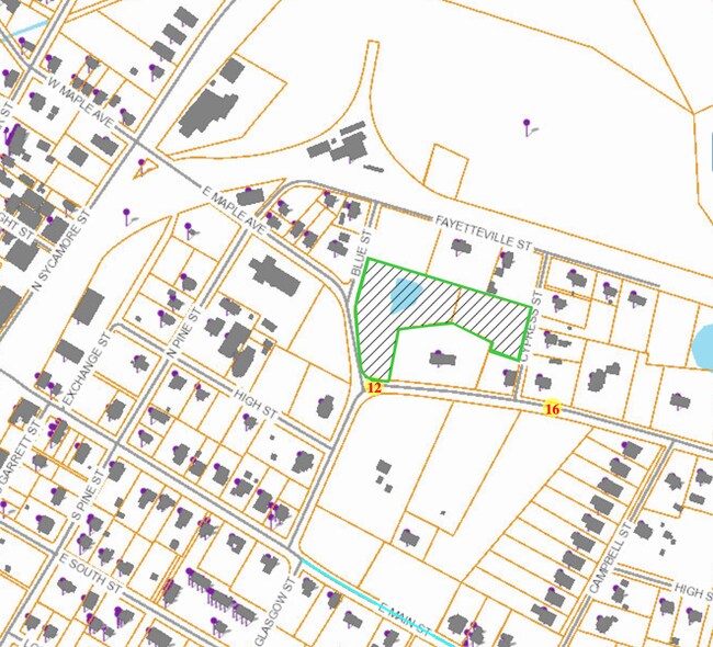
Cypress St
8570-14-43-2301
THOMAS LAND ABERDEEN CITY BETHESDA
Vacantlandnec
MOORE
R20
North Carolina
B and X Area of moderate flood hazard, usually the area between the limits of the 100-year and 500-year floods.
1.11 AC
2025
North Carolina Southeast Area
2025
Other Market Areas
951102
Pinehurst-Southern Pines, NC
NEARBY LISTINGS FOR SALE OR LEASE
DEMOGRAPHICS near Cypress St
1 mile
3 mile
5 mile
2025 Total Population
2,896
16,660
37,311
2030 Population
3,059
17,571
39,590
Pop Growth 2025-2030
+ 5.63%
+ 5.47%
+ 6.11%
Average Age
39
40
43
2025 Total Households
1,167
6,988
16,677
HH Growth 2025-2030
+ 5.66%
+ 5.58%
+ 6.30%
Median Household Inc
$68,382
$73,395
$78,779
Avg Household Size
2.40
2.30
2.20
2025 Avg HH Vehicles
2.00
2.00
2.00
Median Home Value
$342,721
$345,637
$405,145
Median Year Built
1990
1993
1992
Nearby Places
Map Layers
Map Styles
 Street
 Aerial
Layers
 Traffic
 Biking
Places
Listings with unknown addresses are not visible on the map
- Restaurants
- Banks
- Shops
- Fitness
- Groceries
PUBLIC TRANSPORTATION
COMMUTER RAIL
Southern Pines Amtrak Station (Silver Star - Amtrak)
Drive
Walk
Distance
Southern Pines Amtrak Station (Silver Star - Amtrak)
8 min
4.3 mi
Freight Ports
Port of Wilmington
Drive
Walk
Distance
Port of Wilmington
165 min
131.1 mi
SALE & LEASE HISTORY
LISTING DATE
SALE/LEASE

Sep 13, 2017
For Sale
Jul 20, 2018
For Sale
Dec 12, 2019
For Sale
Nearby Properties
Address
Land Use
TOTAL SIZE
Lot Size
Zoning
Address
Land Use
TOTAL SIZE
Lot Size
Zoning
7,024 SF
9.05 AC
Address
Land Use
TOTAL SIZE
Lot Size
Zoning
26.75 AC
Address
Land Use
TOTAL SIZE
Lot Size
Zoning
21,138 SF
473.33 AC
RD
Address
Land Use
TOTAL SIZE
Lot Size
Zoning
70,130 SF
19.18 AC
Address
Land Use
TOTAL SIZE
Lot Size
Zoning
22,772 SF
12.46 AC
HC
Address
Land Use
TOTAL SIZE
Lot Size
Zoning
44.59 AC
MULTI
Address
Land Use
TOTAL SIZE
Lot Size
Zoning
4,184 SF
13.85 AC
R6
Address
Land Use
TOTAL SIZE
Lot Size
Zoning
83,896 SF
66.98 AC
R20
Address
Land Use
TOTAL SIZE
Lot Size
Zoning
Address
Land Use
TOTAL SIZE
Lot Size
Zoning
4,710 SF
6.95 AC
R6
Address
Land Use
TOTAL SIZE
Lot Size
Zoning
17.78 AC
Address
Land Use
TOTAL SIZE
Lot Size
Zoning
199,100 SF
24.89 AC
HC
Address
Land Use
TOTAL SIZE
Lot Size
Zoning
8.15 AC
GC
Address
Land Use
TOTAL SIZE
Lot Size
Zoning
33,296 SF
11.23 AC
HC
Address
Land Use
TOTAL SIZE
Lot Size
Zoning
2,450 SF
2.96 AC
Address
Land Use
TOTAL SIZE
Lot Size
Zoning
57,109 SF
4.08 AC
GBSD
Address
Land Use
TOTAL SIZE
Lot Size
Zoning
0.84 AC
GC
Address
Land Use
TOTAL SIZE
Lot Size
Zoning
Address
Land Use
TOTAL SIZE
Lot Size
Zoning
9,690 SF
19.96 AC
HC
Address
Land Use
TOTAL SIZE
Lot Size
Zoning
37,261 SF
7 AC
OI
Address
Land Use
TOTAL SIZE
Lot Size
Zoning
23,472 SF
3.49 AC
GC
Address
Land Use
TOTAL SIZE
Lot Size
Zoning
Address
Land Use
TOTAL SIZE
Lot Size
Zoning
Address
Land Use
TOTAL SIZE
Lot Size
Zoning
127,725 SF
5.52 AC
GB
Address
Land Use
TOTAL SIZE
Lot Size
Zoning
2,400 SF
0.46 AC
GB
Address
Land Use
TOTAL SIZE
Lot Size
Zoning
10,294 SF
2.11 AC
GB
Address
Land Use
TOTAL SIZE
Lot Size
Zoning
5,946 SF
4.84 AC
GB
Address
Land Use
TOTAL SIZE
Lot Size
Zoning
157,500 SF
10.01 AC
CI
Address
Land Use
TOTAL SIZE
Lot Size
Zoning
31,020 SF
3.65 AC
GBSD
Address
Land Use
TOTAL SIZE
Lot Size
Zoning
The World's #1 Commercial Real Estate Marketplace
Connect with us
© 2026 CoStar Group
The information above has been obtained from sources believed reliable. While we do not doubt its accuracy we have not verified it and make no guarantee, warranty or representation about it. It is your responsibility to independently confirm its accuracy and completeness. Any projections, opinions, assumptions, or estimates used are for example only and do not represent the current or future performance of the property. The value of this transaction to you depends on tax and other factors which should be evaluated by your tax, financial, and legal advisors. You and your advisors should conduct a careful, independent investigation of the property to determine to your satisfaction the suitability of the property for your needs.