Property Record
Daily Rd, Rosenberg, TX 77471

Property Detail
Daily Rd
0106-00-050-0000-901
0106 ANTONIE BALLE, BLOCK 49, ACRES 93.867, SLAVIN & GEORGE
Ranch
FORT BEND
QO
Texas
A Areas with a 1% annual chance of flooding and a 26% chance of flooding over the life of a 30-year mortgage.
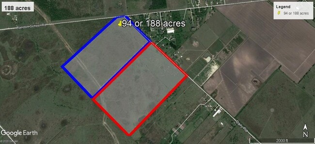
93.58 AC
2024
Southwest Outlier
2025
Houston
675402
Houston-Pasadena-The Woodlands, TX
NEARBY LISTINGS FOR SALE OR LEASE
DEMOGRAPHICS near Daily Rd
1 mile
3 mile
5 mile
2025 Total Population
258
2,930
6,314
2030 Population
298
3,384
7,294
Pop Growth 2025-2030
+ 15.50%
+ 15.49%
+ 15.52%
Average Age
37
38
39
2025 Total Households
81
946
2,072
HH Growth 2025-2030
+ 16.05%
+ 15.96%
+ 15.88%
Median Household Inc
$68,999
$64,046
$69,230
Avg Household Size
3.20
3.10
3.10
2025 Avg HH Vehicles
2.00
2.00
2.00
Median Home Value
$299,999
$377,396
$445,491
Median Year Built
1987
1988
1990
Nearby Places
Map Layers
Map Styles
 Street
 Aerial
Layers
 Traffic
 Biking
Places
Listings with unknown addresses are not visible on the map
- Restaurants
- Banks
- Shops
- Fitness
- Groceries
SALE & LEASE HISTORY
LISTING DATE
SALE/LEASE

Apr 13, 2020
For Sale
Nearby Properties
Address
Land Use
TOTAL SIZE
Lot Size
Zoning
Address
Land Use
TOTAL SIZE
Lot Size
Zoning
100,000 SF
1.32 AC
Address
Land Use
TOTAL SIZE
Lot Size
Zoning
19.57 AC
OY
Address
Land Use
TOTAL SIZE
Lot Size
Zoning
194.64 AC
Address
Land Use
TOTAL SIZE
Lot Size
Zoning
9.51 AC
Address
Land Use
TOTAL SIZE
Lot Size
Zoning
105,350 SF
11.50 AC
R
Address
Land Use
TOTAL SIZE
Lot Size
Zoning
129.15 AC
Address
Land Use
TOTAL SIZE
Lot Size
Zoning
51,250 SF
10.01 AC
S
Address
Land Use
TOTAL SIZE
Lot Size
Zoning
2,064 SF
93.87 AC
QO
Address
Land Use
TOTAL SIZE
Lot Size
Zoning
75.19 AC
Address
Land Use
TOTAL SIZE
Lot Size
Zoning
159.79 AC
OTYM
Address
Land Use
TOTAL SIZE
Lot Size
Zoning
21.35 AC
S
Address
Land Use
TOTAL SIZE
Lot Size
Zoning
Address
Land Use
TOTAL SIZE
Lot Size
Zoning
33,106 SF
6 AC
J
Address
Land Use
TOTAL SIZE
Lot Size
Zoning
13,200 SF
2.20 AC
S
Address
Land Use
TOTAL SIZE
Lot Size
Zoning
13,920 SF
3 AC
SM
Address
Land Use
TOTAL SIZE
Lot Size
Zoning
28,690 SF
4.01 AC
J
Address
Land Use
TOTAL SIZE
Lot Size
Zoning
47,860 SF
4 AC
YS
Address
Land Use
TOTAL SIZE
Lot Size
Zoning
72.55 AC
Address
Land Use
TOTAL SIZE
Lot Size
Zoning
41,500 SF
5 AC
Address
Land Use
TOTAL SIZE
Lot Size
Zoning
800 SF
89.75 AC
OTS
Address
Land Use
TOTAL SIZE
Lot Size
Zoning
13,280 SF
17.10 AC
YZ
Address
Land Use
TOTAL SIZE
Lot Size
Zoning
6,891 SF
4.01 AC
XY
Address
Land Use
TOTAL SIZE
Lot Size
Zoning
78 AC
SO
Address
Land Use
TOTAL SIZE
Lot Size
Zoning
11,820 SF
2.57 AC
MY
Address
Land Use
TOTAL SIZE
Lot Size
Zoning
85.37 AC
Y
Address
Land Use
TOTAL SIZE
Lot Size
Zoning
11.50 AC
Address
Land Use
TOTAL SIZE
Lot Size
Zoning
21,190 SF
10 AC
ST
Address
Land Use
TOTAL SIZE
Lot Size
Zoning
2,910 SF
1 AC
Address
Land Use
TOTAL SIZE
Lot Size
Zoning
58.43 AC
SYO
Address
Land Use
TOTAL SIZE
Lot Size
Zoning
784 SF
1.67 AC
X
The World's #1 Commercial Real Estate Marketplace
Connect with us
© 2026 CoStar Group
The information above has been obtained from sources believed reliable. While we do not doubt its accuracy we have not verified it and make no guarantee, warranty or representation about it. It is your responsibility to independently confirm its accuracy and completeness. Any projections, opinions, assumptions, or estimates used are for example only and do not represent the current or future performance of the property. The value of this transaction to you depends on tax and other factors which should be evaluated by your tax, financial, and legal advisors. You and your advisors should conduct a careful, independent investigation of the property to determine to your satisfaction the suitability of the property for your needs.