Property Record
Dallas Stanley Hwy, , NC


Property Detail
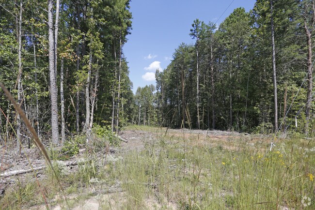
Dallas Stanley Hwy
210309
13 077 005 01 000 SPL
Autorepair
GASTON
C1
North Carolina
B and X Area of moderate flood hazard, usually the area between the limits of the 100-year and 500-year floods.
4.39 AC
0
Gaston County
2025
Charlotte
030302
Charlotte-Concord-Gastonia, NC-SC
13,684 SF
NEARBY LISTINGS FOR SALE OR LEASE
DEMOGRAPHICS near Dallas Stanley Hwy
1 mile
3 mile
5 mile
2025 Total Population
1,084
19,840
57,582
2030 Population
1,151
20,893
60,707
Pop Growth 2025-2030
+ 6.18%
+ 5.31%
+ 5.43%
Average Age
41
39
40
2025 Total Households
434
7,837
22,428
HH Growth 2025-2030
+ 6.22%
+ 5.47%
+ 5.65%
Median Household Inc
$57,999
$59,837
$61,068
Avg Household Size
2.40
2.50
2.50
2025 Avg HH Vehicles
2.00
2.00
2.00
Median Home Value
$212,149
$247,692
$258,391
Median Year Built
1983
1981
1978
Nearby Places
Map Layers
Map Styles
 Street
 Aerial
Layers
 Traffic
 Biking
Places
Listings with unknown addresses are not visible on the map
- Restaurants
- Banks
- Shops
- Fitness
- Groceries
PUBLIC TRANSPORTATION
COMMUTER RAIL
Gastonia Amtrak Station (Crescent - Amtrak)
Drive
Walk
Distance
Gastonia Amtrak Station (Crescent - Amtrak)
11 min
6.2 mi
AIRPORT
Charlotte/Douglas International
Drive
Walk
Distance
Charlotte/Douglas International
35 min
20.3 mi
Concord-Padgett Regional
Drive
Walk
Distance
Concord-Padgett Regional
45 min
30.1 mi
Freight Ports
North Charleston Terminal
Drive
Walk
Distance
North Charleston Terminal
249 min
216.3 mi
Nearby Properties
Address
Land Use
TOTAL SIZE
Lot Size
Zoning
Address
Land Use
TOTAL SIZE
Lot Size
Zoning
11,696 SF
159.68 AC
Address
Land Use
TOTAL SIZE
Lot Size
Zoning
2,688 SF
22.48 AC
OFF01
Address
Land Use
TOTAL SIZE
Lot Size
Zoning
16,776 SF
49.87 AC
PUB01
Address
Land Use
TOTAL SIZE
Lot Size
Zoning
1,914 SF
15.78 AC
MRKT1
Address
Land Use
TOTAL SIZE
Lot Size
Zoning
3,328 SF
10.16 AC
APT02
Address
Land Use
TOTAL SIZE
Lot Size
Zoning
2,776 SF
57.41 AC
R1
Address
Land Use
TOTAL SIZE
Lot Size
Zoning
61,043 SF
30.34 AC
PUB01
Address
Land Use
TOTAL SIZE
Lot Size
Zoning
2,053 SF
15.34 AC
OFF01
Address
Land Use
TOTAL SIZE
Lot Size
Zoning
115,534 SF
50.10 AC
PUB01
Address
Land Use
TOTAL SIZE
Lot Size
Zoning
13,602 SF
8.74 AC
Address
Land Use
TOTAL SIZE
Lot Size
Zoning
2,145 SF
10.19 AC
Address
Land Use
TOTAL SIZE
Lot Size
Zoning
43,164 SF
11.52 AC
SHOP1
Address
Land Use
TOTAL SIZE
Lot Size
Zoning
69,540 SF
19.40 AC
PUB01
Address
Land Use
TOTAL SIZE
Lot Size
Zoning
1,448 SF
2.62 AC
Address
Land Use
TOTAL SIZE
Lot Size
Zoning
1,448 SF
4.14 AC
Address
Land Use
TOTAL SIZE
Lot Size
Zoning
33,721 SF
5 AC
HCAR4
Address
Land Use
TOTAL SIZE
Lot Size
Zoning
41,065 SF
20.65 AC
R1
Address
Land Use
TOTAL SIZE
Lot Size
Zoning
1,184 SF
42.55 AC
OFF01
Address
Land Use
TOTAL SIZE
Lot Size
Zoning
2,172 SF
15.13 AC
OFF01
Address
Land Use
TOTAL SIZE
Lot Size
Zoning
46,070 SF
5.43 AC
SHOP1
Address
Land Use
TOTAL SIZE
Lot Size
Zoning
14,647 SF
1.22 AC
RET05
Address
Land Use
TOTAL SIZE
Lot Size
Zoning
10,204 SF
10.13 AC
INDS2
Address
Land Use
TOTAL SIZE
Lot Size
Zoning
962 SF
79.34 AC
INDS3
Address
Land Use
TOTAL SIZE
Lot Size
Zoning
6.25 AC
Address
Land Use
TOTAL SIZE
Lot Size
Zoning
1,448 SF
1.21 AC
Address
Land Use
TOTAL SIZE
Lot Size
Zoning
3,542 SF
10.04 AC
APT01
Address
Land Use
TOTAL SIZE
Lot Size
Zoning
45,970 SF
7.57 AC
SHOP1
Address
Land Use
TOTAL SIZE
Lot Size
Zoning
4,333 SF
243.05 AC
R1H
Address
Land Use
TOTAL SIZE
Lot Size
Zoning
936 SF
7.80 AC
R1
Address
Land Use
TOTAL SIZE
Lot Size
Zoning
13,646 SF
1.95 AC
R2
The World's #1 Commercial Real Estate Marketplace
Connect with us
© 2026 CoStar Group
The information above has been obtained from sources believed reliable. While we do not doubt its accuracy we have not verified it and make no guarantee, warranty or representation about it. It is your responsibility to independently confirm its accuracy and completeness. Any projections, opinions, assumptions, or estimates used are for example only and do not represent the current or future performance of the property. The value of this transaction to you depends on tax and other factors which should be evaluated by your tax, financial, and legal advisors. You and your advisors should conduct a careful, independent investigation of the property to determine to your satisfaction the suitability of the property for your needs.