Property Record
Darlington, Hubbard, OH 44425

Property Detail
Darlington
Youngstown-Warren, OH
496TO498 110F SCHENLEY PK BELMONT AV
12-469738
TRUMBULL
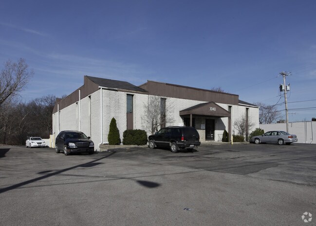
Officebuilding
Ohio
B and X Area of moderate flood hazard, usually the area between the limits of the 100-year and 500-year floods.
496
2024
0.10 AC
2024
Trumbull County
931601
Youngstown/Warren/Boardman
NEARBY LISTINGS FOR SALE OR LEASE
DEMOGRAPHICS near Darlington
1 mile
3 mile
5 mile
2025 Total Population
5,414
41,107
97,730
2030 Population
5,413
41,058
97,600
Pop Growth 2025-2030
(0.02%)
(0.12%)
(0.13%)
Average Age
42
40
41
2025 Total Households
2,382
16,813
41,607
HH Growth 2025-2030
(0.13%)
(0.14%)
(0.21%)
Median Household Inc
$43,709
$36,307
$41,136
Avg Household Size
2.20
2.10
2.20
2025 Avg HH Vehicles
2.00
1.00
2.00
Median Home Value
$98,511
$90,474
$98,269
Median Year Built
1955
1955
1956
Nearby Places
Map Layers
Map Styles
 Street
 Aerial
Transit
 Traffic
 Biking
Places
Listings with unknown addresses are not visible on the map
- Restaurants
- Banks
- Shops
- Fitness
- Groceries
SALE & LEASE HISTORY
LISTING DATE
SALE/LEASE

Sep 25, 2016
For Lease
May 03, 2023
For Lease
Jun 06, 2023
For Lease
Apr 04, 2019
For Lease
Nearby Properties
Address
Land Use
TOTAL SIZE
Lot Size
Zoning
Address
Land Use
TOTAL SIZE
Lot Size
Zoning
981,460 SF
74.87 AC
Address
Land Use
TOTAL SIZE
Lot Size
Zoning
402,080 SF
72.11 AC
Address
Land Use
TOTAL SIZE
Lot Size
Zoning
674,524 SF
7.89 AC
Address
Land Use
TOTAL SIZE
Lot Size
Zoning
119,241 SF
1.30 AC
Address
Land Use
TOTAL SIZE
Lot Size
Zoning
102,465 SF
1.44 AC
Address
Land Use
TOTAL SIZE
Lot Size
Zoning
165,980 SF
1.69 AC
Address
Land Use
TOTAL SIZE
Lot Size
Zoning
1.43 AC
Address
Land Use
TOTAL SIZE
Lot Size
Zoning
131,643 SF
2.38 AC
Address
Land Use
TOTAL SIZE
Lot Size
Zoning
67,680 SF
22.66 AC
Address
Land Use
TOTAL SIZE
Lot Size
Zoning
186,576 SF
2.37 AC
Address
Land Use
TOTAL SIZE
Lot Size
Zoning
55,398 SF
36.73 AC
Address
Land Use
TOTAL SIZE
Lot Size
Zoning
6,207 SF
0.88 AC
Address
Land Use
TOTAL SIZE
Lot Size
Zoning
1.89 AC
Address
Land Use
TOTAL SIZE
Lot Size
Zoning
93,891 SF
0.17 AC
Address
Land Use
TOTAL SIZE
Lot Size
Zoning
139,820 SF
7.10 AC
Address
Land Use
TOTAL SIZE
Lot Size
Zoning
446,250 SF
43.88 AC
Address
Land Use
TOTAL SIZE
Lot Size
Zoning
160,001 SF
0.90 AC
Address
Land Use
TOTAL SIZE
Lot Size
Zoning
153,148 SF
10.12 AC
Address
Land Use
TOTAL SIZE
Lot Size
Zoning
172,733 SF
2.75 AC
Address
Land Use
TOTAL SIZE
Lot Size
Zoning
72,725 SF
5.03 AC
Address
Land Use
TOTAL SIZE
Lot Size
Zoning
543,000 SF
4.03 AC
Address
Land Use
TOTAL SIZE
Lot Size
Zoning
68,058 SF
3.54 AC
Address
Land Use
TOTAL SIZE
Lot Size
Zoning
161,758 SF
0.71 AC
Address
Land Use
TOTAL SIZE
Lot Size
Zoning
96,194 SF
1.42 AC
Address
Land Use
TOTAL SIZE
Lot Size
Zoning
96,184 SF
0.82 AC
Address
Land Use
TOTAL SIZE
Lot Size
Zoning
108,743 SF
0.25 AC
Address
Land Use
TOTAL SIZE
Lot Size
Zoning
106,598 SF
0.17 AC
Address
Land Use
TOTAL SIZE
Lot Size
Zoning
37,644 SF
2.73 AC
Address
Land Use
TOTAL SIZE
Lot Size
Zoning
80,125 SF
0.66 AC
Address
Land Use
TOTAL SIZE
Lot Size
Zoning
51,083 SF
2.06 AC
The World's #1 Commercial Real Estate Marketplace
Connect with us
© 2026 CoStar Group
The information above has been obtained from sources believed reliable. While we do not doubt its accuracy we have not verified it and make no guarantee, warranty or representation about it. It is your responsibility to independently confirm its accuracy and completeness. Any projections, opinions, assumptions, or estimates used are for example only and do not represent the current or future performance of the property. The value of this transaction to you depends on tax and other factors which should be evaluated by your tax, financial, and legal advisors. You and your advisors should conduct a careful, independent investigation of the property to determine to your satisfaction the suitability of the property for your needs.