Property Record
Darlington Rd, Vanport, PA 15009

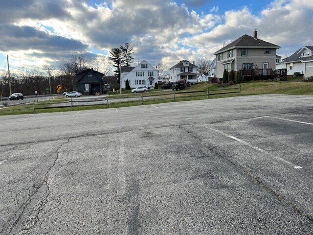
Property Detail
Darlington Rd
Pittsburgh, PA
PT UNNO LOT OR 0.40 AC
72-004-0100.001
BEAVER
Residentialacreage
Pennsylvania
B and X Area of moderate flood hazard, usually the area between the limits of the 100-year and 500-year floods.
0.40 AC
2024
Beaver County
2025
Pittsburgh
602602
NEARBY LISTINGS FOR SALE OR LEASE
DEMOGRAPHICS near Darlington Rd
1 mile
3 mile
5 mile
2025 Total Population
6,332
30,936
59,582
2030 Population
6,284
30,641
59,003
Pop Growth 2025-2030
(0.76%)
(0.95%)
(0.97%)
Average Age
43
42
44
2025 Total Households
2,657
12,750
25,003
HH Growth 2025-2030
(0.79%)
(1.02%)
(1.02%)
Median Household Inc
$53,424
$59,762
$64,219
Avg Household Size
2.20
2.30
2.30
2025 Avg HH Vehicles
2.00
2.00
2.00
Median Home Value
$181,066
$169,237
$196,377
Median Year Built
1954
1953
1954
Nearby Places
Map Layers
Map Styles
 Street
 Aerial
Layers
 Traffic
 Biking
Places
Listings with unknown addresses are not visible on the map
- Restaurants
- Banks
- Shops
- Fitness
- Groceries
PUBLIC TRANSPORTATION
AIRPORT
Pittsburgh International
Drive
Walk
Distance
Pittsburgh International
34 min
24.3 mi
Freight Ports
Port of Toledo
Drive
Walk
Distance
Port of Toledo
227 min
200.2 mi
SALE & LEASE HISTORY
LISTING DATE
SALE/LEASE

Dec 09, 2022
For Lease
Nearby Properties
Address
Land Use
TOTAL SIZE
Lot Size
Zoning
Address
Land Use
TOTAL SIZE
Lot Size
Zoning
84.86 AC
Address
Land Use
TOTAL SIZE
Lot Size
Zoning
21,778 SF
20.14 AC
Address
Land Use
TOTAL SIZE
Lot Size
Zoning
65,080 SF
14.50 AC
Address
Land Use
TOTAL SIZE
Lot Size
Zoning
24,364 SF
37.65 AC
Address
Land Use
TOTAL SIZE
Lot Size
Zoning
14.70 AC
Address
Land Use
TOTAL SIZE
Lot Size
Zoning
8,000 SF
47.98 AC
Address
Land Use
TOTAL SIZE
Lot Size
Zoning
78,562 SF
2.19 AC
Address
Land Use
TOTAL SIZE
Lot Size
Zoning
56,178 SF
74.72 AC
Address
Land Use
TOTAL SIZE
Lot Size
Zoning
72,136 SF
13.57 AC
Address
Land Use
TOTAL SIZE
Lot Size
Zoning
74,951 SF
31.03 AC
Address
Land Use
TOTAL SIZE
Lot Size
Zoning
54,830 SF
26.44 AC
Address
Land Use
TOTAL SIZE
Lot Size
Zoning
42,000 SF
0.51 AC
Address
Land Use
TOTAL SIZE
Lot Size
Zoning
38,204 SF
8.03 AC
Address
Land Use
TOTAL SIZE
Lot Size
Zoning
13,114 SF
2.07 AC
Address
Land Use
TOTAL SIZE
Lot Size
Zoning
40,176 SF
4.42 AC
Address
Land Use
TOTAL SIZE
Lot Size
Zoning
86,664 SF
2.94 AC
Address
Land Use
TOTAL SIZE
Lot Size
Zoning
30,225 SF
4.16 AC
Address
Land Use
TOTAL SIZE
Lot Size
Zoning
89,732 SF
8.20 AC
Address
Land Use
TOTAL SIZE
Lot Size
Zoning
99,072 SF
5.49 AC
Address
Land Use
TOTAL SIZE
Lot Size
Zoning
37,224 SF
1 AC
Address
Land Use
TOTAL SIZE
Lot Size
Zoning
66,640 SF
6.52 AC
Address
Land Use
TOTAL SIZE
Lot Size
Zoning
6.69 AC
Address
Land Use
TOTAL SIZE
Lot Size
Zoning
62,784 SF
11.98 AC
Address
Land Use
TOTAL SIZE
Lot Size
Zoning
6,924 SF
16.06 AC
Address
Land Use
TOTAL SIZE
Lot Size
Zoning
27,460 SF
2.04 AC
Address
Land Use
TOTAL SIZE
Lot Size
Zoning
49,090 SF
1.93 AC
Address
Land Use
TOTAL SIZE
Lot Size
Zoning
31,265 SF
0.35 AC
Address
Land Use
TOTAL SIZE
Lot Size
Zoning
22,380 SF
0.73 AC
Address
Land Use
TOTAL SIZE
Lot Size
Zoning
7,500 SF
3.85 AC
Address
Land Use
TOTAL SIZE
Lot Size
Zoning
54,249 SF
1.60 AC
The World's #1 Commercial Real Estate Marketplace
Connect with us
© 2026 CoStar Group
The information above has been obtained from sources believed reliable. While we do not doubt its accuracy we have not verified it and make no guarantee, warranty or representation about it. It is your responsibility to independently confirm its accuracy and completeness. Any projections, opinions, assumptions, or estimates used are for example only and do not represent the current or future performance of the property. The value of this transaction to you depends on tax and other factors which should be evaluated by your tax, financial, and legal advisors. You and your advisors should conduct a careful, independent investigation of the property to determine to your satisfaction the suitability of the property for your needs.