Property Record
David Rd, Greer, SC 29651


Property Detail
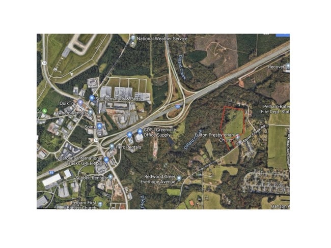
David Rd
Spartanburg, SC
P/O TR 8 NEWTON SMITH EST PB 78-57 DB 135H-367
9-06-00-010.00
SPARTANBURG
Agriculturalland
South Carolina
B and X Area of moderate flood hazard, usually the area between the limits of the 100-year and 500-year floods.
21.48 AC
2024
Rt 101 Corridor
2025
Greenville/Spartanburg
023202
NEARBY LISTINGS FOR SALE OR LEASE
DEMOGRAPHICS near David Rd
1 mile
3 mile
5 mile
2025 Total Population
2,053
19,277
91,245
2030 Population
2,324
21,108
98,924
Pop Growth 2025-2030
+ 13.20%
+ 9.50%
+ 8.42%
Average Age
37
40
40
2025 Total Households
703
7,011
34,912
HH Growth 2025-2030
+ 13.37%
+ 9.64%
+ 8.55%
Median Household Inc
$115,651
$116,244
$98,334
Avg Household Size
2.90
2.70
2.60
2025 Avg HH Vehicles
2.00
2.00
2.00
Median Home Value
$346,820
$404,870
$386,311
Median Year Built
2008
2003
1998
Nearby Places
Map Layers
Map Styles
 Street
 Aerial
Transit
 Traffic
 Biking
Places
Listings with unknown addresses are not visible on the map
- Restaurants
- Banks
- Shops
- Fitness
- Groceries
PUBLIC TRANSPORTATION
AIRPORT
Greenville Spartanburg International
Drive
Walk
Distance
Greenville Spartanburg International
9 min
3.2 mi
Freight Ports
North Charleston Terminal
Drive
Walk
Distance
North Charleston Terminal
233 min
203.3 mi
SALE & LEASE HISTORY
LISTING DATE
SALE/LEASE

Oct 16, 2019
For Sale
Nov 17, 2016
For Sale
Nearby Properties
Address
Land Use
TOTAL SIZE
Lot Size
Zoning
Address
Land Use
TOTAL SIZE
Lot Size
Zoning
136.04 AC
I1
Address
Land Use
TOTAL SIZE
Lot Size
Zoning
88.98 AC
RS
Address
Land Use
TOTAL SIZE
Lot Size
Zoning
17.53 AC
I1
Address
Land Use
TOTAL SIZE
Lot Size
Zoning
1,202 SF
14.38 AC
RS
Address
Land Use
TOTAL SIZE
Lot Size
Zoning
9.50 AC
I1
Address
Land Use
TOTAL SIZE
Lot Size
Zoning
143.57 AC
I1
Address
Land Use
TOTAL SIZE
Lot Size
Zoning
86,884 SF
5.31 AC
Address
Land Use
TOTAL SIZE
Lot Size
Zoning
5.20 AC
TI1
Address
Land Use
TOTAL SIZE
Lot Size
Zoning
5.70 AC
I1
Address
Land Use
TOTAL SIZE
Lot Size
Zoning
4.80 AC
I1
Address
Land Use
TOTAL SIZE
Lot Size
Zoning
9.90 AC
I1
Address
Land Use
TOTAL SIZE
Lot Size
Zoning
16.50 AC
TS1
Address
Land Use
TOTAL SIZE
Lot Size
Zoning
15.90 AC
TS1
Address
Land Use
TOTAL SIZE
Lot Size
Zoning
5.80 AC
RS
Address
Land Use
TOTAL SIZE
Lot Size
Zoning
2,417 SF
115.88 AC
Address
Land Use
TOTAL SIZE
Lot Size
Zoning
29 AC
I1
Address
Land Use
TOTAL SIZE
Lot Size
Zoning
22.48 AC
I1
Address
Land Use
TOTAL SIZE
Lot Size
Zoning
2.30 AC
I1
Address
Land Use
TOTAL SIZE
Lot Size
Zoning
23.20 AC
PD
Address
Land Use
TOTAL SIZE
Lot Size
Zoning
1.70 AC
I1
Address
Land Use
TOTAL SIZE
Lot Size
Zoning
18.53 AC
Address
Land Use
TOTAL SIZE
Lot Size
Zoning
26.29 AC
RS
Address
Land Use
TOTAL SIZE
Lot Size
Zoning
29.80 AC
I1
Address
Land Use
TOTAL SIZE
Lot Size
Zoning
3,507 SF
8.78 AC
I1
Address
Land Use
TOTAL SIZE
Lot Size
Zoning
15.26 AC
Address
Land Use
TOTAL SIZE
Lot Size
Zoning
5.90 AC
TI1
Address
Land Use
TOTAL SIZE
Lot Size
Zoning
1,549 SF
1 AC
RS
Address
Land Use
TOTAL SIZE
Lot Size
Zoning
43.58 AC
RS
Address
Land Use
TOTAL SIZE
Lot Size
Zoning
17.60 AC
PD
Address
Land Use
TOTAL SIZE
Lot Size
Zoning
2.12 AC
I1
The World's #1 Commercial Real Estate Marketplace
Connect with us
© 2026 CoStar Group
The information above has been obtained from sources believed reliable. While we do not doubt its accuracy we have not verified it and make no guarantee, warranty or representation about it. It is your responsibility to independently confirm its accuracy and completeness. Any projections, opinions, assumptions, or estimates used are for example only and do not represent the current or future performance of the property. The value of this transaction to you depends on tax and other factors which should be evaluated by your tax, financial, and legal advisors. You and your advisors should conduct a careful, independent investigation of the property to determine to your satisfaction the suitability of the property for your needs.