Property Record
Davis Lake Rd, Thomaston, GA 30286
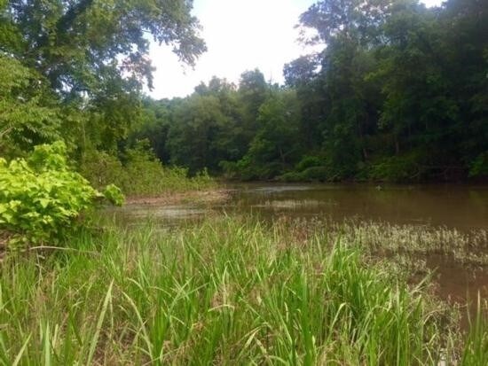

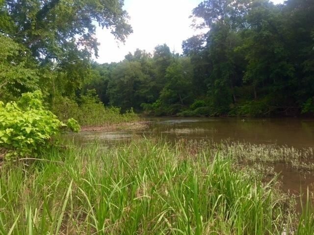
Property Detail
Davis Lake Rd
046-005B
PARCEL 1 26.579ACS PB 31/254
Privatepreserveopenspacevacantlandforestlandconservation
UPSON
R1
Georgia
AE The base floodplain where base flood elevations are provided. AE Zones are now used on new format FIRMs instead of A1-A30 Zones.
26.58 AC
2025
Georgia South Area
2025
Other Market Areas
010402
Thomaston, GA
NEARBY LISTINGS FOR SALE OR LEASE
DEMOGRAPHICS near Davis Lake Rd
1 mile
3 mile
5 mile
2025 Total Population
1,554
10,424
18,252
2030 Population
1,614
10,709
18,647
Pop Growth 2025-2030
+ 3.86%
+ 2.73%
+ 2.16%
Average Age
45
42
41
2025 Total Households
655
4,354
7,442
HH Growth 2025-2030
+ 3.82%
+ 2.62%
+ 2.04%
Median Household Inc
$48,735
$45,937
$45,506
Avg Household Size
2.20
2.30
2.40
2025 Avg HH Vehicles
2.00
2.00
2.00
Median Home Value
$252,542
$167,303
$160,487
Median Year Built
1959
1960
1969
Nearby Places
Map Layers
Map Styles
 Street
 Aerial
Layers
 Traffic
 Biking
Places
Listings with unknown addresses are not visible on the map
- Restaurants
- Banks
- Shops
- Fitness
- Groceries
SALE & LEASE HISTORY
LISTING DATE
SALE/LEASE

Oct 02, 2017
For Sale
Nearby Properties
Address
Land Use
TOTAL SIZE
Lot Size
Zoning
Address
Land Use
TOTAL SIZE
Lot Size
Zoning
6,768 SF
39.20 AC
MR
Address
Land Use
TOTAL SIZE
Lot Size
Zoning
9,588 SF
18.45 AC
PI
Address
Land Use
TOTAL SIZE
Lot Size
Zoning
57,512 SF
29.28 AC
006
Address
Land Use
TOTAL SIZE
Lot Size
Zoning
46,987 SF
24.32 AC
C2
Address
Land Use
TOTAL SIZE
Lot Size
Zoning
121,950 SF
12.57 AC
PI
Address
Land Use
TOTAL SIZE
Lot Size
Zoning
26,248 SF
4 AC
PI
Address
Land Use
TOTAL SIZE
Lot Size
Zoning
48,476 SF
17.80 AC
ES2
Address
Land Use
TOTAL SIZE
Lot Size
Zoning
34,436 SF
3.52 AC
MR
Address
Land Use
TOTAL SIZE
Lot Size
Zoning
22,652 SF
3.50 AC
PI
Address
Land Use
TOTAL SIZE
Lot Size
Zoning
31,412 SF
3.69 AC
DT
Address
Land Use
TOTAL SIZE
Lot Size
Zoning
34,537 SF
6.65 AC
C2
Address
Land Use
TOTAL SIZE
Lot Size
Zoning
24,662 SF
1.09 AC
DT
Address
Land Use
TOTAL SIZE
Lot Size
Zoning
28,266 SF
2.44 AC
PD
Address
Land Use
TOTAL SIZE
Lot Size
Zoning
13,765 SF
7.92 AC
PD
Address
Land Use
TOTAL SIZE
Lot Size
Zoning
61,916 SF
8.93 AC
C2
Address
Land Use
TOTAL SIZE
Lot Size
Zoning
30,719 SF
22.90 AC
PI
Address
Land Use
TOTAL SIZE
Lot Size
Zoning
21,373 SF
2.77 AC
C2
Address
Land Use
TOTAL SIZE
Lot Size
Zoning
5,640 SF
5 AC
MR
Address
Land Use
TOTAL SIZE
Lot Size
Zoning
19,660 SF
1.26 AC
DT
Address
Land Use
TOTAL SIZE
Lot Size
Zoning
7,444 SF
5.44 AC
MR
Address
Land Use
TOTAL SIZE
Lot Size
Zoning
12,810 SF
1.73 AC
R1
Address
Land Use
TOTAL SIZE
Lot Size
Zoning
107,468 SF
7.21 AC
M2
Address
Land Use
TOTAL SIZE
Lot Size
Zoning
600 SF
6 AC
MR
Address
Land Use
TOTAL SIZE
Lot Size
Zoning
44,793 SF
9 AC
R2
Address
Land Use
TOTAL SIZE
Lot Size
Zoning
263,413 SF
20.59 AC
M2
Address
Land Use
TOTAL SIZE
Lot Size
Zoning
1,725 SF
10.68 AC
004
Address
Land Use
TOTAL SIZE
Lot Size
Zoning
1,060.56 AC
AR
Address
Land Use
TOTAL SIZE
Lot Size
Zoning
18,496 SF
0.32 AC
PI
Address
Land Use
TOTAL SIZE
Lot Size
Zoning
1,821 SF
7 AC
R2
Address
Land Use
TOTAL SIZE
Lot Size
Zoning
11,228 SF
0.37 AC
R1
The World's #1 Commercial Real Estate Marketplace
Connect with us
© 2026 CoStar Group
The information above has been obtained from sources believed reliable. While we do not doubt its accuracy we have not verified it and make no guarantee, warranty or representation about it. It is your responsibility to independently confirm its accuracy and completeness. Any projections, opinions, assumptions, or estimates used are for example only and do not represent the current or future performance of the property. The value of this transaction to you depends on tax and other factors which should be evaluated by your tax, financial, and legal advisors. You and your advisors should conduct a careful, independent investigation of the property to determine to your satisfaction the suitability of the property for your needs.