Property Record
Dayton Pike, Soddy Daisy, TN 37379

NEARBY LISTINGS FOR SALE OR LEASE
-
-
View all Soddy Daisy listings for sale on LoopNet.com
Property Detail
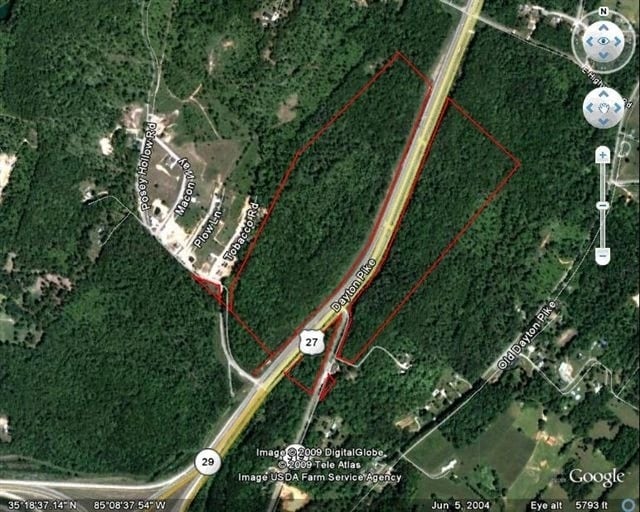
Dayton Pike
041-005
DAYTON PIKE
Vacantlandnec
Hamilton
X
Tennessee
47065C0120G
45.92 AC
2025
Outlying Hamilton County
2025
Chattanooga
010306
Chattanooga, TN-GA
DEMOGRAPHICS near Dayton Pike
1 Mile
3 Mile
5 Mile
2024 Total Population
1,126
7,594
15,684
2029 Population
1,203
8,128
16,787
Pop Growth 2024-2029
+ 6.84%
+ 7.03%
+ 7.03%
Average Age
45
44
44
2024 Total Households
421
2,939
6,110
HH Growth 2024-2029
+ 7.13%
+ 7.15%
+ 7.15%
Median Household Inc
$80,000
$76,073
$75,247
Avg Household Size
2.60
2.50
2.50
2024 Avg HH Vehicles
2.00
2.00
2.00
Median Home Value
$368,656
$314,764
$291,782
Median Year Built
1995
1992
1991
Nearby Places
Map Layers
Map Styles
 Street
 Aerial
- Restaurants
- Banks
- Shops
- Fitness
- Groceries
PUBLIC TRANSPORTATION
AIRPORT
Lovell Field
DRIVE
WALK
Distance
Lovell Field
36 min
26.0 mi
Freight Ports
Georgia Ports - Savannah
DRIVE
WALK
Distance
Georgia Ports - Savannah
431 min
384.0 mi
Nearby Properties
Address
Land Use
TOTAL SIZE
Lot Size
Zoning
Address
Land Use
TOTAL SIZE
Lot Size
Zoning
Address
Land Use
TOTAL SIZE
Lot Size
Zoning
76.50 AC
Address
Land Use
TOTAL SIZE
Lot Size
Zoning
42.50 AC
A
Address
Land Use
TOTAL SIZE
Lot Size
Zoning
26.50 AC
Address
Land Use
TOTAL SIZE
Lot Size
Zoning
26.50 AC
Address
Land Use
TOTAL SIZE
Lot Size
Zoning
25 AC
A
Address
Land Use
TOTAL SIZE
Lot Size
Zoning
22.50 AC
TC
Address
Land Use
TOTAL SIZE
Lot Size
Zoning
129.89 AC
Address
Land Use
TOTAL SIZE
Lot Size
Zoning
Address
Land Use
TOTAL SIZE
Lot Size
Zoning
15 AC
A
Address
Land Use
TOTAL SIZE
Lot Size
Zoning
13,433 SF
2.88 AC
RR
Address
Land Use
TOTAL SIZE
Lot Size
Zoning
99,326 SF
12.83 AC
M1
Address
Land Use
TOTAL SIZE
Lot Size
Zoning
73,096 SF
13.70 AC
M1
Address
Land Use
TOTAL SIZE
Lot Size
Zoning
11,982 SF
6.80 AC
RR
Address
Land Use
TOTAL SIZE
Lot Size
Zoning
8,710 SF
2.17 AC
C3
Address
Land Use
TOTAL SIZE
Lot Size
Zoning
667.54 AC
Address
Land Use
TOTAL SIZE
Lot Size
Zoning
14,217 SF
1.80 AC
UR
Address
Land Use
TOTAL SIZE
Lot Size
Zoning
11,572 SF
2.32 AC
UR
Address
Land Use
TOTAL SIZE
Lot Size
Zoning
7,577 SF
2.50 AC
Address
Land Use
TOTAL SIZE
Lot Size
Zoning
285.85 AC
Address
Land Use
TOTAL SIZE
Lot Size
Zoning
9,100 SF
1.41 AC
C2
Address
Land Use
TOTAL SIZE
Lot Size
Zoning
7,288 SF
0.47 AC
LB
Address
Land Use
TOTAL SIZE
Lot Size
Zoning
11,528 SF
1.51 AC
UR
Address
Land Use
TOTAL SIZE
Lot Size
Zoning
31,600 SF
6.28 AC
M1
Address
Land Use
TOTAL SIZE
Lot Size
Zoning
26,840 SF
4 AC
Address
Land Use
TOTAL SIZE
Lot Size
Zoning
39,798 SF
2 AC
IN
Address
Land Use
TOTAL SIZE
Lot Size
Zoning
9,515 SF
2.72 AC
C3
Address
Land Use
TOTAL SIZE
Lot Size
Zoning
7,284 SF
1.73 AC
C2
Address
Land Use
TOTAL SIZE
Lot Size
Zoning
14,890 SF
1.50 AC
Address
Land Use
TOTAL SIZE
Lot Size
Zoning
5,847 SF
0.88 AC
The World's #1 Commercial Real Estate Marketplace
Connect with us
© 2026 CoStar Group
The information above has been obtained from sources believed reliable. While we do not doubt its accuracy we have not verified it and make no guarantee, warranty or representation about it. It is your responsibility to independently confirm its accuracy and completeness. Any projections, opinions, assumptions, or estimates used are for example only and do not represent the current or future performance of the property. The value of this transaction to you depends on tax and other factors which should be evaluated by your tax, financial, and legal advisors. You and your advisors should conduct a careful, independent investigation of the property to determine to your satisfaction the suitability of the property for your needs.