Property Record
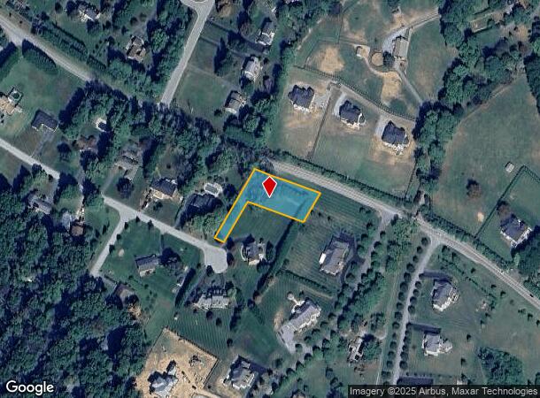
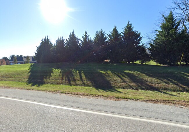
Deanmar Dr, Highland, MD 20777


NEARBY LISTINGS FOR SALE OR LEASE
Property Detail
Deanmar Dr
Baltimore-Columbia-Towson, MD
PAR H 32541 SQ NONBU DEANMAR DRIVE ES OWINGS PROP RSB LOT 1
05-441161
Howard
Residentialacreage
Maryland
X
h
24027C0140D
0.74 AC
2024
Outlying Howard County
2025
Baltimore
605103
DEMOGRAPHICS near Deanmar Dr
1 mile
3 mile
5 mile
2024 Total Population
1,908
17,210
66,522
2029 Population
1,955
17,544
67,818
Pop Growth 2024-2029
+ 2.46%
+ 1.94%
+ 1.95%
Average Age
43
42
42
2024 Total Households
598
5,381
22,240
HH Growth 2024-2029
+ 2.51%
+ 1.90%
+ 1.98%
Median Household Inc
$189,130
$205,459
$169,205
Avg Household Size
3.10
3.20
2.90
2024 Avg HH Vehicles
3.00
3.00
2.00
Median Home Value
$792,410
$784,087
$737,955
Median Year Built
1985
1993
1990
Nearby Places
Map Layers
Map Styles
 Street
 Aerial
Transit
 Traffic
 Biking
Places
Listings with unknown addresses are not visible on the map
- Restaurants
- Banks
- Shops
- Fitness
- Groceries
PUBLIC TRANSPORTATION
COMMUTER RAIL
Laurel (CAMDEN - WASHINGTON - Maryland Area Regional Commuter Trains (The MARC), Camden Line - Maryland Area Regional Commuter Trains (The MARC))
Drive
Walk
Distance
Laurel (CAMDEN - WASHINGTON - Maryland Area Regional Commuter Trains (The MARC), Camden Line - Maryland Area Regional Commuter Trains (The MARC))
17 min
9.6 mi
AIRPORT
Baltimore/Washington International Thurgood Marshall
Drive
Walk
Distance
Baltimore/Washington International Thurgood Marshall
33 min
23.0 mi
Ronald Reagan Washington Ntl
Drive
Walk
Distance
Ronald Reagan Washington Ntl
48 min
28.9 mi
Freight Ports
Port of Baltimore
Drive
Walk
Distance
Port of Baltimore
38 min
25.8 mi
SALE & LEASE HISTORY
LISTING DATE
SALE/LEASE

May 06, 2024
For Sale
Nearby Properties
Address
Land Use
TOTAL SIZE
Lot Size
Zoning
Address
Land Use
TOTAL SIZE
Lot Size
Zoning
243,836 SF
65.29 AC
NT
Address
Land Use
TOTAL SIZE
Lot Size
Zoning
19,253 SF
17.97 AC
RRDEO
Address
Land Use
TOTAL SIZE
Lot Size
Zoning
6,968 SF
11.74 AC
NT
Address
Land Use
TOTAL SIZE
Lot Size
Zoning
82,960 SF
15.40 AC
NT
Address
Land Use
TOTAL SIZE
Lot Size
Zoning
172.63 AC
RRDEO
Address
Land Use
TOTAL SIZE
Lot Size
Zoning
1,056 SF
20.99 AC
RRDEO
Address
Land Use
TOTAL SIZE
Lot Size
Zoning
3,260 SF
8.78 AC
B2
Address
Land Use
TOTAL SIZE
Lot Size
Zoning
27,564 SF
7.60 AC
B1
Address
Land Use
TOTAL SIZE
Lot Size
Zoning
13,272 SF
3.33 AC
B2
Address
Land Use
TOTAL SIZE
Lot Size
Zoning
39,008 SF
7.01 AC
B2
Address
Land Use
TOTAL SIZE
Lot Size
Zoning
2,110 SF
5.44 AC
B1
Address
Land Use
TOTAL SIZE
Lot Size
Zoning
40,000 SF
3.08 AC
B2
Address
Land Use
TOTAL SIZE
Lot Size
Zoning
18,338 SF
5.89 AC
B2
Address
Land Use
TOTAL SIZE
Lot Size
Zoning
26,610 SF
3 AC
B2
Address
Land Use
TOTAL SIZE
Lot Size
Zoning
12,721 SF
1.29 AC
B1
Address
Land Use
TOTAL SIZE
Lot Size
Zoning
29,560 SF
3.79 AC
B2
Address
Land Use
TOTAL SIZE
Lot Size
Zoning
13.56 AC
B2PEC
Address
Land Use
TOTAL SIZE
Lot Size
Zoning
35,802 SF
17.50 AC
RRDEO
Address
Land Use
TOTAL SIZE
Lot Size
Zoning
2,970 SF
3.48 AC
B2
Address
Land Use
TOTAL SIZE
Lot Size
Zoning
27,927 SF
3.42 AC
B2
Address
Land Use
TOTAL SIZE
Lot Size
Zoning
26,160 SF
1.74 AC
NT
Address
Land Use
TOTAL SIZE
Lot Size
Zoning
16,975 SF
3.58 AC
B2
Address
Land Use
TOTAL SIZE
Lot Size
Zoning
3,206 SF
1.30 AC
NT
Address
Land Use
TOTAL SIZE
Lot Size
Zoning
17,846 SF
1.95 AC
B2
Address
Land Use
TOTAL SIZE
Lot Size
Zoning
26,464 SF
1.79 AC
NT
Address
Land Use
TOTAL SIZE
Lot Size
Zoning
15,570 SF
2.49 AC
B2
Address
Land Use
TOTAL SIZE
Lot Size
Zoning
17,838 SF
3.02 AC
RRDEO
Address
Land Use
TOTAL SIZE
Lot Size
Zoning
57,255 SF
3.67 AC
NT
Address
Land Use
TOTAL SIZE
Lot Size
Zoning
13,156 SF
3.30 AC
RRDEO
Address
Land Use
TOTAL SIZE
Lot Size
Zoning
9,901 SF
1.37 AC
RRDEO
The World's #1 Commercial Real Estate Marketplace
Connect with us
© 2026 CoStar Group
The information above has been obtained from sources believed reliable. While we do not doubt its accuracy we have not verified it and make no guarantee, warranty or representation about it. It is your responsibility to independently confirm its accuracy and completeness. Any projections, opinions, assumptions, or estimates used are for example only and do not represent the current or future performance of the property. The value of this transaction to you depends on tax and other factors which should be evaluated by your tax, financial, and legal advisors. You and your advisors should conduct a careful, independent investigation of the property to determine to your satisfaction the suitability of the property for your needs.