Property Record
Japatul Rd, Apple Valley, CA 92308
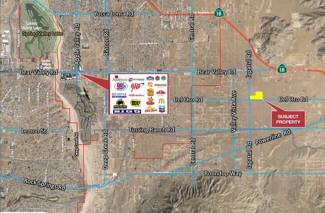
NEARBY LISTINGS FOR SALE OR LEASE
Property Detail
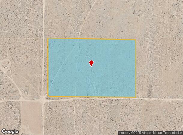
Japatul Rd
Riverside-San Bernardino-Ontario, CA
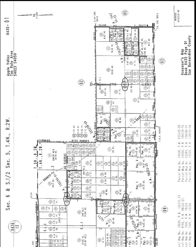
PARCEL MAP 10555 PARCEL 2 BOOK 122 PAGE 32
0435-016-44
San Bernardino
Vacantlandnec
California
2024
13.53 AC
2025
Mojave River Valley
009709
Inland Empire (California)
DEMOGRAPHICS near Japatul Rd
1 Mile
3 Mile
5 Mile
2024 Total Population
164
6,912
36,107
2029 Population
169
7,096
36,776
Pop Growth 2024-2029
+ 3.05%
+ 2.66%
+ 1.85%
Average Age
42
38
37
2024 Total Households
60
2,316
11,759
HH Growth 2024-2029
+ 3.33%
+ 2.68%
+ 1.86%
Median Household Inc
$37,500
$54,504
$56,770
Avg Household Size
2.70
2.90
3.00
2024 Avg HH Vehicles
2.00
2.00
2.00
Median Home Value
$394,444
$317,450
$301,408
Median Year Built
2000
1985
1985
Nearby Places
Map Layers
Map Styles
 Street
 Aerial
- Restaurants
- Banks
- Shops
- Fitness
- Groceries
SALE & LEASE HISTORY
LISTING DATE
SALE/LEASE

Aug 31, 2023
For Sale
Nearby Properties
Address
Land Use
TOTAL SIZE
Lot Size
Zoning
Address
Land Use
TOTAL SIZE
Lot Size
Zoning
4,998 SF
2.76 AC
Address
Land Use
TOTAL SIZE
Lot Size
Zoning
12,505 SF
4.84 AC
Address
Land Use
TOTAL SIZE
Lot Size
Zoning
19,590 SF
2.19 AC
Address
Land Use
TOTAL SIZE
Lot Size
Zoning
19,140 SF
1.84 AC
Address
Land Use
TOTAL SIZE
Lot Size
Zoning
80,103 SF
12.65 AC
Address
Land Use
TOTAL SIZE
Lot Size
Zoning
1.48 AC
Address
Land Use
TOTAL SIZE
Lot Size
Zoning
50,782 SF
11.04 AC
Address
Land Use
TOTAL SIZE
Lot Size
Zoning
120 AC
RL
Address
Land Use
TOTAL SIZE
Lot Size
Zoning
35,360 SF
0.81 AC
Address
Land Use
TOTAL SIZE
Lot Size
Zoning
Address
Land Use
TOTAL SIZE
Lot Size
Zoning
625 SF
18.34 AC
Address
Land Use
TOTAL SIZE
Lot Size
Zoning
29.98 AC
Address
Land Use
TOTAL SIZE
Lot Size
Zoning
38.79 AC
CG
Address
Land Use
TOTAL SIZE
Lot Size
Zoning
13,900 SF
4.09 AC
IC
Address
Land Use
TOTAL SIZE
Lot Size
Zoning
5.07 AC
Address
Land Use
TOTAL SIZE
Lot Size
Zoning
146.89 AC
RL10
Address
Land Use
TOTAL SIZE
Lot Size
Zoning
18.99 AC
Address
Land Use
TOTAL SIZE
Lot Size
Zoning
8.77 AC
Address
Land Use
TOTAL SIZE
Lot Size
Zoning
6,440 SF
0.63 AC
Address
Land Use
TOTAL SIZE
Lot Size
Zoning
900 SF
1.56 AC
Address
Land Use
TOTAL SIZE
Lot Size
Zoning
4,032 SF
0.43 AC
Address
Land Use
TOTAL SIZE
Lot Size
Zoning
37.81 AC
Address
Land Use
TOTAL SIZE
Lot Size
Zoning
160 AC
RL10
Address
Land Use
TOTAL SIZE
Lot Size
Zoning
2,958 SF
0.51 AC
Address
Land Use
TOTAL SIZE
Lot Size
Zoning
9,140 SF
0.62 AC
Address
Land Use
TOTAL SIZE
Lot Size
Zoning
3,472 SF
0.55 AC
Address
Land Use
TOTAL SIZE
Lot Size
Zoning
4.49 AC
Address
Land Use
TOTAL SIZE
Lot Size
Zoning
5,600 SF
0.66 AC
The World's #1 Commercial Real Estate Marketplace
Connect with us
© 2025 CoStar Group
The information above has been obtained from sources believed reliable. While we do not doubt its accuracy we have not verified it and make no guarantee, warranty or representation about it. It is your responsibility to independently confirm its accuracy and completeness. Any projections, opinions, assumptions, or estimates used are for example only and do not represent the current or future performance of the property. The value of this transaction to you depends on tax and other factors which should be evaluated by your tax, financial, and legal advisors. You and your advisors should conduct a careful, independent investigation of the property to determine to your satisfaction the suitability of the property for your needs.