Property Record
312 S Delaney St, La Marque, TX 77568


Property Detail
312 S Delaney St
Houston-Pasadena-The Woodlands, TX
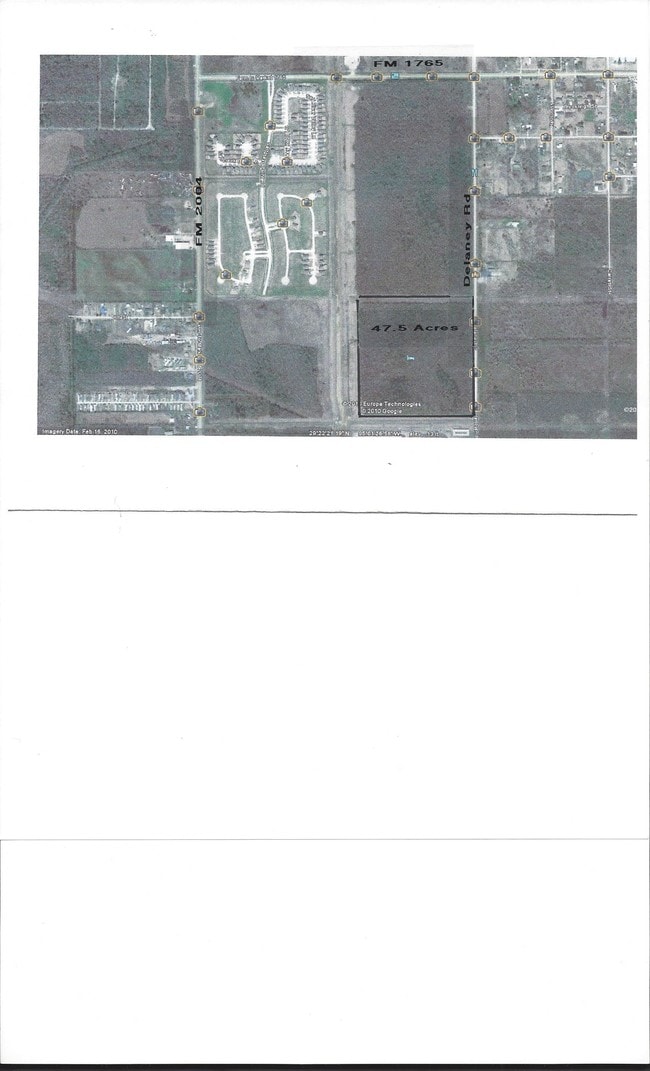
ABST 2 S F AUSTIN SUR TRACT 98, 51.0100 ACRES
0002-0098-0000-000
Galveston
Farms
Texas
AE The base floodplain where base flood elevations are provided. AE Zones are now used on new format FIRMs instead of A1-A30 Zones.
98
2024
51.01 AC
2025
Southeast Outlier
723200
Houston
NEARBY LISTINGS FOR SALE OR LEASE
DEMOGRAPHICS near 312 S Delaney St
1 mile
3 mile
5 mile
2025 Total Population
4,184
35,102
65,189
2030 Population
4,479
36,722
68,346
Pop Growth 2025-2030
+ 7.05%
+ 4.62%
+ 4.84%
Average Age
38
39
39
2025 Total Households
1,460
12,979
24,392
HH Growth 2025-2030
+ 7.12%
+ 4.51%
+ 4.75%
Median Household Inc
$95,600
$73,060
$73,773
Avg Household Size
2.90
2.60
2.60
2025 Avg HH Vehicles
2.00
2.00
2.00
Median Home Value
$265,899
$239,181
$250,162
Median Year Built
2006
1988
1992
Nearby Places
Map Layers
Map Styles
 Street
 Aerial
Transit
 Traffic
 Biking
Places
Listings with unknown addresses are not visible on the map
- Restaurants
- Banks
- Shops
- Fitness
- Groceries
PUBLIC TRANSPORTATION
AIRPORT
William P Hobby
Drive
Walk
Distance
William P Hobby
38 min
25.1 mi
Freight Ports
Port of Galveston
Drive
Walk
Distance
Port of Galveston
20 min
15.2 mi
SALE & LEASE HISTORY
LISTING DATE
SALE/LEASE

Sep 24, 2016
For Sale
Nearby Properties
Address
Land Use
TOTAL SIZE
Lot Size
Zoning
Address
Land Use
TOTAL SIZE
Lot Size
Zoning
396,204 SF
81.22 AC
Address
Land Use
TOTAL SIZE
Lot Size
Zoning
472,306 SF
27.67 AC
E
Address
Land Use
TOTAL SIZE
Lot Size
Zoning
330,000 SF
42.77 AC
Address
Land Use
TOTAL SIZE
Lot Size
Zoning
305,340 SF
15.90 AC
Address
Land Use
TOTAL SIZE
Lot Size
Zoning
259,782 SF
9.40 AC
Address
Land Use
TOTAL SIZE
Lot Size
Zoning
200,000 SF
19.31 AC
A
Address
Land Use
TOTAL SIZE
Lot Size
Zoning
149,850 SF
26.15 AC
Address
Land Use
TOTAL SIZE
Lot Size
Zoning
164,130 SF
36.79 AC
Address
Land Use
TOTAL SIZE
Lot Size
Zoning
107,300 SF
25.86 AC
Address
Land Use
TOTAL SIZE
Lot Size
Zoning
197,584 SF
11.85 AC
Address
Land Use
TOTAL SIZE
Lot Size
Zoning
4,950 SF
15.74 AC
Address
Land Use
TOTAL SIZE
Lot Size
Zoning
2,698 SF
939.08 AC
Address
Land Use
TOTAL SIZE
Lot Size
Zoning
243,492 SF
10.27 AC
Address
Land Use
TOTAL SIZE
Lot Size
Zoning
303,433 SF
24.37 AC
Address
Land Use
TOTAL SIZE
Lot Size
Zoning
135,513 SF
19.56 AC
Address
Land Use
TOTAL SIZE
Lot Size
Zoning
124,867 SF
12.04 AC
Address
Land Use
TOTAL SIZE
Lot Size
Zoning
225,844 SF
22.56 AC
Address
Land Use
TOTAL SIZE
Lot Size
Zoning
319,685 SF
28.84 AC
Address
Land Use
TOTAL SIZE
Lot Size
Zoning
146,724 SF
13.63 AC
E
Address
Land Use
TOTAL SIZE
Lot Size
Zoning
60,288 SF
4.96 AC
Address
Land Use
TOTAL SIZE
Lot Size
Zoning
158,388 SF
16.52 AC
Address
Land Use
TOTAL SIZE
Lot Size
Zoning
74,800 SF
44.61 AC
Address
Land Use
TOTAL SIZE
Lot Size
Zoning
267,588 SF
15.68 AC
Address
Land Use
TOTAL SIZE
Lot Size
Zoning
179,252 SF
19.20 AC
Address
Land Use
TOTAL SIZE
Lot Size
Zoning
367,464 SF
40 AC
Address
Land Use
TOTAL SIZE
Lot Size
Zoning
149,928 SF
13.52 AC
Address
Land Use
TOTAL SIZE
Lot Size
Zoning
37,323 SF
4.50 AC
Address
Land Use
TOTAL SIZE
Lot Size
Zoning
133,888 SF
15.74 AC
Address
Land Use
TOTAL SIZE
Lot Size
Zoning
218,725 SF
10.33 AC
Address
Land Use
TOTAL SIZE
Lot Size
Zoning
141,870 SF
13.69 AC
The World's #1 Commercial Real Estate Marketplace
Connect with us
© 2026 CoStar Group
The information above has been obtained from sources believed reliable. While we do not doubt its accuracy we have not verified it and make no guarantee, warranty or representation about it. It is your responsibility to independently confirm its accuracy and completeness. Any projections, opinions, assumptions, or estimates used are for example only and do not represent the current or future performance of the property. The value of this transaction to you depends on tax and other factors which should be evaluated by your tax, financial, and legal advisors. You and your advisors should conduct a careful, independent investigation of the property to determine to your satisfaction the suitability of the property for your needs.