Property Record
Denmark Rd, Union, MO 63084

Property Detail
Denmark Rd
St. Louis, MO-IL
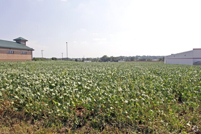
VACANT LANDLOT 12 PRAIRIE DELL CENTRE
17-7-360-0-013-029220
FRANKLIN
Commercialacreage
Missouri
B and X Area of moderate flood hazard, usually the area between the limits of the 100-year and 500-year floods.
12
2025
0.70 AC
2025
Franklin County
800605
St. Louis
NEARBY LISTINGS FOR SALE OR LEASE
DEMOGRAPHICS near Denmark Rd
1 mile
3 mile
5 mile
2025 Total Population
2,078
11,292
21,243
2030 Population
2,131
11,473
21,579
Pop Growth 2025-2030
+ 2.55%
+ 1.60%
+ 1.58%
Average Age
40
40
41
2025 Total Households
787
4,362
8,220
HH Growth 2025-2030
+ 2.80%
+ 1.70%
+ 1.72%
Median Household Inc
$74,009
$69,428
$70,966
Avg Household Size
2.50
2.50
2.50
2025 Avg HH Vehicles
2.00
2.00
2.00
Median Home Value
$243,642
$226,020
$228,991
Median Year Built
2001
1996
1993
Nearby Places
Map Layers
Map Styles
 Street
 Aerial
Transit
 Traffic
 Biking
Places
Listings with unknown addresses are not visible on the map
- Restaurants
- Banks
- Shops
- Fitness
- Groceries
Nearby Properties
Address
Land Use
TOTAL SIZE
Lot Size
Zoning
Address
Land Use
TOTAL SIZE
Lot Size
Zoning
81,944 SF
85.90 AC
Address
Land Use
TOTAL SIZE
Lot Size
Zoning
70,871 SF
13.90 AC
Address
Land Use
TOTAL SIZE
Lot Size
Zoning
130,170 SF
9.80 AC
Address
Land Use
TOTAL SIZE
Lot Size
Zoning
82,428 SF
6.50 AC
Address
Land Use
TOTAL SIZE
Lot Size
Zoning
23,819 SF
2.70 AC
Address
Land Use
TOTAL SIZE
Lot Size
Zoning
70,687 SF
30 AC
Address
Land Use
TOTAL SIZE
Lot Size
Zoning
61,156 SF
22.30 AC
AN
Address
Land Use
TOTAL SIZE
Lot Size
Zoning
40,599 SF
0.90 AC
Address
Land Use
TOTAL SIZE
Lot Size
Zoning
5,096 SF
1.30 AC
Address
Land Use
TOTAL SIZE
Lot Size
Zoning
28,045 SF
4.30 AC
Address
Land Use
TOTAL SIZE
Lot Size
Zoning
101,929 SF
13.30 AC
Address
Land Use
TOTAL SIZE
Lot Size
Zoning
69,500 SF
11.80 AC
Address
Land Use
TOTAL SIZE
Lot Size
Zoning
49,415 SF
2.10 AC
Address
Land Use
TOTAL SIZE
Lot Size
Zoning
46,540 SF
24 AC
ANU
Address
Land Use
TOTAL SIZE
Lot Size
Zoning
2,420 SF
3.30 AC
Address
Land Use
TOTAL SIZE
Lot Size
Zoning
6.50 AC
SD
Address
Land Use
TOTAL SIZE
Lot Size
Zoning
1,110 SF
43.90 AC
Address
Land Use
TOTAL SIZE
Lot Size
Zoning
37,598 SF
7 AC
Address
Land Use
TOTAL SIZE
Lot Size
Zoning
27,835 SF
11.50 AC
Address
Land Use
TOTAL SIZE
Lot Size
Zoning
11,794 SF
1.10 AC
Address
Land Use
TOTAL SIZE
Lot Size
Zoning
4,014 SF
9.60 AC
Address
Land Use
TOTAL SIZE
Lot Size
Zoning
13,272 SF
10 AC
Address
Land Use
TOTAL SIZE
Lot Size
Zoning
24,300 SF
0.90 AC
Address
Land Use
TOTAL SIZE
Lot Size
Zoning
5,400 SF
3.20 AC
Address
Land Use
TOTAL SIZE
Lot Size
Zoning
13,832 SF
0.80 AC
Address
Land Use
TOTAL SIZE
Lot Size
Zoning
16,613 SF
0.60 AC
Address
Land Use
TOTAL SIZE
Lot Size
Zoning
15,981 SF
5.50 AC
Address
Land Use
TOTAL SIZE
Lot Size
Zoning
109,252 SF
18 AC
Address
Land Use
TOTAL SIZE
Lot Size
Zoning
33,184 SF
3.90 AC
Address
Land Use
TOTAL SIZE
Lot Size
Zoning
15,053 SF
48.10 AC
The World's #1 Commercial Real Estate Marketplace
Connect with us
© 2026 CoStar Group
The information above has been obtained from sources believed reliable. While we do not doubt its accuracy we have not verified it and make no guarantee, warranty or representation about it. It is your responsibility to independently confirm its accuracy and completeness. Any projections, opinions, assumptions, or estimates used are for example only and do not represent the current or future performance of the property. The value of this transaction to you depends on tax and other factors which should be evaluated by your tax, financial, and legal advisors. You and your advisors should conduct a careful, independent investigation of the property to determine to your satisfaction the suitability of the property for your needs.