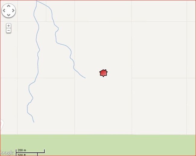
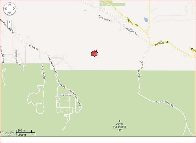
Property Record
Devil Punchbowl, Llano, CA 93544

Property Detail
Devil Punchbowl
Los Angeles-Long Beach-Glendale, CA
80 ACS E 1/2 OF SE 1/4 OF SEC 18 T 4N R 9W
3061-012-030
LOS ANGELES
Desertorbarrenland
California
LCA12*
18
D Areas with possible but undetermined flood hazards.
80.36 AC
2024
East LA County Outlying
2025
Los Angeles
911001
NEARBY LISTINGS FOR SALE OR LEASE
-
-
View all Llano listings for sale on LoopNet.com
DEMOGRAPHICS near Devil Punchbowl
1 mile
3 mile
5 mile
2025 Total Population
48
538
2,115
2030 Population
46
526
2,092
Pop Growth 2025-2030
(4.17%)
(2.23%)
(1.09%)
Average Age
47
47
47
2025 Total Households
17
199
818
HH Growth 2025-2030
(5.88%)
(2.51%)
(1.34%)
Median Household Inc
$93,749
$88,068
$80,208
Avg Household Size
2.30
2.50
2.50
2025 Avg HH Vehicles
3.00
2.00
2.00
Median Home Value
$499,999
$474,999
$403,101
Median Year Built
1975
1975
1975
Nearby Places
Map Layers
Map Styles
 Street
 Aerial
Transit
 Traffic
 Biking
Places
Listings with unknown addresses are not visible on the map
- Restaurants
- Banks
- Shops
- Fitness
- Groceries
SALE & LEASE HISTORY
LISTING DATE
SALE/LEASE

Aug 31, 2017
For Sale
Nearby Properties
Address
Land Use
TOTAL SIZE
Lot Size
Zoning
Address
Land Use
TOTAL SIZE
Lot Size
Zoning
13,869 SF
79.83 AC
LCA21*
Address
Land Use
TOTAL SIZE
Lot Size
Zoning
3,850 SF
156.81 AC
LCA11*
Address
Land Use
TOTAL SIZE
Lot Size
Zoning
8,344 SF
39.79 AC
LCA22*
Address
Land Use
TOTAL SIZE
Lot Size
Zoning
27,490 SF
41.06 AC
LCA21*
Address
Land Use
TOTAL SIZE
Lot Size
Zoning
12,561 SF
136.52 AC
LCRR*
Address
Land Use
TOTAL SIZE
Lot Size
Zoning
161.26 AC
LCC4-A22*
Address
Land Use
TOTAL SIZE
Lot Size
Zoning
1 SF
274.77 AC
LCA11-A120
Address
Land Use
TOTAL SIZE
Lot Size
Zoning
139.65 AC
LCA22*
Address
Land Use
TOTAL SIZE
Lot Size
Zoning
158.41 AC
LCA11*
Address
Land Use
TOTAL SIZE
Lot Size
Zoning
318.88 AC
LCA11*
Address
Land Use
TOTAL SIZE
Lot Size
Zoning
155.46 AC
LCA11*
Address
Land Use
TOTAL SIZE
Lot Size
Zoning
44.78 AC
LCA22*
Address
Land Use
TOTAL SIZE
Lot Size
Zoning
1 SF
80.17 AC
LCA21*
Address
Land Use
TOTAL SIZE
Lot Size
Zoning
528 SF
42.69 AC
LCA22*
Address
Land Use
TOTAL SIZE
Lot Size
Zoning
100.93 AC
LCRR2*
Address
Land Use
TOTAL SIZE
Lot Size
Zoning
7,200 SF
80.93 AC
LCA12*
Address
Land Use
TOTAL SIZE
Lot Size
Zoning
4,170 SF
2.21 AC
LCRR*
Address
Land Use
TOTAL SIZE
Lot Size
Zoning
3,594 SF
41.95 AC
LCA22*
Address
Land Use
TOTAL SIZE
Lot Size
Zoning
828 SF
39.86 AC
LCA22*
Address
Land Use
TOTAL SIZE
Lot Size
Zoning
84.05 AC
LCA11*
Address
Land Use
TOTAL SIZE
Lot Size
Zoning
188.86 AC
LCA11*
Address
Land Use
TOTAL SIZE
Lot Size
Zoning
41.18 AC
LCA22*
Address
Land Use
TOTAL SIZE
Lot Size
Zoning
41.02 AC
LCA22*
Address
Land Use
TOTAL SIZE
Lot Size
Zoning
1,648 SF
38.50 AC
LCA22*
Address
Land Use
TOTAL SIZE
Lot Size
Zoning
40.32 AC
LCRR2-A22*
Address
Land Use
TOTAL SIZE
Lot Size
Zoning
37.46 AC
LCA22*
Address
Land Use
TOTAL SIZE
Lot Size
Zoning
1,726 SF
108.83 AC
LCA11*
Address
Land Use
TOTAL SIZE
Lot Size
Zoning
187.06 AC
LCA120000*
Address
Land Use
TOTAL SIZE
Lot Size
Zoning
20 AC
LCA11*
Address
Land Use
TOTAL SIZE
Lot Size
Zoning
36.87 AC
LCA11*
The World's #1 Commercial Real Estate Marketplace
Connect with us
© 2026 CoStar Group
The information above has been obtained from sources believed reliable. While we do not doubt its accuracy we have not verified it and make no guarantee, warranty or representation about it. It is your responsibility to independently confirm its accuracy and completeness. Any projections, opinions, assumptions, or estimates used are for example only and do not represent the current or future performance of the property. The value of this transaction to you depends on tax and other factors which should be evaluated by your tax, financial, and legal advisors. You and your advisors should conduct a careful, independent investigation of the property to determine to your satisfaction the suitability of the property for your needs.