Property Record
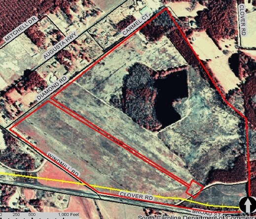
Diamond Rd, Leesville, SC 29070

Property Detail
Diamond Rd
006000-10-014
PARCLES A & B
Countyproperty
LEXINGTON
RD
South Carolina
B and X Area of moderate flood hazard, usually the area between the limits of the 100-year and 500-year floods.
106.46 AC
0
Outlying Lexington County
2024
Columbia
021404
Columbia, SC
990 SF
NEARBY LISTINGS FOR SALE OR LEASE
DEMOGRAPHICS near Diamond Rd
1 mile
3 mile
5 mile
2025 Total Population
432
5,183
14,333
2030 Population
452
5,478
15,174
Pop Growth 2025-2030
+ 4.63%
+ 5.69%
+ 5.87%
Average Age
44
42
42
2025 Total Households
179
2,105
5,750
HH Growth 2025-2030
+ 5.03%
+ 5.89%
+ 6.05%
Median Household Inc
$59,999
$57,990
$59,222
Avg Household Size
2.40
2.40
2.50
2025 Avg HH Vehicles
2.00
2.00
2.00
Median Home Value
$201,562
$204,512
$212,923
Median Year Built
1978
1981
1984
Nearby Places
Map Layers
Map Styles
 Street
 Aerial
Layers
 Traffic
 Biking
Places
Listings with unknown addresses are not visible on the map
- Restaurants
- Banks
- Shops
- Fitness
- Groceries
PUBLIC TRANSPORTATION
AIRPORT
Columbia Metro
Drive
Walk
Distance
Columbia Metro
52 min
28.1 mi
Freight Ports
North Charleston Terminal
Drive
Walk
Distance
North Charleston Terminal
153 min
126.0 mi
Nearby Properties
Address
Land Use
TOTAL SIZE
Lot Size
Zoning
Address
Land Use
TOTAL SIZE
Lot Size
Zoning
204,496 SF
23.59 AC
Address
Land Use
TOTAL SIZE
Lot Size
Zoning
38,320 SF
5.87 AC
RD
Address
Land Use
TOTAL SIZE
Lot Size
Zoning
13,894 SF
1.43 AC
Address
Land Use
TOTAL SIZE
Lot Size
Zoning
25,056 SF
5.88 AC
RD
Address
Land Use
TOTAL SIZE
Lot Size
Zoning
3,142 SF
1.12 AC
RD
Address
Land Use
TOTAL SIZE
Lot Size
Zoning
15,794 SF
4.45 AC
LR
Address
Land Use
TOTAL SIZE
Lot Size
Zoning
6,214 SF
7.39 AC
R
Address
Land Use
TOTAL SIZE
Lot Size
Zoning
11,831 SF
1.27 AC
RD
Address
Land Use
TOTAL SIZE
Lot Size
Zoning
1,227 SF
7 AC
C1
Address
Land Use
TOTAL SIZE
Lot Size
Zoning
55,682 SF
6.34 AC
C1
Address
Land Use
TOTAL SIZE
Lot Size
Zoning
15,673 SF
2.65 AC
C2
Address
Land Use
TOTAL SIZE
Lot Size
Zoning
75,000 SF
19.88 AC
RD
Address
Land Use
TOTAL SIZE
Lot Size
Zoning
10,000 SF
4.98 AC
ID
Address
Land Use
TOTAL SIZE
Lot Size
Zoning
3,488 SF
0.81 AC
Address
Land Use
TOTAL SIZE
Lot Size
Zoning
3,000 SF
0.72 AC
RD
Address
Land Use
TOTAL SIZE
Lot Size
Zoning
2,748 SF
0.80 AC
C1
Address
Land Use
TOTAL SIZE
Lot Size
Zoning
8,640 SF
0.88 AC
Address
Land Use
TOTAL SIZE
Lot Size
Zoning
6,440 SF
0.74 AC
Address
Land Use
TOTAL SIZE
Lot Size
Zoning
160.03 AC
RD
Address
Land Use
TOTAL SIZE
Lot Size
Zoning
924 SF
10.79 AC
RD
Address
Land Use
TOTAL SIZE
Lot Size
Zoning
24.57 AC
RD
Address
Land Use
TOTAL SIZE
Lot Size
Zoning
4,500 SF
0.86 AC
C2
Address
Land Use
TOTAL SIZE
Lot Size
Zoning
7,270 SF
2.57 AC
RD
Address
Land Use
TOTAL SIZE
Lot Size
Zoning
3,450 SF
1.03 AC
ID
Address
Land Use
TOTAL SIZE
Lot Size
Zoning
5,624 SF
1.03 AC
Address
Land Use
TOTAL SIZE
Lot Size
Zoning
3,925 SF
1.72 AC
Address
Land Use
TOTAL SIZE
Lot Size
Zoning
2,040 SF
0.13 AC
Address
Land Use
TOTAL SIZE
Lot Size
Zoning
51,830 SF
5.37 AC
Address
Land Use
TOTAL SIZE
Lot Size
Zoning
2,237 SF
0.66 AC
C1
Address
Land Use
TOTAL SIZE
Lot Size
Zoning
7,170 SF
0.96 AC
RD
The World's #1 Commercial Real Estate Marketplace
Connect with us
© 2026 CoStar Group
The information above has been obtained from sources believed reliable. While we do not doubt its accuracy we have not verified it and make no guarantee, warranty or representation about it. It is your responsibility to independently confirm its accuracy and completeness. Any projections, opinions, assumptions, or estimates used are for example only and do not represent the current or future performance of the property. The value of this transaction to you depends on tax and other factors which should be evaluated by your tax, financial, and legal advisors. You and your advisors should conduct a careful, independent investigation of the property to determine to your satisfaction the suitability of the property for your needs.