Property Record
3300 N Highway 94 St, Saint Charles, MO 63301

Property Detail
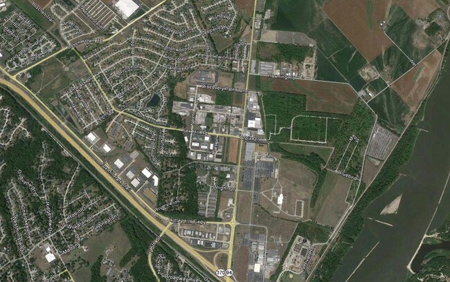
3300 N Highway 94 St
St. Louis, MO-IL
PT FREEMAN TRACT & PT BLK 10 STEEN & CUNNINGHAM
5-0081-3280-10-0007.9000000
ST. CHARLES
Vacantlandnec
Missouri
AC1
7
AE The base floodplain where base flood elevations are provided. AE Zones are now used on new format FIRMs instead of A1-A30 Zones.
21.49 AC
2024
St Charles County
2025
St. Louis
310301
NEARBY LISTINGS FOR SALE OR LEASE
-
-
-
-
-
No Photo
-
View all Saint Charles listings for sale on LoopNet.com
DEMOGRAPHICS near 3300 N Highway 94 St
1 mile
3 mile
5 mile
2025 Total Population
4,358
31,476
74,064
2030 Population
4,527
32,790
76,825
Pop Growth 2025-2030
+ 3.88%
+ 4.17%
+ 3.73%
Average Age
42
41
41
2025 Total Households
1,830
12,531
31,961
HH Growth 2025-2030
+ 3.88%
+ 4.37%
+ 3.87%
Median Household Inc
$90,426
$90,329
$78,754
Avg Household Size
2.30
2.30
2.20
2025 Avg HH Vehicles
2.00
2.00
2.00
Median Home Value
$329,753
$289,749
$273,766
Median Year Built
1993
1977
1978
Nearby Places
Map Layers
Map Styles
 Street
 Aerial
Transit
 Traffic
 Biking
Places
Listings with unknown addresses are not visible on the map
- Restaurants
- Banks
- Shops
- Fitness
- Groceries
PUBLIC TRANSPORTATION
AIRPORT
St Louis Lambert International
Drive
Walk
Distance
St Louis Lambert International
17 min
10.5 mi
Freight Ports
Port Milwaukee
Drive
Walk
Distance
Port Milwaukee
437 min
383.6 mi
SALE & LEASE HISTORY
LISTING DATE
SALE/LEASE

Sep 24, 2016
For Sale
Nearby Properties
Address
Land Use
TOTAL SIZE
Lot Size
Zoning
Address
Land Use
TOTAL SIZE
Lot Size
Zoning
140,801 SF
6.35 AC
Address
Land Use
TOTAL SIZE
Lot Size
Zoning
833,525 SF
25.53 AC
R1
Address
Land Use
TOTAL SIZE
Lot Size
Zoning
43,890 SF
28.96 AC
Address
Land Use
TOTAL SIZE
Lot Size
Zoning
564,552 SF
42.07 AC
10M-1
Address
Land Use
TOTAL SIZE
Lot Size
Zoning
201,270 SF
13.01 AC
Address
Land Use
TOTAL SIZE
Lot Size
Zoning
662,199 SF
26.58 AC
10M-1
Address
Land Use
TOTAL SIZE
Lot Size
Zoning
395,327 SF
34.69 AC
Address
Land Use
TOTAL SIZE
Lot Size
Zoning
83.11 AC
AC9
Address
Land Use
TOTAL SIZE
Lot Size
Zoning
317,145 SF
21.71 AC
10M-1
Address
Land Use
TOTAL SIZE
Lot Size
Zoning
403,200 SF
21.99 AC
10M-1
Address
Land Use
TOTAL SIZE
Lot Size
Zoning
119,925 SF
72.26 AC
10M-1
Address
Land Use
TOTAL SIZE
Lot Size
Zoning
239,545 SF
80 AC
Address
Land Use
TOTAL SIZE
Lot Size
Zoning
61,292 SF
9.50 AC
Address
Land Use
TOTAL SIZE
Lot Size
Zoning
285,738 SF
117.71 AC
AB6
Address
Land Use
TOTAL SIZE
Lot Size
Zoning
384,180 SF
17 AC
Address
Land Use
TOTAL SIZE
Lot Size
Zoning
109,992 SF
6.67 AC
Address
Land Use
TOTAL SIZE
Lot Size
Zoning
278,550 SF
18 AC
10M-1
Address
Land Use
TOTAL SIZE
Lot Size
Zoning
235,200 SF
13.96 AC
10M-1
Address
Land Use
TOTAL SIZE
Lot Size
Zoning
296,115 SF
23.79 AC
Address
Land Use
TOTAL SIZE
Lot Size
Zoning
291,100 SF
14.32 AC
Address
Land Use
TOTAL SIZE
Lot Size
Zoning
27,641 SF
7.90 AC
Address
Land Use
TOTAL SIZE
Lot Size
Zoning
192,180 SF
24.89 AC
10M-1
Address
Land Use
TOTAL SIZE
Lot Size
Zoning
217,282 SF
7.93 AC
Address
Land Use
TOTAL SIZE
Lot Size
Zoning
189,800 SF
10.74 AC
10M-1
Address
Land Use
TOTAL SIZE
Lot Size
Zoning
42.97 AC
AC9
Address
Land Use
TOTAL SIZE
Lot Size
Zoning
10.42 AC
AC9
Address
Land Use
TOTAL SIZE
Lot Size
Zoning
231,332 SF
32.80 AC
Address
Land Use
TOTAL SIZE
Lot Size
Zoning
196,112 SF
12.06 AC
Address
Land Use
TOTAL SIZE
Lot Size
Zoning
347,688 SF
22.85 AC
Address
Land Use
TOTAL SIZE
Lot Size
Zoning
155,820 SF
11.79 AC
10M-1
The World's #1 Commercial Real Estate Marketplace
Connect with us
© 2026 CoStar Group
The information above has been obtained from sources believed reliable. While we do not doubt its accuracy we have not verified it and make no guarantee, warranty or representation about it. It is your responsibility to independently confirm its accuracy and completeness. Any projections, opinions, assumptions, or estimates used are for example only and do not represent the current or future performance of the property. The value of this transaction to you depends on tax and other factors which should be evaluated by your tax, financial, and legal advisors. You and your advisors should conduct a careful, independent investigation of the property to determine to your satisfaction the suitability of the property for your needs.