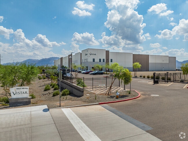
Property Record
9500 S 65Th Ave, Laveen, AZ 85339


Property Detail
9500 S 65Th Ave
Phoenix
DOBBINS INDUSTRIAL TECH PARK PHASE 1 MCR 1764-08
Phoenix-Mesa-Chandler, AZ
MARICOPA
300-01-971
Arizona
Industrialacreage
3
2025
33.64 AC
2025
Chandler
116619
NEARBY LISTINGS FOR SALE OR LEASE
-
-
View all Laveen listings for sale on LoopNet.com
DEMOGRAPHICS near 9500 S 65Th Ave
1 mile
3 mile
5 mile
2025 Total Population
2,114
42,906
99,417
2030 Population
2,298
45,473
104,598
Pop Growth 2025-2030
+ 8.70%
+ 5.98%
+ 5.21%
Average Age
34
34
34
2025 Total Households
591
11,774
26,889
HH Growth 2025-2030
+ 8.97%
+ 6.19%
+ 5.41%
Median Household Inc
$109,490
$112,177
$97,823
Avg Household Size
3.50
3.50
3.60
2025 Avg HH Vehicles
2.00
2.00
2.00
Median Home Value
$450,000
$455,313
$441,215
Median Year Built
2009
2007
2006
Nearby Places
Map Layers
Map Styles
 Street
 Aerial
Transit
 Traffic
 Biking
Places
Listings with unknown addresses are not visible on the map
- Restaurants
- Banks
- Shops
- Fitness
- Groceries
PUBLIC TRANSPORTATION
AIRPORT
Phoenix Sky Harbor International
Drive
Walk
Distance
Phoenix Sky Harbor International
30 min
20.8 mi
Freight Ports
Port of San Diego
Drive
Walk
Distance
Port of San Diego
399 min
356.5 mi
Nearby Properties
Address
Land Use
TOTAL SIZE
Lot Size
Zoning
Address
Land Use
TOTAL SIZE
Lot Size
Zoning
392,945 SF
47.26 AC
R-43AG
Address
Land Use
TOTAL SIZE
Lot Size
Zoning
233,156 SF
15.77 AC
R3A
Address
Land Use
TOTAL SIZE
Lot Size
Zoning
51,323 SF
17.50 AC
S1
Address
Land Use
TOTAL SIZE
Lot Size
Zoning
103,253 SF
13.22 AC
R-43AG
Address
Land Use
TOTAL SIZE
Lot Size
Zoning
93,394 SF
12.06 AC
R-8
Address
Land Use
TOTAL SIZE
Lot Size
Zoning
105,401 SF
13.82 AC
Address
Land Use
TOTAL SIZE
Lot Size
Zoning
101,619 SF
13.71 AC
R-8
Address
Land Use
TOTAL SIZE
Lot Size
Zoning
96,409 SF
14.63 AC
S1
Address
Land Use
TOTAL SIZE
Lot Size
Zoning
164,212 SF
11.81 AC
R-8
Address
Land Use
TOTAL SIZE
Lot Size
Zoning
120,280 SF
12.39 AC
R3
Address
Land Use
TOTAL SIZE
Lot Size
Zoning
39,000 SF
3.92 AC
C-C
Address
Land Use
TOTAL SIZE
Lot Size
Zoning
102,085 SF
12.32 AC
C-C
Address
Land Use
TOTAL SIZE
Lot Size
Zoning
4,056 SF
4.62 AC
C-G
Address
Land Use
TOTAL SIZE
Lot Size
Zoning
55,320 SF
6.27 AC
C-C
Address
Land Use
TOTAL SIZE
Lot Size
Zoning
53,188 SF
19.06 AC
R-43
Address
Land Use
TOTAL SIZE
Lot Size
Zoning
70,953 SF
7.42 AC
C-C
Address
Land Use
TOTAL SIZE
Lot Size
Zoning
1,745 SF
1.56 AC
R-43AG
Address
Land Use
TOTAL SIZE
Lot Size
Zoning
41,873 SF
4.59 AC
C-N
Address
Land Use
TOTAL SIZE
Lot Size
Zoning
85,052 SF
4 AC
R-6
Address
Land Use
TOTAL SIZE
Lot Size
Zoning
64,524 SF
10.74 AC
R-43AG
Address
Land Use
TOTAL SIZE
Lot Size
Zoning
48,662 SF
6.72 AC
C-C
Address
Land Use
TOTAL SIZE
Lot Size
Zoning
9,410 SF
33.05 AC
S1
Address
Land Use
TOTAL SIZE
Lot Size
Zoning
32,016 SF
2.52 AC
C2
Address
Land Use
TOTAL SIZE
Lot Size
Zoning
19,024 SF
8.93 AC
IND2
Address
Land Use
TOTAL SIZE
Lot Size
Zoning
41,911 SF
4.44 AC
Address
Land Use
TOTAL SIZE
Lot Size
Zoning
21,985 SF
2.84 AC
C-N
Address
Land Use
TOTAL SIZE
Lot Size
Zoning
415,041 SF
13.66 AC
Address
Land Use
TOTAL SIZE
Lot Size
Zoning
94,999 SF
3.49 AC
C-C
Address
Land Use
TOTAL SIZE
Lot Size
Zoning
24,420 SF
3.78 AC
C-C
Address
Land Use
TOTAL SIZE
Lot Size
Zoning
25,030 SF
2.78 AC
C-C
The World's #1 Commercial Real Estate Marketplace
Connect with us
© 2026 CoStar Group
The information above has been obtained from sources believed reliable. While we do not doubt its accuracy we have not verified it and make no guarantee, warranty or representation about it. It is your responsibility to independently confirm its accuracy and completeness. Any projections, opinions, assumptions, or estimates used are for example only and do not represent the current or future performance of the property. The value of this transaction to you depends on tax and other factors which should be evaluated by your tax, financial, and legal advisors. You and your advisors should conduct a careful, independent investigation of the property to determine to your satisfaction the suitability of the property for your needs.