Property Record
Dockberry, Brownsville, TX 78521

Property Detail
Dockberry
Brownsville-Harlingen, TX
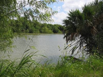
EL JARDIN RESUBDIVISION LOT 5 BLK 205, 23.2900 ACRES
747540-2050-005000
CAMERON
Vacantlandnec
Texas
A Areas with a 1% annual chance of flooding and a 26% chance of flooding over the life of a 30-year mortgage.
5
0
23.29 AC
2025
Greater Brownsville
013303
Brownsville/Harlingen
945 SF
NEARBY LISTINGS FOR SALE OR LEASE
-
-
View all Brownsville listings for sale on LoopNet.com
DEMOGRAPHICS near Dockberry
1 mile
3 mile
5 mile
2025 Total Population
2,035
48,512
96,993
2030 Population
2,125
49,888
99,523
Pop Growth 2025-2030
+ 4.42%
+ 2.84%
+ 2.61%
Average Age
35
35
35
2025 Total Households
556
13,877
28,571
HH Growth 2025-2030
+ 4.50%
+ 2.99%
+ 2.67%
Median Household Inc
$32,444
$39,401
$39,894
Avg Household Size
3.60
3.40
3.30
2025 Avg HH Vehicles
2.00
2.00
2.00
Median Home Value
$106,989
$100,820
$107,402
Median Year Built
2000
1993
1992
Nearby Places
Map Layers
Map Styles
 Street
 Aerial
Transit
 Traffic
 Biking
Places
Listings with unknown addresses are not visible on the map
- Restaurants
- Banks
- Shops
- Fitness
- Groceries
PUBLIC TRANSPORTATION
AIRPORT
Brownsville/South Padre Island International
Drive
Walk
Distance
Brownsville/South Padre Island International
6 min
2.3 mi
Valley International
Drive
Walk
Distance
Valley International
43 min
32.7 mi
Freight Ports
Port of Brownsville
Drive
Walk
Distance
Port of Brownsville
8 min
4.6 mi
Nearby Properties
Address
Land Use
TOTAL SIZE
Lot Size
Zoning
Address
Land Use
TOTAL SIZE
Lot Size
Zoning
328,021 SF
70.19 AC
SD6
Address
Land Use
TOTAL SIZE
Lot Size
Zoning
248,857 SF
37.16 AC
Address
Land Use
TOTAL SIZE
Lot Size
Zoning
167,737 SF
29.87 AC
Address
Land Use
TOTAL SIZE
Lot Size
Zoning
88,591 SF
22 AC
SD6
Address
Land Use
TOTAL SIZE
Lot Size
Zoning
87,909 SF
12 AC
Address
Land Use
TOTAL SIZE
Lot Size
Zoning
392,622 SF
55 AC
I
Address
Land Use
TOTAL SIZE
Lot Size
Zoning
195,810 SF
26.95 AC
Address
Land Use
TOTAL SIZE
Lot Size
Zoning
462.60 AC
Address
Land Use
TOTAL SIZE
Lot Size
Zoning
56,918 SF
2.95 AC
Address
Land Use
TOTAL SIZE
Lot Size
Zoning
82,098 SF
20.25 AC
Address
Land Use
TOTAL SIZE
Lot Size
Zoning
151,872 SF
Address
Land Use
TOTAL SIZE
Lot Size
Zoning
75,196 SF
15.86 AC
Address
Land Use
TOTAL SIZE
Lot Size
Zoning
141,320 SF
10.01 AC
B
Address
Land Use
TOTAL SIZE
Lot Size
Zoning
191,664 SF
39.75 AC
Address
Land Use
TOTAL SIZE
Lot Size
Zoning
67,743 SF
6.32 AC
A-C
Address
Land Use
TOTAL SIZE
Lot Size
Zoning
62,358 SF
3 AC
Address
Land Use
TOTAL SIZE
Lot Size
Zoning
100,000 SF
6.05 AC
Address
Land Use
TOTAL SIZE
Lot Size
Zoning
86,780 SF
5.96 AC
Address
Land Use
TOTAL SIZE
Lot Size
Zoning
101,500 SF
5.72 AC
Address
Land Use
TOTAL SIZE
Lot Size
Zoning
100,000 SF
5.94 AC
Address
Land Use
TOTAL SIZE
Lot Size
Zoning
119,820 SF
3.57 AC
Address
Land Use
TOTAL SIZE
Lot Size
Zoning
28,796 SF
6.10 AC
Address
Land Use
TOTAL SIZE
Lot Size
Zoning
112,638 SF
10.95 AC
Address
Land Use
TOTAL SIZE
Lot Size
Zoning
60,400 SF
184.22 AC
Address
Land Use
TOTAL SIZE
Lot Size
Zoning
89,714 SF
7.10 AC
Address
Land Use
TOTAL SIZE
Lot Size
Zoning
5,620 SF
10.03 AC
Address
Land Use
TOTAL SIZE
Lot Size
Zoning
80,200 SF
SD6
Address
Land Use
TOTAL SIZE
Lot Size
Zoning
84,177 SF
5.47 AC
Address
Land Use
TOTAL SIZE
Lot Size
Zoning
61,604 SF
4.83 AC
Address
Land Use
TOTAL SIZE
Lot Size
Zoning
2,520 SF
14.23 AC
The World's #1 Commercial Real Estate Marketplace
Connect with us
© 2026 CoStar Group
The information above has been obtained from sources believed reliable. While we do not doubt its accuracy we have not verified it and make no guarantee, warranty or representation about it. It is your responsibility to independently confirm its accuracy and completeness. Any projections, opinions, assumptions, or estimates used are for example only and do not represent the current or future performance of the property. The value of this transaction to you depends on tax and other factors which should be evaluated by your tax, financial, and legal advisors. You and your advisors should conduct a careful, independent investigation of the property to determine to your satisfaction the suitability of the property for your needs.