Property Record
Dry Fork Rd, Harrison, OH 45030
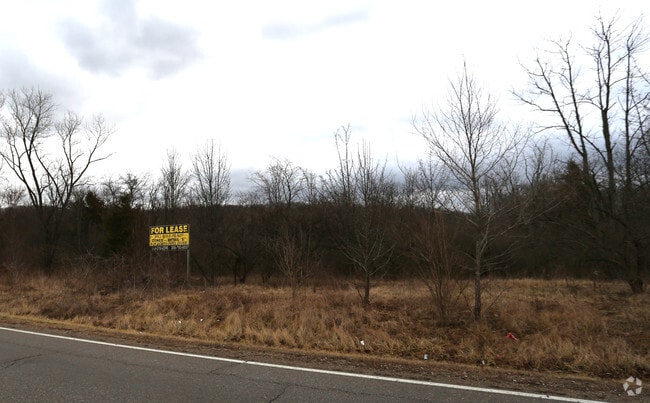
Property Detail
Dry Fork Rd
Cincinnati, OH-KY-IN
DRY FORK RD 235.27 X 231.42 IR LOT 7 COLONIAL PK SUB BLK A
561-0018-0014
HAMILTON
Commercialacreage
Ohio
ASPISC
7
B and X Area of moderate flood hazard, usually the area between the limits of the 100-year and 500-year floods.
0.48 AC
2025
Forest Park/West
2025
Cincinnati/Dayton
026001
NEARBY LISTINGS FOR SALE OR LEASE
DEMOGRAPHICS near Dry Fork Rd
1 mile
3 mile
5 mile
2025 Total Population
1,236
18,729
30,515
2030 Population
1,264
18,888
30,843
Pop Growth 2025-2030
+ 2.27%
+ 0.85%
+ 1.07%
Average Age
45
40
41
2025 Total Households
478
7,248
11,896
HH Growth 2025-2030
+ 2.09%
+ 0.75%
+ 0.98%
Median Household Inc
$48,981
$89,348
$89,449
Avg Household Size
2.30
2.50
2.50
2025 Avg HH Vehicles
2.00
2.00
2.00
Median Home Value
$67,767
$248,184
$267,165
Median Year Built
1983
1987
1988
Nearby Places
Map Layers
Map Styles
 Street
 Aerial
Layers
 Traffic
 Biking
Places
Listings with unknown addresses are not visible on the map
- Restaurants
- Banks
- Shops
- Fitness
- Groceries
PUBLIC TRANSPORTATION
AIRPORT
Cincinnati/Northern Kentucky International
Drive
Walk
Distance
Cincinnati/Northern Kentucky International
40 min
27.4 mi
Freight Ports
Port of Toledo
Drive
Walk
Distance
Port of Toledo
245 min
211.4 mi
SALE & LEASE HISTORY
LISTING DATE
SALE/LEASE

Jan 13, 2017
For Sale
Nearby Properties
Address
Land Use
TOTAL SIZE
Lot Size
Zoning
Address
Land Use
TOTAL SIZE
Lot Size
Zoning
102.29 AC
Address
Land Use
TOTAL SIZE
Lot Size
Zoning
35.80 AC
Address
Land Use
TOTAL SIZE
Lot Size
Zoning
57.20 AC
Address
Land Use
TOTAL SIZE
Lot Size
Zoning
2,040 SF
27.24 AC
Address
Land Use
TOTAL SIZE
Lot Size
Zoning
22.19 AC
Address
Land Use
TOTAL SIZE
Lot Size
Zoning
15.65 AC
Address
Land Use
TOTAL SIZE
Lot Size
Zoning
11.94 AC
Address
Land Use
TOTAL SIZE
Lot Size
Zoning
8.43 AC
Address
Land Use
TOTAL SIZE
Lot Size
Zoning
27,234 SF
12.68 AC
Address
Land Use
TOTAL SIZE
Lot Size
Zoning
20.52 AC
Address
Land Use
TOTAL SIZE
Lot Size
Zoning
10.33 AC
FPUDSPI
Address
Land Use
TOTAL SIZE
Lot Size
Zoning
2,167 SF
87.81 AC
GSPISC
Address
Land Use
TOTAL SIZE
Lot Size
Zoning
19.13 AC
Address
Land Use
TOTAL SIZE
Lot Size
Zoning
61.50 AC
H
Address
Land Use
TOTAL SIZE
Lot Size
Zoning
11.90 AC
Address
Land Use
TOTAL SIZE
Lot Size
Zoning
7.86 AC
Address
Land Use
TOTAL SIZE
Lot Size
Zoning
12.34 AC
Address
Land Use
TOTAL SIZE
Lot Size
Zoning
Address
Land Use
TOTAL SIZE
Lot Size
Zoning
10.49 AC
FPUDSPI
Address
Land Use
TOTAL SIZE
Lot Size
Zoning
Address
Land Use
TOTAL SIZE
Lot Size
Zoning
49,011 SF
11.22 AC
H
Address
Land Use
TOTAL SIZE
Lot Size
Zoning
19.28 AC
Address
Land Use
TOTAL SIZE
Lot Size
Zoning
14.95 AC
Address
Land Use
TOTAL SIZE
Lot Size
Zoning
7.48 AC
Address
Land Use
TOTAL SIZE
Lot Size
Zoning
12,120 SF
7.47 AC
Address
Land Use
TOTAL SIZE
Lot Size
Zoning
25.54 AC
A
Address
Land Use
TOTAL SIZE
Lot Size
Zoning
26,900 SF
15.31 AC
Address
Land Use
TOTAL SIZE
Lot Size
Zoning
5.19 AC
FPUDSPI
Address
Land Use
TOTAL SIZE
Lot Size
Zoning
5.32 AC
D
Address
Land Use
TOTAL SIZE
Lot Size
Zoning
35,000 SF
14.90 AC
The World's #1 Commercial Real Estate Marketplace
Connect with us
© 2026 CoStar Group
The information above has been obtained from sources believed reliable. While we do not doubt its accuracy we have not verified it and make no guarantee, warranty or representation about it. It is your responsibility to independently confirm its accuracy and completeness. Any projections, opinions, assumptions, or estimates used are for example only and do not represent the current or future performance of the property. The value of this transaction to you depends on tax and other factors which should be evaluated by your tax, financial, and legal advisors. You and your advisors should conduct a careful, independent investigation of the property to determine to your satisfaction the suitability of the property for your needs.