Property Record
Dunn Rd, Wade, NC 28395

NEARBY LISTINGS FOR SALE OR LEASE
-
-
View all Wade listings for sale on LoopNet.com
Property Detail
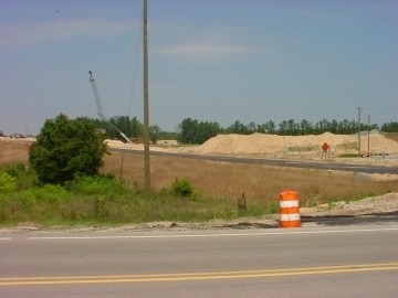
Dunn Rd
Fayetteville, NC
Eastover Commercial
0570-30-2981
15.92 ACS MCPHAIL LD
Commercialacreage
Cumberland
X
North Carolina
3720057000J
2981
2025
15.92 AC
2025
East Fayetteville
002701
Fayetteville
DEMOGRAPHICS near Dunn Rd
1 mile
3 mile
5 mile
2024 Total Population
100
3,057
8,179
2029 Population
99
3,037
8,121
Pop Growth 2024-2029
(1.00%)
(0.65%)
(0.71%)
Average Age
41
42
42
2024 Total Households
39
1,222
3,188
HH Growth 2024-2029
0.00%
(0.65%)
(0.75%)
Median Household Inc
$62,500
$65,198
$66,602
Avg Household Size
2.50
2.40
2.50
2024 Avg HH Vehicles
2.00
2.00
2.00
Median Home Value
$184,615
$219,213
$222,199
Median Year Built
1984
1985
1989
Nearby Places
Map Layers
Map Styles
 Street
 Aerial
Transit
 Traffic
 Biking
Places
Listings with unknown addresses are not visible on the map
- Restaurants
- Banks
- Shops
- Fitness
- Groceries
PUBLIC TRANSPORTATION
COMMUTER RAIL
Fayetteville Amtrak Station (Palmetto - Amtrak, Silver Meteor - Amtrak)
Drive
Walk
Distance
Fayetteville Amtrak Station (Palmetto - Amtrak, Silver Meteor - Amtrak)
14 min
9.9 mi
AIRPORT
Fayetteville Regional/Grannis Field
Drive
Walk
Distance
Fayetteville Regional/Grannis Field
21 min
14.0 mi
Freight Ports
Port of Wilmington
Drive
Walk
Distance
Port of Wilmington
133 min
93.5 mi
Nearby Properties
Address
Land Use
TOTAL SIZE
Lot Size
Zoning
Address
Land Use
TOTAL SIZE
Lot Size
Zoning
29,976 SF
12.71 AC
RR
Address
Land Use
TOTAL SIZE
Lot Size
Zoning
278.66 AC
A1
Address
Land Use
TOTAL SIZE
Lot Size
Zoning
2,540 SF
16.80 AC
RR
Address
Land Use
TOTAL SIZE
Lot Size
Zoning
2,814 SF
10 AC
R6A
Address
Land Use
TOTAL SIZE
Lot Size
Zoning
4,390 SF
3.59 AC
CP
Address
Land Use
TOTAL SIZE
Lot Size
Zoning
31,135 SF
5.35 AC
RR
Address
Land Use
TOTAL SIZE
Lot Size
Zoning
14,298 SF
2.23 AC
CP
Address
Land Use
TOTAL SIZE
Lot Size
Zoning
6,171 SF
4.57 AC
CP
Address
Land Use
TOTAL SIZE
Lot Size
Zoning
1,050 SF
4.18 AC
CP-PLANNED
Address
Land Use
TOTAL SIZE
Lot Size
Zoning
7,381 SF
1.13 AC
RR
Address
Land Use
TOTAL SIZE
Lot Size
Zoning
1.62 AC
CPCZ
Address
Land Use
TOTAL SIZE
Lot Size
Zoning
43,000 SF
11.13 AC
M2
Address
Land Use
TOTAL SIZE
Lot Size
Zoning
6,987 SF
16.19 AC
A1-AGRI DI
Address
Land Use
TOTAL SIZE
Lot Size
Zoning
24.15 AC
RR
Address
Land Use
TOTAL SIZE
Lot Size
Zoning
6,411 SF
2 AC
R40
Address
Land Use
TOTAL SIZE
Lot Size
Zoning
9,642 SF
2 AC
O&I
Address
Land Use
TOTAL SIZE
Lot Size
Zoning
8,680 SF
5.39 AC
RR
Address
Land Use
TOTAL SIZE
Lot Size
Zoning
228.61 AC
A1
Address
Land Use
TOTAL SIZE
Lot Size
Zoning
984 SF
2.41 AC
C1P-SHOPPI
Address
Land Use
TOTAL SIZE
Lot Size
Zoning
1,345 SF
69.86 AC
A1
Address
Land Use
TOTAL SIZE
Lot Size
Zoning
5,487 SF
0.87 AC
R6A
Address
Land Use
TOTAL SIZE
Lot Size
Zoning
5,487 SF
0.84 AC
R6A
Address
Land Use
TOTAL SIZE
Lot Size
Zoning
1,909 SF
186.52 AC
A1-AGRI DI
Address
Land Use
TOTAL SIZE
Lot Size
Zoning
7,037 SF
10.08 AC
A1
Address
Land Use
TOTAL SIZE
Lot Size
Zoning
328.73 AC
A1
Address
Land Use
TOTAL SIZE
Lot Size
Zoning
1,620 SF
40.08 AC
RR
Address
Land Use
TOTAL SIZE
Lot Size
Zoning
4,357 SF
2.75 AC
R40
Address
Land Use
TOTAL SIZE
Lot Size
Zoning
957 SF
1.94 AC
C2PCZ
Address
Land Use
TOTAL SIZE
Lot Size
Zoning
4,432 SF
20 AC
A1
Address
Land Use
TOTAL SIZE
Lot Size
Zoning
5,388 SF
17.83 AC
A1
The World's #1 Commercial Real Estate Marketplace
Connect with us
© 2026 CoStar Group
The information above has been obtained from sources believed reliable. While we do not doubt its accuracy we have not verified it and make no guarantee, warranty or representation about it. It is your responsibility to independently confirm its accuracy and completeness. Any projections, opinions, assumptions, or estimates used are for example only and do not represent the current or future performance of the property. The value of this transaction to you depends on tax and other factors which should be evaluated by your tax, financial, and legal advisors. You and your advisors should conduct a careful, independent investigation of the property to determine to your satisfaction the suitability of the property for your needs.