Property Record
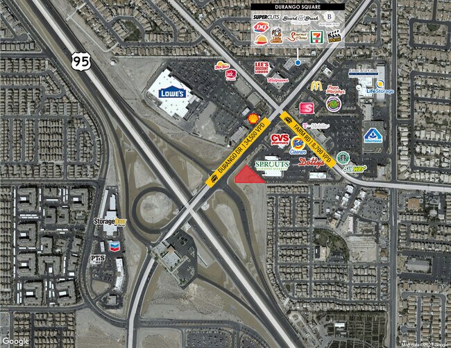
8431 Farm Rd, Las Vegas, NV 89131

Current Lease Availabilities
Property Detail
8431 Farm Rd
Las Vegas-Henderson-North Las Vegas, NV
FARM & DURANGO COMMERCIAL CENTER PLAT BOOK 152 PAGE 84 LOT 1
125-17-613-001
CLARK
Storebuilding
Nevada
B and X Area of moderate flood hazard, usually the area between the limits of the 100-year and 500-year floods.
1
2026
9.50 AC
2026
North Las Vegas
003318
Las Vegas
72,654 SF
NEARBY LISTINGS FOR SALE OR LEASE
DEMOGRAPHICS near 8431 Farm Rd
1 mile
3 mile
5 mile
2025 Total Population
28,591
118,537
213,552
2030 Population
29,943
125,802
226,308
Pop Growth 2025-2030
+ 4.73%
+ 6.13%
+ 5.97%
Average Age
36
38
39
2025 Total Households
10,252
41,460
75,172
HH Growth 2025-2030
+ 4.91%
+ 6.14%
+ 5.99%
Median Household Inc
$85,343
$104,334
$104,100
Avg Household Size
2.80
2.80
2.80
2025 Avg HH Vehicles
2.00
2.00
2.00
Median Home Value
$395,159
$506,361
$498,463
Median Year Built
2004
2006
2004
Nearby Places
Map Layers
Map Styles
 Street
 Aerial
Transit
 Traffic
 Biking
Places
Listings with unknown addresses are not visible on the map
- Restaurants
- Banks
- Shops
- Fitness
- Groceries
PUBLIC TRANSPORTATION
AIRPORT
Harry Reid International
Drive
Walk
Distance
Harry Reid International
33 min
21.9 mi
Freight Ports
Port of Long Beach
Drive
Walk
Distance
Port of Long Beach
334 min
297.4 mi
Nearby Properties
Address
Land Use
TOTAL SIZE
Lot Size
Zoning
Address
Land Use
TOTAL SIZE
Lot Size
Zoning
358,316 SF
35.74 AC
TC
Address
Land Use
TOTAL SIZE
Lot Size
Zoning
195,916 SF
5.91 AC
L:T-C
Address
Land Use
TOTAL SIZE
Lot Size
Zoning
27,487 SF
697.78 AC
CV
Address
Land Use
TOTAL SIZE
Lot Size
Zoning
6,386 SF
15.82 AC
Address
Land Use
TOTAL SIZE
Lot Size
Zoning
20,943 SF
17.99 AC
PD
Address
Land Use
TOTAL SIZE
Lot Size
Zoning
704 SF
7.49 AC
Address
Land Use
TOTAL SIZE
Lot Size
Zoning
Address
Land Use
TOTAL SIZE
Lot Size
Zoning
140,690 SF
37.50 AC
CV
Address
Land Use
TOTAL SIZE
Lot Size
Zoning
9,415 SF
12.63 AC
Address
Land Use
TOTAL SIZE
Lot Size
Zoning
25 AC
RE
Address
Land Use
TOTAL SIZE
Lot Size
Zoning
Address
Land Use
TOTAL SIZE
Lot Size
Zoning
19.10 AC
PF
Address
Land Use
TOTAL SIZE
Lot Size
Zoning
14.92 AC
UPROS
Address
Land Use
TOTAL SIZE
Lot Size
Zoning
43,952 SF
7.96 AC
Address
Land Use
TOTAL SIZE
Lot Size
Zoning
20 AC
CV
Address
Land Use
TOTAL SIZE
Lot Size
Zoning
178,800 SF
16.79 AC
TC
Address
Land Use
TOTAL SIZE
Lot Size
Zoning
132,309 SF
12.45 AC
L:T-C
Address
Land Use
TOTAL SIZE
Lot Size
Zoning
172,927 SF
20.78 AC
TC
Address
Land Use
TOTAL SIZE
Lot Size
Zoning
12.42 AC
PF
Address
Land Use
TOTAL SIZE
Lot Size
Zoning
3,315 SF
13.23 AC
TC
Address
Land Use
TOTAL SIZE
Lot Size
Zoning
105,205 SF
18.86 AC
TC
Address
Land Use
TOTAL SIZE
Lot Size
Zoning
4,273 SF
16.04 AC
Address
Land Use
TOTAL SIZE
Lot Size
Zoning
4,273 SF
15.06 AC
Address
Land Use
TOTAL SIZE
Lot Size
Zoning
90,599 SF
12.14 AC
Address
Land Use
TOTAL SIZE
Lot Size
Zoning
2,224 SF
8.66 AC
TC
Address
Land Use
TOTAL SIZE
Lot Size
Zoning
117,088 SF
5.49 AC
Address
Land Use
TOTAL SIZE
Lot Size
Zoning
30.06 AC
TC
Address
Land Use
TOTAL SIZE
Lot Size
Zoning
14.99 AC
PF
Address
Land Use
TOTAL SIZE
Lot Size
Zoning
136,533 SF
13.34 AC
TC
The World's #1 Commercial Real Estate Marketplace
Connect with us
© 2026 CoStar Group
The information above has been obtained from sources believed reliable. While we do not doubt its accuracy we have not verified it and make no guarantee, warranty or representation about it. It is your responsibility to independently confirm its accuracy and completeness. Any projections, opinions, assumptions, or estimates used are for example only and do not represent the current or future performance of the property. The value of this transaction to you depends on tax and other factors which should be evaluated by your tax, financial, and legal advisors. You and your advisors should conduct a careful, independent investigation of the property to determine to your satisfaction the suitability of the property for your needs.