Property Record
Durham Ave, South Plainfield, NJ 07080
NEARBY LISTINGS FOR SALE OR LEASE
-
-
View all South Plainfield listings for sale on LoopNet.com
Property Detail
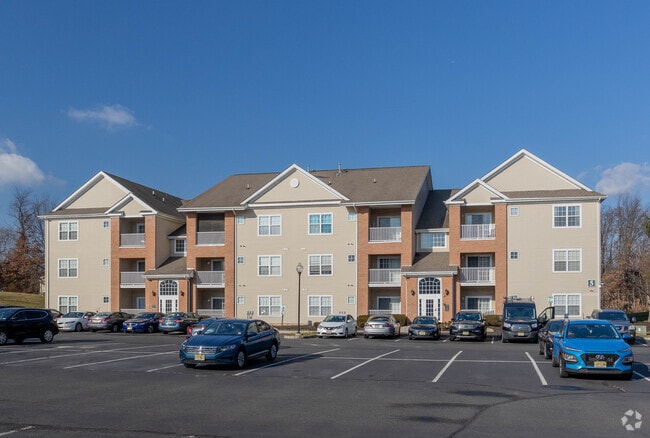
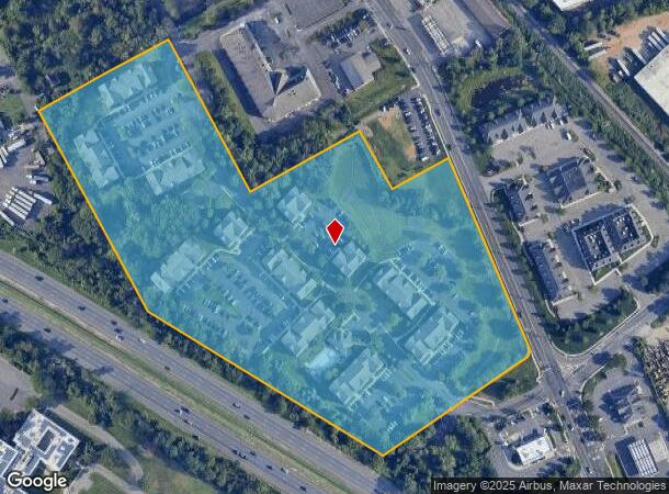
Durham Ave
New York-Jersey City-White Plains, NY-NJ
16.9 ACRES
22-00525-01-00001
Middlesex
Vacantlandnec
New Jersey
X
1
34023C0041F
16.90 AC
2024
North Middlesex County
2025
Northern New Jersey
001003
DEMOGRAPHICS near Durham Ave
1 Mile
3 Mile
5 Mile
2024 Total Population
8,493
102,757
350,605
2029 Population
8,489
102,316
348,008
Pop Growth 2024-2029
(0.05%)
(0.43%)
(0.74%)
Average Age
39
39
38
2024 Total Households
2,779
34,039
115,718
HH Growth 2024-2029
(0.22%)
(0.48%)
(0.72%)
Median Household Inc
$135,664
$118,834
$100,996
Avg Household Size
3.00
2.90
2.80
2024 Avg HH Vehicles
2.00
2.00
2.00
Median Home Value
$446,705
$413,019
$401,162
Median Year Built
1993
1973
1966
Nearby Places
Map Layers
Map Styles
 Street
 Aerial
- Restaurants
- Banks
- Shops
- Fitness
- Groceries
PUBLIC TRANSPORTATION
COMMUTER RAIL
Metuchen (Northeast Corridor Line - NJ Transit Commuter Rail (NJ Transit))
DRIVE
WALK
Distance
Metuchen (Northeast Corridor Line - NJ Transit Commuter Rail (NJ Transit))
8 min
3.9 mi
Edison (Northeast Corridor Line - NJ Transit Commuter Rail (NJ Transit))
DRIVE
WALK
Distance
Edison (Northeast Corridor Line - NJ Transit Commuter Rail (NJ Transit))
9 min
4.5 mi
AIRPORT
Newark Liberty International
DRIVE
WALK
Distance
Newark Liberty International
34 min
26.2 mi
Trenton Mercer
DRIVE
WALK
Distance
Trenton Mercer
52 min
37.8 mi
Freight Ports
New York Container Terminal
DRIVE
WALK
Distance
New York Container Terminal
28 min
20.5 mi
Nearby Properties
Address
Land Use
TOTAL SIZE
Lot Size
Zoning
Address
Land Use
TOTAL SIZE
Lot Size
Zoning
27.46 AC
LI5
Address
Land Use
TOTAL SIZE
Lot Size
Zoning
138,550 SF
104.63 AC
E
Address
Land Use
TOTAL SIZE
Lot Size
Zoning
24.12 AC
LI5
Address
Land Use
TOTAL SIZE
Lot Size
Zoning
24.62 AC
R20
Address
Land Use
TOTAL SIZE
Lot Size
Zoning
41.40 AC
LI5
Address
Land Use
TOTAL SIZE
Lot Size
Zoning
17.01 AC
RM
Address
Land Use
TOTAL SIZE
Lot Size
Zoning
52,074 SF
68.14 AC
E
Address
Land Use
TOTAL SIZE
Lot Size
Zoning
64.99 AC
LI5
Address
Land Use
TOTAL SIZE
Lot Size
Zoning
23,140 SF
107.63 AC
E
Address
Land Use
TOTAL SIZE
Lot Size
Zoning
17.64 AC
R10A
Address
Land Use
TOTAL SIZE
Lot Size
Zoning
27.51 AC
RM
Address
Land Use
TOTAL SIZE
Lot Size
Zoning
38.04 AC
RM
Address
Land Use
TOTAL SIZE
Lot Size
Zoning
12.57 AC
RM
Address
Land Use
TOTAL SIZE
Lot Size
Zoning
137.89 AC
RAA
Address
Land Use
TOTAL SIZE
Lot Size
Zoning
23.94 AC
M2
Address
Land Use
TOTAL SIZE
Lot Size
Zoning
48.79 AC
SC
Address
Land Use
TOTAL SIZE
Lot Size
Zoning
38.35 AC
ER
Address
Land Use
TOTAL SIZE
Lot Size
Zoning
290,756 SF
19.78 AC
LI5
Address
Land Use
TOTAL SIZE
Lot Size
Zoning
49.83 AC
LI
Address
Land Use
TOTAL SIZE
Lot Size
Zoning
16.75 AC
LI5
Address
Land Use
TOTAL SIZE
Lot Size
Zoning
17.21 AC
L15
Address
Land Use
TOTAL SIZE
Lot Size
Zoning
19.81 AC
M2
Address
Land Use
TOTAL SIZE
Lot Size
Zoning
16.21 AC
RM
Address
Land Use
TOTAL SIZE
Lot Size
Zoning
63.87 AC
LI5
Address
Land Use
TOTAL SIZE
Lot Size
Zoning
254,656 SF
16.53 AC
LI5
Address
Land Use
TOTAL SIZE
Lot Size
Zoning
103,973 SF
51.10 AC
LI1
Address
Land Use
TOTAL SIZE
Lot Size
Zoning
55.57 AC
LI
Address
Land Use
TOTAL SIZE
Lot Size
Zoning
214,683 SF
13.38 AC
LI5
Address
Land Use
TOTAL SIZE
Lot Size
Zoning
25.74 AC
LI5
Address
Land Use
TOTAL SIZE
Lot Size
Zoning
233,217 SF
36.91 AC
LI5
The World's #1 Commercial Real Estate Marketplace
Connect with us
© 2025 CoStar Group
The information above has been obtained from sources believed reliable. While we do not doubt its accuracy we have not verified it and make no guarantee, warranty or representation about it. It is your responsibility to independently confirm its accuracy and completeness. Any projections, opinions, assumptions, or estimates used are for example only and do not represent the current or future performance of the property. The value of this transaction to you depends on tax and other factors which should be evaluated by your tax, financial, and legal advisors. You and your advisors should conduct a careful, independent investigation of the property to determine to your satisfaction the suitability of the property for your needs.