Property Record
9830 Dyer St, El Paso, TX 79924


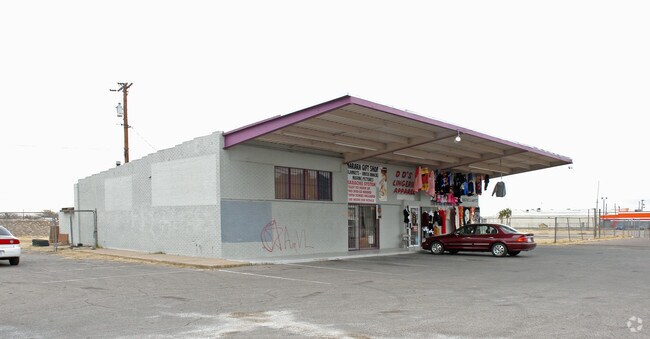
Property Detail
9830 Dyer St
S033-999-0040-5100
4 SAHARA NWLY PT OF 2 (446.32 FT ON NWLY- 180 FT ON NELY-370.25 FT ON ELY- 250.21 FT ON SLY) (90559.20 SQFT)
Commercialnec
EL PASO
C3
Texas
2024
2.08 AC
2025
Northeast
000205
El Paso
2,872 SF
El Paso, TX
NEARBY LISTINGS FOR SALE OR LEASE
DEMOGRAPHICS near 9830 Dyer St
1 mile
3 mile
5 mile
2025 Total Population
16,545
81,710
115,452
2030 Population
16,603
82,048
116,303
Pop Growth 2025-2030
+ 0.35%
+ 0.41%
+ 0.74%
Average Age
38
38
36
2025 Total Households
6,184
29,716
41,626
HH Growth 2025-2030
+ 0.57%
+ 0.59%
+ 0.85%
Median Household Inc
$51,503
$54,947
$56,981
Avg Household Size
2.60
2.70
2.70
2025 Avg HH Vehicles
2.00
2.00
2.00
Median Home Value
$149,613
$154,106
$162,621
Median Year Built
1967
1976
1980
Nearby Places
Map Layers
Map Styles
 Street
 Aerial
Transit
 Traffic
 Biking
Places
Listings with unknown addresses are not visible on the map
- Restaurants
- Banks
- Shops
- Fitness
- Groceries
PUBLIC TRANSPORTATION
AIRPORT
El Paso International
Drive
Walk
Distance
El Paso International
22 min
12.5 mi
Freight Ports
Port of Corpus Christi
Drive
Walk
Distance
Port of Corpus Christi
687 min
700.5 mi
Nearby Properties
Address
Land Use
TOTAL SIZE
Lot Size
Zoning
Address
Land Use
TOTAL SIZE
Lot Size
Zoning
427,550 SF
40 AC
R4
Address
Land Use
TOTAL SIZE
Lot Size
Zoning
311,618 SF
17.74 AC
C3
Address
Land Use
TOTAL SIZE
Lot Size
Zoning
263,488 SF
13.88 AC
R3
Address
Land Use
TOTAL SIZE
Lot Size
Zoning
261,148 SF
21.61 AC
PR2
Address
Land Use
TOTAL SIZE
Lot Size
Zoning
117,210 SF
8.55 AC
R4
Address
Land Use
TOTAL SIZE
Lot Size
Zoning
73,904 SF
42.88 AC
R4
Address
Land Use
TOTAL SIZE
Lot Size
Zoning
136,000 SF
84.83 AC
R4
Address
Land Use
TOTAL SIZE
Lot Size
Zoning
148,277 SF
17.14 AC
R4
Address
Land Use
TOTAL SIZE
Lot Size
Zoning
322,175 SF
22.17 AC
M1
Address
Land Use
TOTAL SIZE
Lot Size
Zoning
240,114 SF
26.84 AC
C1
Address
Land Use
TOTAL SIZE
Lot Size
Zoning
348,316 SF
39.67 AC
R4
Address
Land Use
TOTAL SIZE
Lot Size
Zoning
468,270 SF
60 AC
M1
Address
Land Use
TOTAL SIZE
Lot Size
Zoning
140,086 SF
13.13 AC
C3
Address
Land Use
TOTAL SIZE
Lot Size
Zoning
158,370 SF
18.18 AC
C3
Address
Land Use
TOTAL SIZE
Lot Size
Zoning
251,542 SF
12.76 AC
C1
Address
Land Use
TOTAL SIZE
Lot Size
Zoning
88,806 SF
9.41 AC
C1S
Address
Land Use
TOTAL SIZE
Lot Size
Zoning
112,888 SF
5.60 AC
SCZ
Address
Land Use
TOTAL SIZE
Lot Size
Zoning
231,035 SF
15.85 AC
R3
Address
Land Use
TOTAL SIZE
Lot Size
Zoning
123,824 SF
3.85 AC
A3
Address
Land Use
TOTAL SIZE
Lot Size
Zoning
76,082 SF
13.59 AC
Address
Land Use
TOTAL SIZE
Lot Size
Zoning
28,289 SF
3.31 AC
C1
Address
Land Use
TOTAL SIZE
Lot Size
Zoning
136,880 SF
19.21 AC
C3
Address
Land Use
TOTAL SIZE
Lot Size
Zoning
67,808 SF
9.64 AC
C1
Address
Land Use
TOTAL SIZE
Lot Size
Zoning
44,178 SF
1.03 AC
A1C
Address
Land Use
TOTAL SIZE
Lot Size
Zoning
102,026 SF
5.90 AC
M1
Address
Land Use
TOTAL SIZE
Lot Size
Zoning
78,875 SF
6.41 AC
C3
Address
Land Use
TOTAL SIZE
Lot Size
Zoning
133,538 SF
10.04 AC
C1
Address
Land Use
TOTAL SIZE
Lot Size
Zoning
219,241 SF
6.92 AC
M1
Address
Land Use
TOTAL SIZE
Lot Size
Zoning
75,857 SF
C1
Address
Land Use
TOTAL SIZE
Lot Size
Zoning
91,288 SF
14 AC
C1
The World's #1 Commercial Real Estate Marketplace
Connect with us
© 2026 CoStar Group
The information above has been obtained from sources believed reliable. While we do not doubt its accuracy we have not verified it and make no guarantee, warranty or representation about it. It is your responsibility to independently confirm its accuracy and completeness. Any projections, opinions, assumptions, or estimates used are for example only and do not represent the current or future performance of the property. The value of this transaction to you depends on tax and other factors which should be evaluated by your tax, financial, and legal advisors. You and your advisors should conduct a careful, independent investigation of the property to determine to your satisfaction the suitability of the property for your needs.