Property Record
E 116Th St N, Claremore, OK 74017

Save to a Folder
{{folder.Name}}
{{folder.ListingIds.length}} Properties
{{folder.ListingIds.length}} Property
Create a New Folder
Property Detail
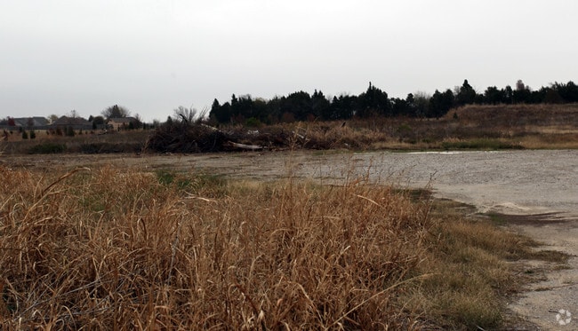
E 116Th St N
Tulsa, OK
LOT 1 BLOCK 1 ATTIC 20.
660075722
ROGERS
Commercialacreage
Oklahoma
B and X Area of moderate flood hazard, usually the area between the limits of the 100-year and 500-year floods.
1
2025
7.03 AC
2025
Rogers County
050304
Tulsa
NEARBY LISTINGS FOR SALE OR LEASE
DEMOGRAPHICS near E 116Th St N
1 mile
3 mile
5 mile
2025 Total Population
2,467
14,895
49,992
2030 Population
2,584
15,521
51,969
Pop Growth 2025-2030
+ 4.74%
+ 4.20%
+ 3.95%
Average Age
41
40
39
2025 Total Households
870
5,281
18,110
HH Growth 2025-2030
+ 4.83%
+ 4.24%
+ 3.99%
Median Household Inc
$87,500
$91,365
$89,506
Avg Household Size
2.70
2.80
2.70
2025 Avg HH Vehicles
3.00
2.00
2.00
Median Home Value
$250,000
$282,273
$274,583
Median Year Built
1992
2000
2000
Nearby Places
Map Layers
Map Styles
 Street
 Aerial
Layers
 Traffic
 Biking
Places
Listings with unknown addresses are not visible on the map
- Restaurants
- Banks
- Shops
- Fitness
- Groceries
PUBLIC TRANSPORTATION
AIRPORT
Tulsa International
Drive
Walk
Distance
Tulsa International
19 min
13.8 mi
Freight Ports
Tulsa Port Of Catoosa
Drive
Walk
Distance
Tulsa Port Of Catoosa
16 min
8.4 mi
SALE & LEASE HISTORY
LISTING DATE
SALE/LEASE

Sep 24, 2016
For Sale
Nearby Properties
Address
Land Use
TOTAL SIZE
Lot Size
Zoning
Address
Land Use
TOTAL SIZE
Lot Size
Zoning
299,471 SF
64.32 AC
AG
Address
Land Use
TOTAL SIZE
Lot Size
Zoning
47,798 SF
5.13 AC
CS
Address
Land Use
TOTAL SIZE
Lot Size
Zoning
24,164 SF
11.81 AC
NCU
Address
Land Use
TOTAL SIZE
Lot Size
Zoning
226,062 SF
11.78 AC
RM2
Address
Land Use
TOTAL SIZE
Lot Size
Zoning
40,822 SF
11.39 AC
AG
Address
Land Use
TOTAL SIZE
Lot Size
Zoning
103,300 SF
13.81 AC
CS
Address
Land Use
TOTAL SIZE
Lot Size
Zoning
43,414 SF
5 AC
CS
Address
Land Use
TOTAL SIZE
Lot Size
Zoning
32,810 SF
4.61 AC
CS
Address
Land Use
TOTAL SIZE
Lot Size
Zoning
16,097 SF
6.06 AC
AG
Address
Land Use
TOTAL SIZE
Lot Size
Zoning
5,852 SF
1.04 AC
CS
Address
Land Use
TOTAL SIZE
Lot Size
Zoning
23.63 AC
Address
Land Use
TOTAL SIZE
Lot Size
Zoning
42,248 SF
5.22 AC
AG
Address
Land Use
TOTAL SIZE
Lot Size
Zoning
2,800 SF
5.18 AC
Address
Land Use
TOTAL SIZE
Lot Size
Zoning
24,298 SF
2.42 AC
CS
Address
Land Use
TOTAL SIZE
Lot Size
Zoning
288 SF
3.95 AC
Address
Land Use
TOTAL SIZE
Lot Size
Zoning
9,126 SF
1.24 AC
CS
Address
Land Use
TOTAL SIZE
Lot Size
Zoning
6,240 SF
2.41 AC
Address
Land Use
TOTAL SIZE
Lot Size
Zoning
6,270 SF
1.69 AC
CS
Address
Land Use
TOTAL SIZE
Lot Size
Zoning
36,147 SF
3.27 AC
OM
Address
Land Use
TOTAL SIZE
Lot Size
Zoning
14,722 SF
1.63 AC
AG
Address
Land Use
TOTAL SIZE
Lot Size
Zoning
27,000 SF
4.44 AC
Address
Land Use
TOTAL SIZE
Lot Size
Zoning
3.12 AC
CS
Address
Land Use
TOTAL SIZE
Lot Size
Zoning
9,869 SF
0.93 AC
OM
Address
Land Use
TOTAL SIZE
Lot Size
Zoning
4,551 SF
2.24 AC
CS
Address
Land Use
TOTAL SIZE
Lot Size
Zoning
10,209 SF
0.92 AC
Address
Land Use
TOTAL SIZE
Lot Size
Zoning
3,844 SF
1.65 AC
CS
Address
Land Use
TOTAL SIZE
Lot Size
Zoning
976 SF
0.83 AC
CS
Address
Land Use
TOTAL SIZE
Lot Size
Zoning
2,519 SF
0.70 AC
CS
Address
Land Use
TOTAL SIZE
Lot Size
Zoning
2,065 SF
0.45 AC
CS
Address
Land Use
TOTAL SIZE
Lot Size
Zoning
4,126 SF
0.61 AC
CS
The World's #1 Commercial Real Estate Marketplace
Connect with us
© 2026 CoStar Group
The information above has been obtained from sources believed reliable. While we do not doubt its accuracy we have not verified it and make no guarantee, warranty or representation about it. It is your responsibility to independently confirm its accuracy and completeness. Any projections, opinions, assumptions, or estimates used are for example only and do not represent the current or future performance of the property. The value of this transaction to you depends on tax and other factors which should be evaluated by your tax, financial, and legal advisors. You and your advisors should conduct a careful, independent investigation of the property to determine to your satisfaction the suitability of the property for your needs.