Property Record
E 145Th St, Little Rock, AR 72206

NEARBY LISTINGS FOR SALE OR LEASE
-
-
View all Little Rock listings for sale on LoopNet.com
Property Detail
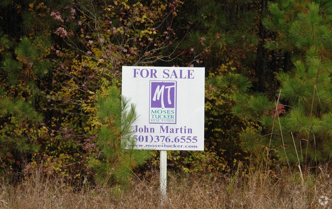
E 145Th St
35R-024-00-023-04
PART OF THE EAST HALF OF SECTION 24, TOWNSHIP 1 SOUTH, RANGE 12 WEST, PULASKI COUNTY, ARKANSAS, AND BEING MORE PARTICULARLY DESCRIBED AS FOLLOWS: COMMENCING AT A POINT, SAID POINT BEING AT THE NORTHWEST CORNER OF THE SOUTHWEST QUARTER OF SAID SECTION
Residentialacreage
Pulaski
X
Arkansas
05125C0450E
7.39 AC
2025
Outlying Pulaski County
2025
Little Rock/N Little Rock
004001
Little Rock-North Little Rock-Conway, AR
DEMOGRAPHICS near E 145Th St
1 mile
3 mile
5 mile
2024 Total Population
307
4,438
12,619
2029 Population
312
4,526
12,926
Pop Growth 2024-2029
+ 1.63%
+ 1.98%
+ 2.43%
Average Age
42
44
43
2024 Total Households
127
1,824
5,018
HH Growth 2024-2029
+ 1.57%
+ 2.03%
+ 2.47%
Median Household Inc
$48,610
$44,090
$50,631
Avg Household Size
2.40
2.40
2.40
2024 Avg HH Vehicles
2.00
2.00
2.00
Median Home Value
$103,704
$113,058
$134,449
Median Year Built
1987
1982
1981
Nearby Places
Map Layers
Map Styles
 Street
 Aerial
Transit
 Traffic
 Biking
Places
Listings with unknown addresses are not visible on the map
- Restaurants
- Banks
- Shops
- Fitness
- Groceries
PUBLIC TRANSPORTATION
AIRPORT
Bill and Hillary Clinton Ntl/Adams Field
Drive
Walk
Distance
Bill and Hillary Clinton Ntl/Adams Field
15 min
11.2 mi
Freight Ports
Port of Shreveport
Drive
Walk
Distance
Port of Shreveport
257 min
238.6 mi
Nearby Properties
Address
Land Use
TOTAL SIZE
Lot Size
Zoning
Address
Land Use
TOTAL SIZE
Lot Size
Zoning
55,632 SF
49.68 AC
Address
Land Use
TOTAL SIZE
Lot Size
Zoning
38,125 SF
23.40 AC
Address
Land Use
TOTAL SIZE
Lot Size
Zoning
30,261 SF
70 AC
Address
Land Use
TOTAL SIZE
Lot Size
Zoning
48,000 SF
11.67 AC
Address
Land Use
TOTAL SIZE
Lot Size
Zoning
23,200 SF
33.98 AC
Address
Land Use
TOTAL SIZE
Lot Size
Zoning
24,800 SF
13.07 AC
Address
Land Use
TOTAL SIZE
Lot Size
Zoning
7,360 SF
8.75 AC
Address
Land Use
TOTAL SIZE
Lot Size
Zoning
12.86 AC
Address
Land Use
TOTAL SIZE
Lot Size
Zoning
25,466 SF
8 AC
Address
Land Use
TOTAL SIZE
Lot Size
Zoning
3,696 SF
1.46 AC
Address
Land Use
TOTAL SIZE
Lot Size
Zoning
5,748 SF
14.91 AC
Address
Land Use
TOTAL SIZE
Lot Size
Zoning
9,000 SF
1.04 AC
Address
Land Use
TOTAL SIZE
Lot Size
Zoning
48,000 SF
11.80 AC
Address
Land Use
TOTAL SIZE
Lot Size
Zoning
34,500 SF
71.68 AC
Address
Land Use
TOTAL SIZE
Lot Size
Zoning
10,004 SF
9.46 AC
Address
Land Use
TOTAL SIZE
Lot Size
Zoning
4,788 SF
3 AC
Address
Land Use
TOTAL SIZE
Lot Size
Zoning
167.50 AC
Address
Land Use
TOTAL SIZE
Lot Size
Zoning
49,150 SF
2.76 AC
Address
Land Use
TOTAL SIZE
Lot Size
Zoning
4,988 SF
4.79 AC
Address
Land Use
TOTAL SIZE
Lot Size
Zoning
4,130 SF
9.74 AC
Address
Land Use
TOTAL SIZE
Lot Size
Zoning
5,389 SF
0.50 AC
Address
Land Use
TOTAL SIZE
Lot Size
Zoning
1,248 SF
80 AC
Address
Land Use
TOTAL SIZE
Lot Size
Zoning
7,256 SF
146.23 AC
Address
Land Use
TOTAL SIZE
Lot Size
Zoning
5,118 SF
0.42 AC
Address
Land Use
TOTAL SIZE
Lot Size
Zoning
6,837 SF
11.84 AC
Address
Land Use
TOTAL SIZE
Lot Size
Zoning
5,786 SF
10 AC
Address
Land Use
TOTAL SIZE
Lot Size
Zoning
20,000 SF
1.32 AC
Address
Land Use
TOTAL SIZE
Lot Size
Zoning
2,696 SF
40 AC
Address
Land Use
TOTAL SIZE
Lot Size
Zoning
5,062 SF
1.83 AC
Address
Land Use
TOTAL SIZE
Lot Size
Zoning
4,315 SF
3.63 AC
The World's #1 Commercial Real Estate Marketplace
Connect with us
© 2026 CoStar Group
The information above has been obtained from sources believed reliable. While we do not doubt its accuracy we have not verified it and make no guarantee, warranty or representation about it. It is your responsibility to independently confirm its accuracy and completeness. Any projections, opinions, assumptions, or estimates used are for example only and do not represent the current or future performance of the property. The value of this transaction to you depends on tax and other factors which should be evaluated by your tax, financial, and legal advisors. You and your advisors should conduct a careful, independent investigation of the property to determine to your satisfaction the suitability of the property for your needs.