Property Record
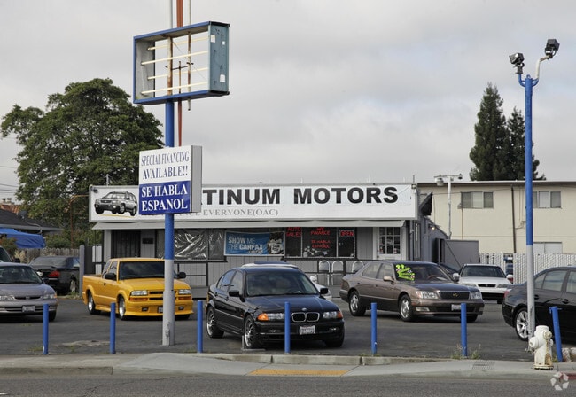
E 14Th St, San Leandro, CA 94578


Property Detail
E 14Th St
077D-1432-061-01
LOT: 00001 BLK: 0061 AR: 077D PAGE: 1432 ;LOT: 00002 BLK: 0061 AR: 077D PAGE: 1432
Parkinglot
ALAMEDA
B and X Area of moderate flood hazard, usually the area between the limits of the 100-year and 500-year floods.
California
2024
0.28 AC
2025
San Leandro
433102
East Bay/Oakland
384 SF
Oakland-Fremont-Berkeley, CA
NEARBY LISTINGS FOR SALE OR LEASE
DEMOGRAPHICS near E 14Th St
1 mile
3 mile
5 mile
2025 Total Population
24,817
185,608
366,627
2030 Population
24,711
184,579
364,784
Pop Growth 2025-2030
(0.43%)
(0.55%)
(0.50%)
Average Age
42
41
40
2025 Total Households
9,193
61,059
119,665
HH Growth 2025-2030
(0.53%)
(0.67%)
(0.60%)
Median Household Inc
$89,889
$97,473
$96,892
Avg Household Size
2.60
2.90
2.90
2025 Avg HH Vehicles
2.00
2.00
2.00
Median Home Value
$778,498
$794,409
$791,409
Median Year Built
1959
1958
1960
Nearby Places
Map Layers
Map Styles
 Street
 Aerial
Layers
 Traffic
 Biking
Places
Listings with unknown addresses are not visible on the map
- Restaurants
- Banks
- Shops
- Fitness
- Groceries
PUBLIC TRANSPORTATION
COMMUTER RAIL
Drive
Walk
Distance
9 min
4.9 mi
Drive
Walk
Distance
9 min
4.9 mi
AIRPORT
Metro Oakland International
Drive
Walk
Distance
Metro Oakland International
12 min
6.1 mi
San Francisco International
Drive
Walk
Distance
San Francisco International
35 min
26.6 mi
Norman Y Mineta San Jose International
Drive
Walk
Distance
Norman Y Mineta San Jose International
39 min
31.1 mi
Freight Ports
Port of Oakland
Drive
Walk
Distance
Port of Oakland
16 min
10.8 mi
Nearby Properties
Address
Land Use
TOTAL SIZE
Lot Size
Zoning
Address
Land Use
TOTAL SIZE
Lot Size
Zoning
285,595 SF
53.21 AC
Address
Land Use
TOTAL SIZE
Lot Size
Zoning
298,256 SF
12.16 AC
Address
Land Use
TOTAL SIZE
Lot Size
Zoning
597,179 SF
19.16 AC
Address
Land Use
TOTAL SIZE
Lot Size
Zoning
437,104 SF
0.73 AC
Address
Land Use
TOTAL SIZE
Lot Size
Zoning
726,931 SF
37.03 AC
Address
Land Use
TOTAL SIZE
Lot Size
Zoning
713,010 SF
19.96 AC
Address
Land Use
TOTAL SIZE
Lot Size
Zoning
1.64 AC
Address
Land Use
TOTAL SIZE
Lot Size
Zoning
289,747 SF
11.31 AC
Address
Land Use
TOTAL SIZE
Lot Size
Zoning
203,925 SF
8.54 AC
Address
Land Use
TOTAL SIZE
Lot Size
Zoning
323,080 SF
12.50 AC
I2
Address
Land Use
TOTAL SIZE
Lot Size
Zoning
99,039 SF
1.04 AC
Address
Land Use
TOTAL SIZE
Lot Size
Zoning
235,760 SF
9.52 AC
Address
Land Use
TOTAL SIZE
Lot Size
Zoning
292,698 SF
12.92 AC
Address
Land Use
TOTAL SIZE
Lot Size
Zoning
693,679 SF
43.49 AC
Address
Land Use
TOTAL SIZE
Lot Size
Zoning
294,146 SF
14.22 AC
Address
Land Use
TOTAL SIZE
Lot Size
Zoning
133,974 SF
4.99 AC
Address
Land Use
TOTAL SIZE
Lot Size
Zoning
240,668 SF
14.11 AC
Address
Land Use
TOTAL SIZE
Lot Size
Zoning
241,382 SF
12.72 AC
Address
Land Use
TOTAL SIZE
Lot Size
Zoning
214,062 SF
16.20 AC
Address
Land Use
TOTAL SIZE
Lot Size
Zoning
310,072 SF
14.96 AC
Address
Land Use
TOTAL SIZE
Lot Size
Zoning
458,489 SF
27.38 AC
Address
Land Use
TOTAL SIZE
Lot Size
Zoning
24.51 AC
Address
Land Use
TOTAL SIZE
Lot Size
Zoning
132,018 SF
1.11 AC
Address
Land Use
TOTAL SIZE
Lot Size
Zoning
625,101 SF
35.95 AC
Address
Land Use
TOTAL SIZE
Lot Size
Zoning
168,104 SF
13.73 AC
Address
Land Use
TOTAL SIZE
Lot Size
Zoning
231,756 SF
9.15 AC
Address
Land Use
TOTAL SIZE
Lot Size
Zoning
136,618 SF
6.34 AC
Address
Land Use
TOTAL SIZE
Lot Size
Zoning
105,730 SF
5.32 AC
Address
Land Use
TOTAL SIZE
Lot Size
Zoning
243,524 SF
15.17 AC
Address
Land Use
TOTAL SIZE
Lot Size
Zoning
149,602 SF
6.90 AC
The World's #1 Commercial Real Estate Marketplace
Connect with us
© 2026 CoStar Group
The information above has been obtained from sources believed reliable. While we do not doubt its accuracy we have not verified it and make no guarantee, warranty or representation about it. It is your responsibility to independently confirm its accuracy and completeness. Any projections, opinions, assumptions, or estimates used are for example only and do not represent the current or future performance of the property. The value of this transaction to you depends on tax and other factors which should be evaluated by your tax, financial, and legal advisors. You and your advisors should conduct a careful, independent investigation of the property to determine to your satisfaction the suitability of the property for your needs.