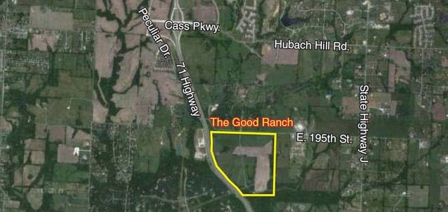
Property Record
E 195Th St, Raymore, MO 64083

Property Detail
E 195Th St
Kansas City, MO-KS
ALL SEC 32 EAST OF HWY EX 40A IN NE CR S29.50 A
2188900
CASS
Agriculturalland
Missouri
AE The base floodplain where base flood elevations are provided. AE Zones are now used on new format FIRMs instead of A1-A30 Zones.
220.50 AC
2023
Cass County
2025
Kansas City
060309
NEARBY LISTINGS FOR SALE OR LEASE
-
-
View all Raymore listings for sale on LoopNet.com
DEMOGRAPHICS near E 195Th St
1 mile
3 mile
5 mile
2025 Total Population
211
17,806
55,582
2030 Population
231
18,664
58,235
Pop Growth 2025-2030
+ 9.48%
+ 4.82%
+ 4.77%
Average Age
44
41
41
2025 Total Households
81
6,649
21,157
HH Growth 2025-2030
+ 8.64%
+ 4.99%
+ 4.98%
Median Household Inc
$85,869
$102,904
$85,098
Avg Household Size
2.60
2.60
2.60
2025 Avg HH Vehicles
3.00
2.00
2.00
Median Home Value
$330,434
$320,546
$279,139
Median Year Built
2008
1999
1994
Nearby Places
Map Layers
Map Styles
 Street
 Aerial
Transit
 Traffic
 Biking
Places
Listings with unknown addresses are not visible on the map
- Restaurants
- Banks
- Shops
- Fitness
- Groceries
SALE & LEASE HISTORY
LISTING DATE
SALE/LEASE

Sep 24, 2016
For Sale
Apr 17, 2020
For Sale
Nearby Properties
Address
Land Use
TOTAL SIZE
Lot Size
Zoning
Address
Land Use
TOTAL SIZE
Lot Size
Zoning
59.51 AC
Address
Land Use
TOTAL SIZE
Lot Size
Zoning
28.36 AC
Address
Land Use
TOTAL SIZE
Lot Size
Zoning
27.53 AC
Address
Land Use
TOTAL SIZE
Lot Size
Zoning
3.31 AC
Address
Land Use
TOTAL SIZE
Lot Size
Zoning
2.23 AC
Address
Land Use
TOTAL SIZE
Lot Size
Zoning
50,121 SF
2.98 AC
Address
Land Use
TOTAL SIZE
Lot Size
Zoning
2.18 AC
Address
Land Use
TOTAL SIZE
Lot Size
Zoning
1.94 AC
Address
Land Use
TOTAL SIZE
Lot Size
Zoning
1.76 AC
Address
Land Use
TOTAL SIZE
Lot Size
Zoning
103,066 SF
4.86 AC
Address
Land Use
TOTAL SIZE
Lot Size
Zoning
8,499 SF
1.65 AC
Address
Land Use
TOTAL SIZE
Lot Size
Zoning
12,556 SF
10.63 AC
Address
Land Use
TOTAL SIZE
Lot Size
Zoning
94,275 SF
4.92 AC
Address
Land Use
TOTAL SIZE
Lot Size
Zoning
8,000 SF
10 AC
Address
Land Use
TOTAL SIZE
Lot Size
Zoning
1.10 AC
Address
Land Use
TOTAL SIZE
Lot Size
Zoning
15,282 SF
10 AC
Address
Land Use
TOTAL SIZE
Lot Size
Zoning
0.54 AC
Address
Land Use
TOTAL SIZE
Lot Size
Zoning
41,732 SF
4.30 AC
Address
Land Use
TOTAL SIZE
Lot Size
Zoning
Address
Land Use
TOTAL SIZE
Lot Size
Zoning
125,480 SF
17.88 AC
Address
Land Use
TOTAL SIZE
Lot Size
Zoning
63,432 SF
8.01 AC
Address
Land Use
TOTAL SIZE
Lot Size
Zoning
19.12 AC
Address
Land Use
TOTAL SIZE
Lot Size
Zoning
1,200 SF
1 AC
Address
Land Use
TOTAL SIZE
Lot Size
Zoning
272,263 SF
13.20 AC
Address
Land Use
TOTAL SIZE
Lot Size
Zoning
16 AC
Address
Land Use
TOTAL SIZE
Lot Size
Zoning
12,920 SF
3 AC
Address
Land Use
TOTAL SIZE
Lot Size
Zoning
6.35 AC
Address
Land Use
TOTAL SIZE
Lot Size
Zoning
16,800 SF
5.72 AC
Address
Land Use
TOTAL SIZE
Lot Size
Zoning
9,411 SF
43.28 AC
Address
Land Use
TOTAL SIZE
Lot Size
Zoning
12 AC
The World's #1 Commercial Real Estate Marketplace
Connect with us
© 2026 CoStar Group
The information above has been obtained from sources believed reliable. While we do not doubt its accuracy we have not verified it and make no guarantee, warranty or representation about it. It is your responsibility to independently confirm its accuracy and completeness. Any projections, opinions, assumptions, or estimates used are for example only and do not represent the current or future performance of the property. The value of this transaction to you depends on tax and other factors which should be evaluated by your tax, financial, and legal advisors. You and your advisors should conduct a careful, independent investigation of the property to determine to your satisfaction the suitability of the property for your needs.