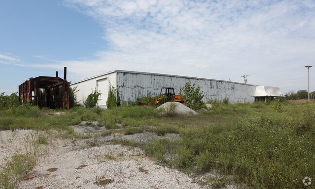
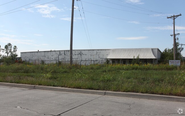
Property Record
E 275Th St, Harrisonville, MO 64701
Property Detail
E 275Th St
0781501
BG NECR E2 NWNW S143 W50 TPB NW ALG R/W ACCESS RD.
Publicstorage
CASS
B and X Area of moderate flood hazard, usually the area between the limits of the 100-year and 500-year floods.
Missouri
2023
1.05 AC
2025
Cass County
060800
Kansas City
8,036 SF
Kansas City, MO-KS
NEARBY LISTINGS FOR SALE OR LEASE
-
-
View all Harrisonville listings for sale on LoopNet.com
DEMOGRAPHICS near E 275Th St
1 mile
3 mile
5 mile
2025 Total Population
209
8,836
13,789
2030 Population
216
9,154
14,304
Pop Growth 2025-2030
+ 3.35%
+ 3.60%
+ 3.73%
Average Age
44
40
41
2025 Total Households
76
3,371
5,314
HH Growth 2025-2030
+ 3.95%
+ 3.83%
+ 3.95%
Median Household Inc
$89,583
$70,837
$76,431
Avg Household Size
2.70
2.50
2.50
2025 Avg HH Vehicles
3.00
2.00
2.00
Median Home Value
$309,091
$233,181
$261,470
Median Year Built
1982
1972
1977
Nearby Places
Map Layers
Map Styles
 Street
 Aerial
Transit
 Traffic
 Biking
Places
Listings with unknown addresses are not visible on the map
- Restaurants
- Banks
- Shops
- Fitness
- Groceries
SALE & LEASE HISTORY
LISTING DATE
SALE/LEASE

Apr 05, 2018
For Sale
Nearby Properties
Address
Land Use
TOTAL SIZE
Lot Size
Zoning
Address
Land Use
TOTAL SIZE
Lot Size
Zoning
197,883 SF
30 AC
Address
Land Use
TOTAL SIZE
Lot Size
Zoning
367,575 SF
53.34 AC
Address
Land Use
TOTAL SIZE
Lot Size
Zoning
996,962 SF
75.28 AC
Address
Land Use
TOTAL SIZE
Lot Size
Zoning
219,735 SF
33.54 AC
Address
Land Use
TOTAL SIZE
Lot Size
Zoning
1,030,621 SF
43.38 AC
Address
Land Use
TOTAL SIZE
Lot Size
Zoning
55,413 SF
8 AC
Address
Land Use
TOTAL SIZE
Lot Size
Zoning
42,378 SF
14.20 AC
Address
Land Use
TOTAL SIZE
Lot Size
Zoning
Address
Land Use
TOTAL SIZE
Lot Size
Zoning
105,500 SF
4.29 AC
Address
Land Use
TOTAL SIZE
Lot Size
Zoning
103,920 SF
12.29 AC
Address
Land Use
TOTAL SIZE
Lot Size
Zoning
53,673 SF
12.16 AC
Address
Land Use
TOTAL SIZE
Lot Size
Zoning
65,356 SF
6.21 AC
Address
Land Use
TOTAL SIZE
Lot Size
Zoning
19,600 SF
6.30 AC
Address
Land Use
TOTAL SIZE
Lot Size
Zoning
40,784 SF
0.45 AC
Address
Land Use
TOTAL SIZE
Lot Size
Zoning
460,328 SF
20 AC
Address
Land Use
TOTAL SIZE
Lot Size
Zoning
74,086 SF
5.39 AC
Address
Land Use
TOTAL SIZE
Lot Size
Zoning
21,310 SF
3.40 AC
Address
Land Use
TOTAL SIZE
Lot Size
Zoning
20,600 SF
3.90 AC
Address
Land Use
TOTAL SIZE
Lot Size
Zoning
48.57 AC
Address
Land Use
TOTAL SIZE
Lot Size
Zoning
107,500 SF
7.10 AC
Address
Land Use
TOTAL SIZE
Lot Size
Zoning
11,070 SF
10.15 AC
Address
Land Use
TOTAL SIZE
Lot Size
Zoning
45,944 SF
7 AC
Address
Land Use
TOTAL SIZE
Lot Size
Zoning
90,300 SF
34.03 AC
Address
Land Use
TOTAL SIZE
Lot Size
Zoning
7,540 SF
0.82 AC
Address
Land Use
TOTAL SIZE
Lot Size
Zoning
17,589 SF
4.50 AC
Address
Land Use
TOTAL SIZE
Lot Size
Zoning
84,525 SF
4.84 AC
Address
Land Use
TOTAL SIZE
Lot Size
Zoning
5,812 SF
19.87 AC
Address
Land Use
TOTAL SIZE
Lot Size
Zoning
5,355 SF
2.05 AC
Address
Land Use
TOTAL SIZE
Lot Size
Zoning
8,894 SF
0.22 AC
Address
Land Use
TOTAL SIZE
Lot Size
Zoning
14,736 SF
1.87 AC
The World's #1 Commercial Real Estate Marketplace
Connect with us
© 2026 CoStar Group
The information above has been obtained from sources believed reliable. While we do not doubt its accuracy we have not verified it and make no guarantee, warranty or representation about it. It is your responsibility to independently confirm its accuracy and completeness. Any projections, opinions, assumptions, or estimates used are for example only and do not represent the current or future performance of the property. The value of this transaction to you depends on tax and other factors which should be evaluated by your tax, financial, and legal advisors. You and your advisors should conduct a careful, independent investigation of the property to determine to your satisfaction the suitability of the property for your needs.